Country:
Region:
City:
Latitude and Longitude:
Time Zone:
Postal Code:
IP information under different IP Channel
ip-api
Country
Region
City
ASN
Time Zone
ISP
Blacklist
Proxy
Latitude
Longitude
Postal
Route
Luminati
Country
Region
c
City
buenosaires
ASN
Time Zone
America/Argentina/Buenos_Aires
ISP
ATGS-MMD-AS
Latitude
Longitude
Postal
IPinfo
Country
Region
City
ASN
Time Zone
ISP
Blacklist
Proxy
Latitude
Longitude
Postal
Route
db-ip
Country
Region
City
ASN
Time Zone
ISP
Blacklist
Proxy
Latitude
Longitude
Postal
Route
ipdata
Country
Region
City
ASN
Time Zone
ISP
Blacklist
Proxy
Latitude
Longitude
Postal
Route
Popular places and events near this IP address

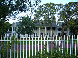
The Casements
Historic house in Florida, United States
Distance: Approx. 1047 meters
Latitude and longitude: 29.28916667,-81.04583333
The Casements is a mansion in Ormond Beach, Florida, U.S., famous for being the winter residence of American oil magnate John D. Rockefeller. It is currently owned by the city of Ormond Beach and is used as a cultural center and park. It is located on a barrier island within the city limits, overlooking the Halifax River, which is now part of the Florida Intracoastal Waterway.

Anderson–Price Memorial Library Building
United States historic place
Distance: Approx. 995 meters
Latitude and longitude: 29.29055556,-81.04722222
The Anderson–Price Memorial Library Building (also known as the Ormond Beach Woman's Club) is a historic library in Ormond Beach, Florida, United States. It is located at 42 North Beach Street, and was named for the City of Ormond Beach's co-founders John Anderson and Joseph D. Price. It was added to the National Register of Historic Places in 1984.

Ormond Hotel
United States historic place
Distance: Approx. 910 meters
Latitude and longitude: 29.28905278,-81.0473
The Ormond Hotel (also known as The Flagler Hotel) was a historic hotel in Ormond Beach, Florida, United States. It was located at 15 East Granada Boulevard.

Dix House
Historic house in Florida, United States
Distance: Approx. 531 meters
Latitude and longitude: 29.29027778,-81.05777778
The Dix House is a historic home in Ormond Beach, Florida, United States. On September 6, 1989, it was added to the U.S. National Register of Historic Places. The Dix house was originally built by Colonel Dix for his two sisters.

John Anderson Lodge
Historic house that has been demolished in Florida, United States
Distance: Approx. 995 meters
Latitude and longitude: 29.29055556,-81.04722222
The John Anderson Lodge was an historic home built around 1886 at 71 Orchard Lane in Ormond Beach, Florida, United States. It was built for Ormond Beach promoter John Anderson (1853–1911), who was one of the first owners of the Ormond Hotel. The lodge was originally used by employees of the hotel and to host parties.

Lippincott Mansion
Historic house in Florida, United States
Distance: Approx. 578 meters
Latitude and longitude: 29.28083333,-81.05416667
The Lippincott Mansion (also known as the Melrose Hall) is a historic site in Ormond Beach, Florida, United States. On February 21, 1985, it was added to the U.S. National Register of Historic Places.

The Porches
Historic house in Florida, United States
Distance: Approx. 557 meters
Latitude and longitude: 29.28111111,-81.05388889
The Porches is a historic site in Ormond Beach, Florida, United States. It is located at 176 South Beach Street. On October 6, 1988, it was added to the U.S. National Register of Historic Places.

Rowallan
Historic house in Florida, United States
Distance: Approx. 1031 meters
Latitude and longitude: 29.29333333,-81.04972222
Rowallan is a historic site in Ormond Beach, Florida, United States. It is located at 253 John Anderson Highway. On October 6, 1988, it was added to the U.S. National Register of Historic Places.

Talahloka
Historic house in Florida, United States
Distance: Approx. 928 meters
Latitude and longitude: 29.29055556,-81.04805556
Talahloka is a historic site in Ormond Beach, Florida, United States. It is located at 19 Orchard Lane. On September 6, 1989, it was added to the U.S. National Register of Historic Places.

Ormond Yacht Club
United States historic place
Distance: Approx. 220 meters
Latitude and longitude: 29.28777778,-81.05583333
The Ormond Yacht Club building is a historic site in Ormond Beach, Florida, United States. The organization was chartered on February 10, 1910, and its constitution stated, "The object of the club shall be to increase the sociability and general up-building of the town of Ormond and to promote boating in its broadest sense," It is located at 63 North Beach Street, and was built in 1910 on the Halifax River. The structure is supported by a foundation of concrete piers with wooden posts.
Granada Bridge (Ormond Beach)
Structure in Florida, United States
Distance: Approx. 379 meters
Latitude and longitude: 29.28694444,-81.05222222
The Granada Bridge is a high-clearance bridge that spans the Halifax River and Intracoastal Waterway, linking the mainland and beach peninsula parts of Ormond Beach, Volusia County, Florida. Granada Bridge carries four lanes of State Road 40 and Granada Blvd. The Casements, along with City Hall Plaza, Fortunato Park, and Riverbridge Park reside at the four corners of Ormond Beach's Granada Bridge, which give their collective name to the annual "Four Corners Festival" in Ormond Beach.
St. James Episcopal Church (Ormond Beach, Florida)
Distance: Approx. 1080 meters
Latitude and longitude: 29.28864,-81.04526
St. James’ Episcopal Church is an historic church located at 38 South Halifax Drive in Ormond Beach, Florida.
Weather in this IP's area
light rain
24 Celsius
25 Celsius
23 Celsius
25 Celsius
1019 hPa
88 %
1019 hPa
1019 hPa
10000 meters
6.17 m/s
10.29 m/s
100 degree
100 %
06:44:31
17:32:00
