Country:
Region:
City:
Latitude and Longitude:
Time Zone:
Postal Code:
IP information under different IP Channel
ip-api
Country
Region
City
ASN
Time Zone
ISP
Blacklist
Proxy
Latitude
Longitude
Postal
Route
Luminati
Country
ASN
Time Zone
America/Chicago
ISP
ATGS-MMD-AS
Latitude
Longitude
Postal
IPinfo
Country
Region
City
ASN
Time Zone
ISP
Blacklist
Proxy
Latitude
Longitude
Postal
Route
db-ip
Country
Region
City
ASN
Time Zone
ISP
Blacklist
Proxy
Latitude
Longitude
Postal
Route
ipdata
Country
Region
City
ASN
Time Zone
ISP
Blacklist
Proxy
Latitude
Longitude
Postal
Route
Popular places and events near this IP address
Boquerón, Chiriquí
Corregimiento in Chiriquí, Panama
Distance: Approx. 4811 meters
Latitude and longitude: 8.5,-82.56
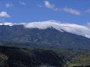
Boquerón is a corregimiento in Boquerón District, Chiriquí Province, Panama, near the volcano of Volcán Barú. It is the seat of Boquerón District. It has a land area of 39.9 square kilometres (15.4 sq mi) and had a population of 3,881 as of 2010, giving it a population density of 97.2 inhabitants per square kilometre (252/sq mi).
Sortová
Corregimiento in Chiriquí, Panama
Distance: Approx. 8343 meters
Latitude and longitude: 8.55,-82.65
Sortová is a corregimiento in Bugaba District, Chiriquí Province, Panama. It has a land area of 33.4 square kilometres (12.9 sq mi) and had a population of 2,440 as of 2010, giving it a population density of 73 inhabitants per square kilometre (190/sq mi). Its population as of 1990 was 2,064; its population as of 2000 was 2,183.

Bugaba District
District in Chiriquí Province, Panama
Distance: Approx. 8388 meters
Latitude and longitude: 8.48,-82.62
Bugaba District (Spanish pronunciation: [ˈbuɣaβa]) is a district (distrito) of Chiriquí Province in Panama. The population according to the 2000 census was 68,570. The district covers a total area of 884 km².

Boquerón District
District in Chiriquí Province, Panama
Distance: Approx. 4811 meters
Latitude and longitude: 8.5,-82.56
Boquerón District is a district (distrito) of Chiriquí Province in Panama. The population according to the 2000 census was 12,275. The district covers a total area of 282 km².

Boquete District
District in Chiriquí Province, Panama
Distance: Approx. 4811 meters
Latitude and longitude: 8.5,-82.56
Boquete District is a district (distrito) of Chiriquí Province in Panama located on the North of the Chiriqui Province, in the western side of the country. The population according to the 2010 census was 22,435. The district covers a total area of 488.48 square kilometres (188.60 sq mi).
Guabal, Panama
Corregimiento in Chiriquí, Panama
Distance: Approx. 6587 meters
Latitude and longitude: 8.5831,-82.5331
Guabal is a corregimiento in Boquerón District, Chiriquí Province, Panama. It has a land area of 32.1 square kilometres (12.4 sq mi) and had a population of 884 as of 2010, giving it a population density of 27.6 inhabitants per square kilometre (71/sq mi). Its population as of 1990 was 602; its population as of 2000 was 649.
Guayabal, Panama
Corregimiento in Chiriquí, Panama
Distance: Approx. 8514 meters
Latitude and longitude: 8.6167,-82.5831
Guayabal is a corregimiento in Boquerón District, Chiriquí Province, Panama. It has a land area of 57.3 square kilometres (22.1 sq mi) and had a population of 2,111 as of 2010, giving it a population density of 36.9 inhabitants per square kilometre (96/sq mi). Its population as of 1990 was 1,543; its population as of 2000 was 1,797.
Tijeras, Chiriquí
Corregimiento in Chiriquí, Panama
Distance: Approx. 8123 meters
Latitude and longitude: 8.4701,-82.556
Tijeras is a corregimiento in Boquerón District, Chiriquí Province, Panama. It has a land area of 17.5 square kilometres (6.8 sq mi) and had a population of 2,670 as of 2010, giving it a population density of 152.2 inhabitants per square kilometre (394/sq mi). Its population as of 1990 was 1,341; its population as of 2000 was 2,057.
Bugaba (corregimiento)
Corregimiento in Chiriquí, Panama
Distance: Approx. 8415 meters
Latitude and longitude: 8.4797,-82.62
Bugaba is a corregimiento in Bugaba District, Chiriquí Province, Panama. It has a land area of 12.9 square kilometres (5.0 sq mi) and had a population of 3,718 as of 2010, giving it a population density of 288.6 inhabitants per square kilometre (747/sq mi). Its population as of 1990 was 1,989; its population as of 2000 was 2,817.
El Bongo
Corregimiento in Chiriquí, Panama
Distance: Approx. 6618 meters
Latitude and longitude: 8.5833,-82.6167
El Bongo is a corregimiento in Bugaba District, Chiriquí Province, Panama. It has a land area of 41.9 square kilometres (16.2 sq mi) and had a population of 1,448 as of 2010, giving it a population density of 34.6 inhabitants per square kilometre (90/sq mi). It was created by Law 10 of March 7, 1997; this measure was complemented by Law 5 of January 19, 1998 and Law 69 of October 28, 1998.
La Concepción, Chiriquí
Corregimiento in Chiriquí, Panama
Distance: Approx. 5328 meters
Latitude and longitude: 8.5167,-82.6167
La Concepción is a corregimiento in Bugaba District, Chiriquí Province, Panama. It is the seat of Bugaba District. It has a land area of 66.9 square kilometres (25.8 sq mi) and had a population of 21,356 as of 2010, giving it a population density of 319.2 inhabitants per square kilometre (827/sq mi).
Guacá
Corregimiento in Chiriquí, Panama
Distance: Approx. 2921 meters
Latitude and longitude: 8.55,-82.55
Guacá is a corregimiento in David District, Chiriquí Province, Panama. It has a land area of 69.2 square kilometres (26.7 sq mi) and had a population of 1,891 as of 2010, giving it a population density of 27.3 inhabitants per square kilometre (71/sq mi). Its population as of 1990 was 1,483; its population as of 2000 was 1,726.
Weather in this IP's area
moderate rain
19 Celsius
20 Celsius
19 Celsius
22 Celsius
1014 hPa
96 %
1014 hPa
979 hPa
7140 meters
0.33 m/s
0.79 m/s
13 degree
100 %
06:21:33
18:07:07