Country:
Region:
City:
Latitude and Longitude:
Time Zone:
Postal Code:
IP information under different IP Channel
ip-api
Country
Region
City
ASN
Time Zone
ISP
Blacklist
Proxy
Latitude
Longitude
Postal
Route
Luminati
Country
ASN
Time Zone
America/Chicago
ISP
ATGS-MMD-AS
Latitude
Longitude
Postal
IPinfo
Country
Region
City
ASN
Time Zone
ISP
Blacklist
Proxy
Latitude
Longitude
Postal
Route
db-ip
Country
Region
City
ASN
Time Zone
ISP
Blacklist
Proxy
Latitude
Longitude
Postal
Route
ipdata
Country
Region
City
ASN
Time Zone
ISP
Blacklist
Proxy
Latitude
Longitude
Postal
Route
Popular places and events near this IP address
Barva
District in Barva canton, Heredia province, Costa Rica
Distance: Approx. 2508 meters
Latitude and longitude: 10.0203917,-84.1233912
Barva is a district of the Barva canton, in the Heredia province of Costa Rica. The city is known for having a nice mix of rural and metropolitan landscape.

National University of Costa Rica
Distance: Approx. 915 meters
Latitude and longitude: 9.999,-84.1115
hj The National University of Costa Rica (in Spanish, Universidad Nacional de Costa Rica, abbreviated UNA) is one of five public universities in the Republic of Costa Rica, in Central America. The main campus is located in the city of Heredia. According to recent international studies, The National University of Costa Rica ranks 85th in Latin America and 1576th in the world .

Estadio Eladio Rosabal Cordero
Football stadium in Costa Rica
Distance: Approx. 395 meters
Latitude and longitude: 9.99963,-84.123065
Estadio Eladio Rosabal Cordero is a multi-purpose stadium in Heredia, Costa Rica. The stadium holds 8,700 people and opened in 1951. It is currently used mostly for football matches and is the home stadium of Herediano.
Palacio de los Deportes (Heredia)
Distance: Approx. 279 meters
Latitude and longitude: 9.999154,-84.122131
Palacio de los Deportes (English language:Palace of Sports) is an indoor arena with capacity for 7,500 persons located in Heredia, Costa Rica. The arena regularly hosts local events such as sporting events, concerts, and trade shows. In 2004, the arena hosted the CONCACAF Futsal Championship.
Heredia, Costa Rica
Place in Heredia Province, Costa Rica
Distance: Approx. 324 meters
Latitude and longitude: 9.9984632,-84.1168617
Heredia (Spanish pronunciation: [eˈɾeðja]) is a district in the Heredia canton of Heredia province, Costa Rica. As the seat of the municipality of Heredia canton, it is awarded the status of city, and by virtue of being the city of the first canton, it is the Province Capital of Heredia province as well. It is 10 kilometers to the north of the country's capital, San José.
European School of Costa Rica
Distance: Approx. 1842 meters
Latitude and longitude: 9.99519,-84.10327
The European School of Costa Rica is a K-12 International Baccalaureate school located in San Pablo de Heredia, Costa Rica with enrollment of approximately 500. It was founded in 1989.
Iglesia de la Inmaculada
Distance: Approx. 405 meters
Latitude and longitude: 9.99833333,-84.11611111
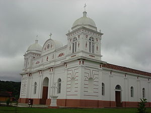
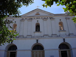
The Iglesia de la Inmaculada Concepción, commonly known as La Inmaculada, is a church located in Heredia, Costa Rica.
Santiago District, San Rafael
District in San Rafael canton, Heredia province, Costa Rica
Distance: Approx. 2306 meters
Latitude and longitude: 10.0053227,-84.1000659
Santiago is a district of the San Rafael canton, in the Heredia province of Costa Rica.
Mercedes District, Heredia
District in Heredia canton, Heredia province, Costa Rica
Distance: Approx. 1710 meters
Latitude and longitude: 10.0062029,-84.1330732
Mercedes is a district of the Heredia canton, in the Heredia province of Costa Rica.
San Francisco District, Heredia
District in Heredia canton, Heredia province, Costa Rica
Distance: Approx. 2331 meters
Latitude and longitude: 9.9855772,-84.1368109
San Francisco is a district of the Heredia canton, in the Heredia province of Costa Rica.
San Josecito
District in San Rafael canton, Heredia province, Costa Rica
Distance: Approx. 1827 meters
Latitude and longitude: 10.0125734,-84.1118754
San Josecito is a district of the San Rafael canton, in the Heredia province of Costa Rica.
Rincón de Sabanilla
District in San Pablo canton, Heredia province, Costa Rica
Distance: Approx. 2424 meters
Latitude and longitude: 9.9821346,-84.1048062
Rincón de Sabanilla is a district of the San Pablo canton, in the Heredia province of Costa Rica.
Weather in this IP's area
broken clouds
21 Celsius
21 Celsius
20 Celsius
22 Celsius
1014 hPa
80 %
1014 hPa
887 hPa
10000 meters
1.03 m/s
120 degree
75 %
05:29:35
17:11:26

