31.57.182.234 - IP Lookup: Free IP Address Lookup, Postal Code Lookup, IP Location Lookup, IP ASN, Public IP
Country:
Region:
City:
Location:
Time Zone:
Postal Code:
ISP:
ASN:
language:
User-Agent:
Proxy IP:
Blacklist:
IP information under different IP Channel
ip-api
Country
Region
City
ASN
Time Zone
ISP
Blacklist
Proxy
Latitude
Longitude
Postal
Route
db-ip
Country
Region
City
ASN
Time Zone
ISP
Blacklist
Proxy
Latitude
Longitude
Postal
Route
IPinfo
Country
Region
City
ASN
Time Zone
ISP
Blacklist
Proxy
Latitude
Longitude
Postal
Route
IP2Location
31.57.182.234Country
Region
england
City
cinderford
Time Zone
Europe/London
ISP
Language
User-Agent
Latitude
Longitude
Postal
ipdata
Country
Region
City
ASN
Time Zone
ISP
Blacklist
Proxy
Latitude
Longitude
Postal
Route
Popular places and events near this IP address

Cinderford
Town in Gloucestershire, England
Distance: Approx. 190 meters
Latitude and longitude: 51.8225,-2.4989
Cinderford is a town and civil parish on the eastern fringe of the Forest of Dean in Gloucestershire, England. The population was 8,777 at the 2021 Census. The town came into existence in the 19th century, following the rapid expansion of the Forest of Dean Coalfield and the construction of Cinderford Ironworks.
Cinderford Town A.F.C.
Association football club in England
Distance: Approx. 477 meters
Latitude and longitude: 51.82688611,-2.49329694
Cinderford Town Association Football Club is a football club based in Cinderford in Gloucestershire, England. Affiliated to the Gloucestershire County FA, they are currently members of the Southern League Division One South and play at the Causeway Ground.

Littledean
Village in England
Distance: Approx. 1821 meters
Latitude and longitude: 51.81466,-2.47721
Littledean is a village in the Forest of Dean, west Gloucestershire, England. The village has a long history and formerly had the status of a town. Littledean Hall was originally a Saxon hall, although it has been rebuilt and the current house dates back to 1612.
Cinderford Canal
Private canal in Gloucestershire, England
Distance: Approx. 1003 meters
Latitude and longitude: 51.832,-2.506
The Cinderford Canal was a private canal, opened in about 1797, in Gloucestershire, England, which was used to provide coke and water to Cinderford Ironworks.

Cinderford Ironworks
Historic site in England, UK
Distance: Approx. 1350 meters
Latitude and longitude: 51.813727,-2.508579
Cinderford Ironworks, also known as Cinderford Furnace, was a coke-fired blast furnace, built in 1795, just west of Cinderford, in the Forest of Dean, Gloucestershire, England.

Ruspidge Halt railway station
Former railway station in England
Distance: Approx. 1594 meters
Latitude and longitude: 51.8115,-2.5094
Ruspidge Halt railway station is a disused railway station opened by the Great Western Railway (GWR) on the former Bullo Pill Railway, later known as the GWR Forest of Dean Branch.

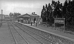
Cinderford New railway station
Former railway station in England
Distance: Approx. 554 meters
Latitude and longitude: 51.8248,-2.5067
Cinderford New railway station was a railway station that was opened by the former Severn and Wye Railway to serve the mining town of Cinderford. The station was later operated by both the Midland Railway and Great Western Railway after a loop to the station, via Cinderford Junction from the Forest of Dean Branch (ex Bullo Pill Railway) at Bilson was constructed.
Bilson Halt railway station
Disused railway station in Cinderford, Forest of Dean
Distance: Approx. 1082 meters
Latitude and longitude: 51.8236,-2.5144
Bilson Halt railway station is a disused railway station opened on the former Bullo Pill Railway, later known as the Great Western Railway Forest of Dean Branch.

Laymoor Quag
Distance: Approx. 1399 meters
Latitude and longitude: 51.82932778,-2.51727222
Laymoor Quag (grid reference SO644146) is a 3.5-hectare (8.6-acre) nature reserve within the Forest of Dean in Gloucestershire. The site is listed in the 'Forest of Dean Local Plan Review' as a Key Wildlife Site (KWS). The site is owned by the Forestry Commission and managed under agreement by the Gloucestershire Wildlife Trust since 1982.

Edgehills Bog
Nature reserve in Gloucestershire, England
Distance: Approx. 1418 meters
Latitude and longitude: 51.83661944,-2.49413333
Edgehills Bog (grid reference SO660154) is a 0.66-hectare (1.6-acre) nature reserve in Gloucestershire in the Forest of Dean. The site is managed by the Gloucestershire Wildlife Trust and held under agreement with the Forestry Commission since 1987. The site is listed in the Forest of Dean Local Plan Review as a Key Wildlife Site (KWS).

The Forest High School, Cinderford
Academy in Cinderford, Gloucestershire, England
Distance: Approx. 650 meters
Latitude and longitude: 51.829,-2.49331
SGS Forest High School is a coeducational secondary school with academy status, located in Cinderford in the English county of Gloucestershire. The school was established as Double View Secondary Modern School on Woodville Road in Cinderford, but expanded to the current site on Causeway Road in the early-mid-1970s. The school continued to operate over both sites until 1979 when the Woodville Road site closed.
Whimsey Halt railway station
Disused railway station in Cinderford, Gloucestershire
Distance: Approx. 1411 meters
Latitude and longitude: 51.8339,-2.5119
Whimsey Halt railway station served the town of Cinderford, Gloucestershire, England, from 1907 to 1930 on the Mitcheldean Road and Forest of Dean Junction Railway.
Weather in this IP's area
light rain
7 Celsius
4 Celsius
7 Celsius
7 Celsius
974 hPa
90 %
974 hPa
964 hPa
10000 meters
5.36 m/s
9.83 m/s
178 degree
84 %