31.41.94.27 - IP Lookup: Free IP Address Lookup, Postal Code Lookup, IP Location Lookup, IP ASN, Public IP
Country:
Region:
City:
Location:
Time Zone:
Postal Code:
IP information under different IP Channel
ip-api
Country
Region
City
ASN
Time Zone
ISP
Blacklist
Proxy
Latitude
Longitude
Postal
Route
Luminati
Country
Region
21
City
bushtyno
ASN
Time Zone
Europe/Kyiv
ISP
New Information Systems PP
Latitude
Longitude
Postal
IPinfo
Country
Region
City
ASN
Time Zone
ISP
Blacklist
Proxy
Latitude
Longitude
Postal
Route
IP2Location
31.41.94.27Country
Region
zakarpatska oblast
City
bilky
Time Zone
Europe/Uzhgorod
ISP
Language
User-Agent
Latitude
Longitude
Postal
db-ip
Country
Region
City
ASN
Time Zone
ISP
Blacklist
Proxy
Latitude
Longitude
Postal
Route
ipdata
Country
Region
City
ASN
Time Zone
ISP
Blacklist
Proxy
Latitude
Longitude
Postal
Route
Popular places and events near this IP address
Transcarpathia
Historic region located on the northeastern side of the Carpathian Mountains
Distance: Approx. 7737 meters
Latitude and longitude: 48.33333333,23.23333333
Transcarpathia (Ukrainian: Закарпаття, romanized: Zakarpattia, pronounced [zɐkɐrˈpatʲːɐ] ) is a historical region on the border between Central and Eastern Europe, mostly located in western Ukraine's Zakarpattia Oblast. From the Hungarian conquest of the Carpathian Basin (at the end of the 9th century) to the end of World War I (Treaty of Trianon in 1920), most of this region was part of the Kingdom of Hungary. In the interwar period, it was part of the First and Second Czechoslovak Republics.
Irshava
City in Zakarpattia Oblast, Ukraine
Distance: Approx. 6333 meters
Latitude and longitude: 48.3,23.05
Irshava (Ukrainian: Іршава, IPA: [irˈʃɑwɐ] ; Hungarian: Ilosva) is a city located in Zakarpattia Oblast (province) in western Ukraine. It was the administrative center of Irshava Raion (district) until it was abolished in 2020 and was merged with Khust Raion. Today, the population is 9,163 (2022 estimate).
Velykyi Rakovets
Distance: Approx. 6258 meters
Latitude and longitude: 48.26,23.15
Velykyi Rakovets (Ukrainian: Великий Раковець; Rusyn: Великый Раковиць; Hungarian: Nagy-Rákócz, Nagyrákóc, Rákóc, Rákócz, Rakowec; Slovak: Veľký Rakovec) is a village located in western Ukraine, within the Khust Raion in Zakarpattia Oblast, although it was formerly administered under Irshava Raion. It had a population of 4,549 according to the 2001 census.

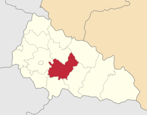
Irshava Raion
Former subdivision of Zakarpattia Oblast, Ukraine
Distance: Approx. 7483 meters
Latitude and longitude: 48.32016944,23.03171111
Irshava Raion (Ukrainian: Іршавський район) was a raion (district) of Zakarpattia Oblast in the westernmost corner of Ukraine. The only city and the administrative center was Irshava. Irshava Raion was situated on the foothills on the Carpathian Mountains.
Zacharovana Dolyna State Park
Distance: Approx. 5047 meters
Latitude and longitude: 48.35636111,23.10457222
Zacharovana Dolyna (Ukrainian: Зачарована долина; translated as "Enchanted Valley") is a state park located in Irshava Raion, Zakarpattia Oblast, Ukraine.
Protection of the Theotokos Church, Ilnytsia
Church building in Ilnitsya, Ukraine
Distance: Approx. 5021 meters
Latitude and longitude: 48.34333333,23.07972222
The Protection of the Theotokos Church (Ukrainian: Свято-Покровська церква) is an Orthodox temple in the central part of the village of Ilnytsia, Khust Raion, Zakarpattia Oblast, Ukraine.
Bilky, Khust Raion
Village in Zakarpattia Oblast, Ukraine
Distance: Approx. 1694 meters
Latitude and longitude: 48.32944444,23.13972222
Bilky (Ukrainian: Бі́лки; Hungarian: Bilke) is a village in Khust Raion of Zakarpattia Oblast, Ukraine. The village covers an area of 4,4 km2. The population of the village is about 8 064.

Zacharovanyi Krai National Nature Park
National park in Ukraine
Distance: Approx. 6059 meters
Latitude and longitude: 48.3528,23.0736
Zacharovanyi Krai National Nature Park (Ukrainian: Національний парк «Зачарований край», meaning "Enchanted Land") is one of the National Parks in Ukraine, located in Zakarpattia Oblast in the country's southwest. It was established in 2009 and covers an area of 6,101 ha (61.01 km2). The park has its headquarters in the town of Irshava, Khust Raion.
Weather in this IP's area
light snow
-1 Celsius
-4 Celsius
-1 Celsius
1 Celsius
1023 hPa
85 %
1023 hPa
987 hPa
5221 meters
2.18 m/s
3.79 m/s
215 degree
100 %