31.41.92.97 - IP Lookup: Free IP Address Lookup, Postal Code Lookup, IP Location Lookup, IP ASN, Public IP
Country:
Region:
City:
Location:
Time Zone:
Postal Code:
IP information under different IP Channel
ip-api
Country
Region
City
ASN
Time Zone
ISP
Blacklist
Proxy
Latitude
Longitude
Postal
Route
Luminati
Country
Region
21
City
uzhhorod
ASN
Time Zone
Europe/Kyiv
ISP
New Information Systems PP
Latitude
Longitude
Postal
IPinfo
Country
Region
City
ASN
Time Zone
ISP
Blacklist
Proxy
Latitude
Longitude
Postal
Route
IP2Location
31.41.92.97Country
Region
zakarpatska oblast
City
sredneye
Time Zone
Europe/Uzhgorod
ISP
Language
User-Agent
Latitude
Longitude
Postal
db-ip
Country
Region
City
ASN
Time Zone
ISP
Blacklist
Proxy
Latitude
Longitude
Postal
Route
ipdata
Country
Region
City
ASN
Time Zone
ISP
Blacklist
Proxy
Latitude
Longitude
Postal
Route
Popular places and events near this IP address
Kuzmyno
Distance: Approx. 4542 meters
Latitude and longitude: 48.54138889,22.56861111
Kuzmyno (Ukrainian: Кузьмино, translit. Kuz'myno), also referred to as Kalnik, Kuzmics, Kuzmino, Kuzmina, Kuz'myno, or in Hungarian: Beregszilvás, is a village located in the Mukacheve Raion (district) in the Zakarpattia Oblast (province) in western Ukraine. It has a population of 216.
Chabanivka
Distance: Approx. 6210 meters
Latitude and longitude: 48.49138889,22.54722222
Chabanivka (pronounced: Tscha-ba-novka; Hungarian: Bacsó) is a village in Uzhhorod Raion, Zakarpattia Oblast, Ukraine. It was part of the Kingdom of Hungary (11th century - 1918 and 1938–1944) with the name of Bačsava in the Ungvári járás (district) and Ung megye (county), next part of Czechoslovakia (1918–1938) with the name of Bačovo in Podkarpatská Rus (Sub-Carpathia), then part of the Soviet Union (Ukraine) (1945–1993) with the name of Čsabanyivka in the Uzhhorod (district) and since 1993 known as Chabanivka in the Uzhhorod Raion (district) and the Zakarpats'ka Oblast (county) of Ukraine. Other spellings/names for Chabanivka are: Bacsó, Batčhive, Čhabanowka, Tschabaniwka, and Tschabanowka.

Serednie
Rural locality in Zakarpattia Oblast, Ukraine
Distance: Approx. 409 meters
Latitude and longitude: 48.53916667,22.51222222
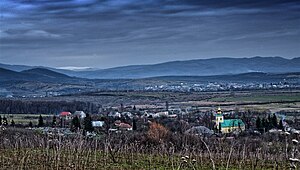
Serednie (Ukrainian: Середнє; Hungarian: Szerednye; Slovak: Seredné; Russian: Среднее) is a rural settlement in Uzhhorod Raion, Zakarpattia Oblast, western Ukraine. The town's population was 3,505 as of the 2001 Ukrainian Census. Current population: 4,361 (2022 estimate).

Vovkove, Zakarpattia Oblast
Village in Zakarpattia Oblast, Ukraine
Distance: Approx. 3361 meters
Latitude and longitude: 48.5225,22.47027778
Vovkove (Ukrainian: Вовкове, Hungarian: Ungordas) is a village in Uzhhorod Raion of Zakarpattia Oblast in Ukraine.
Weather in this IP's area
overcast clouds
1 Celsius
-1 Celsius
1 Celsius
1 Celsius
1023 hPa
74 %
1023 hPa
998 hPa
10000 meters
2.06 m/s
3.9 m/s
241 degree
100 %