31.41.89.31 - IP Lookup: Free IP Address Lookup, Postal Code Lookup, IP Location Lookup, IP ASN, Public IP
Country:
Region:
City:
Location:
Time Zone:
Postal Code:
IP information under different IP Channel
ip-api
Country
Region
City
ASN
Time Zone
ISP
Blacklist
Proxy
Latitude
Longitude
Postal
Route
Luminati
Country
Region
21
City
bushtyno
ASN
Time Zone
Europe/Kyiv
ISP
New Information Systems PP
Latitude
Longitude
Postal
IPinfo
Country
Region
City
ASN
Time Zone
ISP
Blacklist
Proxy
Latitude
Longitude
Postal
Route
IP2Location
31.41.89.31Country
Region
zakarpatska oblast
City
tyachiv
Time Zone
Europe/Uzhgorod
ISP
Language
User-Agent
Latitude
Longitude
Postal
db-ip
Country
Region
City
ASN
Time Zone
ISP
Blacklist
Proxy
Latitude
Longitude
Postal
Route
ipdata
Country
Region
City
ASN
Time Zone
ISP
Blacklist
Proxy
Latitude
Longitude
Postal
Route
Popular places and events near this IP address

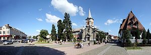
Tiachiv
City in Zakarpattia Oblast, Ukraine
Distance: Approx. 129 meters
Latitude and longitude: 48.01138889,23.57222222
Tiachiv (Ukrainian: Тячів, IPA: [ˈtʲɑtʃiu̯]; Rusyn: Тячово; Hungarian: Técső; Yiddish: טעטש, romanized: Tetsh) is a city located on the Tisza River in Zakarpattia Oblast (region) in western Ukraine. It is the administrative center of Tiachiv Raion (district). Today, the population is 8,887 (2022 estimate).
Baia (Tisza)
River in Maramureș County, Romania
Distance: Approx. 5983 meters
Latitude and longitude: 47.9917,23.6451
The Baia is a left tributary of the river Tisza in Romania. It discharges into the Tisza in Remeți, on the border with Ukraine. Its length is 8 km (5.0 mi) and its basin size is 17 km2 (6.6 sq mi).

Săpânța (river)
River in Romania
Distance: Approx. 9616 meters
Latitude and longitude: 47.9897,23.6954
The Săpânța Hungarian: Szaplonca is a left tributary of the river Tisza in Romania. It discharges into the Tisza in the village Săpânța, on the border with Ukraine. Its length is 19 km (12 mi) and its basin size is 145 km2 (56 sq mi).
Remeți
Commune in Maramureș, Romania
Distance: Approx. 5646 meters
Latitude and longitude: 47.98333333,23.63333333
Remeți (Ukrainian: Ремета; Rusyn: Ремети; Hungarian: Pálosremete; German: Remetz; Yiddish: רעמיק, romanized: Remit) is a commune in Maramureș County, Maramureș, Romania. It is composed of three villages: Piatra (Ukrainian: Каминиця; Hungarian: Kövesláz or Ferencvölgye), Remeți, and Teceu Mic (Тячів; Kistécső).

Huta Pass
Distance: Approx. 7632 meters
Latitude and longitude: 47.959265,23.504777
Huta Pass (elevation 587 m (1,926 ft)) is a pass in the Oaș Mountains of the Inner Eastern Carpathians in northern Romania. The pass connects the counties of Maramureș and Satu Mare. The Huta Pass is traversed by national road DN19, which starts in Sighetu Marmației, 41 km (25 mi) to the east, continues over the pass, and then descends to Negrești-Oaș, 14.5 km (9 mi) to the southwest.

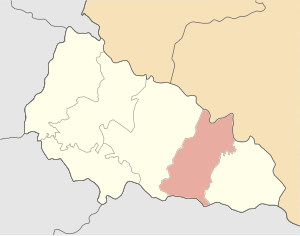
Tiachiv Raion
Subdivision of Zakarpattia Oblast, Ukraine
Distance: Approx. 898 meters
Latitude and longitude: 48.01966667,23.56792222
Tiachiv Raion (Ukrainian: Тячівський район, Romanian: Raionul Teceu, Hungarian: Técsői járás) is a raion in Zakarpattia Oblast in western Ukraine. Its administrative center is Tiachiv. Population: 183,756 (2022 estimate).
Bushtyno
Rural locality in Zakarpattia Oblast, Ukraine
Distance: Approx. 8400 meters
Latitude and longitude: 48.05361111,23.47666667
Bushtyno (Ukrainian: Буштино [ˈbuʃteno]; Hungarian: Bustyaháza; Romanian: Bustea; Slovak: Buštín; Yiddish: בישטינא) is a rural settlement in Tiachiv Raion, Zakarpattia Oblast, western Ukraine. Bushtyno is located in a small valley where the Tereblia and the Tisza rivers meet. The town's population was 8,506 as of the 2001 Ukrainian census.
Teresva
Rural locality in Zakarpattia Oblast, Ukraine
Distance: Approx. 9095 meters
Latitude and longitude: 48.00111111,23.69166667
Teresva (Ukrainian: Тересва, German: Theresiental, Romanian: Teresva, Hungarian: Taracköz, Slovak: Terešva) is a rural settlement in Tiachiv Raion (district) of Zakarpattia Oblast (region) in western Ukraine. It is situated at the confluence of the rivers Tisza and Teresva. The town's population was 7,554 at the 2001 Ukrainian Census.
Bedevlia
Village in Zakarpattia Oblast, Ukraine
Distance: Approx. 7024 meters
Latitude and longitude: 48.00388889,23.66416667
Bedevlia (Ukrainian: Бедевля or Bedevlya, Hungarian: Bedőháza, Yiddish: בידעוולא or Bedevle, Romanian: Bedeu) is a village in Zakarpattia Oblast (province) of western Ukraine. As of 2001, its population was 3,971.

Teresva (river)
River in Ukraine
Distance: Approx. 6972 meters
Latitude and longitude: 47.9887,23.6576
The Teresva (Ukrainian: Тересва) is a right tributary of the river Tisza in the Zakarpattia Oblast, western Ukraine. Its drainage basin covers an area of 1,220 km2 (470 sq mi).: 23 It rises in the Eastern Carpathians. It flows through the towns Ust-Chorna and Dubove, and it discharges into the Tisza near the town Teresva, on the border with Romania.

Tereblia (river)
River in Ukraine
Distance: Approx. 7584 meters
Latitude and longitude: 48.0355,23.4751
The Tereblia (Ukrainian: Теребля) is a right tributary of the river Tisza in the Zakarpattia Oblast, western Ukraine. It flows through the villages Synevyr, Kolochava, Drahovo and Tereblia, and discharges into the Tisza in Bushtyno.
Tiachiv urban hromada
Urban hromada in Zakarpattia Oblast, Ukraine
Distance: Approx. 129 meters
Latitude and longitude: 48.01138889,23.57222222
Tiachiv urban territorial hromada (Ukrainian: Тячівська міська територіальна громада, romanized: Tiachivska miska terytorialna hromada) is one of the hromadas of Ukraine, located in the country's western Zakarpattia Oblast. Its administrative centre is the city of Tiachiv. The hromada has a size of 97.8 km2 (37.8 sq mi).
Weather in this IP's area
broken clouds
1 Celsius
-1 Celsius
1 Celsius
1 Celsius
1030 hPa
77 %
1030 hPa
1003 hPa
10000 meters
2.04 m/s
3.27 m/s
57 degree
64 %


