31.41.87.182 - IP Lookup: Free IP Address Lookup, Postal Code Lookup, IP Location Lookup, IP ASN, Public IP
Country:
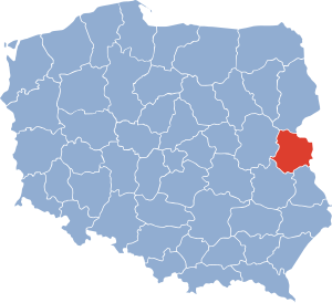
 Poland
Region:
City:
Location:
Time Zone:
Postal Code:
ISP:
ASN:
language:
User-Agent:
Proxy IP:
Blacklist:
IP information under different IP Channel
ip-api
Country
Region
City
ASN
Time Zone
ISP
Blacklist
Proxy
Latitude
Longitude
Postal
Route
db-ip
Country
Region
City
ASN
Time Zone
ISP
Blacklist
Proxy
Latitude
Longitude
Postal
Route
IPinfo
Country
Region
City
ASN
Time Zone
ISP
Blacklist
Proxy
Latitude
Longitude
Postal
Route
IP2Location
31.41.87.182Country
plRegion
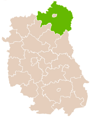
lubelskie
City
biala podlaska
Time Zone
Europe/Warsaw
ISP
Language
User-Agent
Latitude
Longitude
Postal
ipdata
Country
Region
City
ASN
Time Zone
ISP
Blacklist
Proxy
Latitude
Longitude
Postal
Route
Popular places and events near this IP address
Biała Podlaska Voivodeship
Former voivodeship of Poland from 1975 to 1998.
Distance: Approx. 731 meters
Latitude and longitude: 52.037029,23.124063
The Biała Podlaska Voivodeship was a voivodeship (province) of the Polish People's Republic from 1975 to 1989, and the Third Republic of Poland from 1989 to 1998. Its capital was Biała Podlaska. It was established on 1 June 1975, from the parts of the voivodeships of Lublin, and Warsaw Voivodeship, and existed until 31 December 1998, when it was partitioned between then-established Lublin, and Masovian Voivodeships.

Biała Podlaska
Place in Lublin Voivodeship, Poland
Distance: Approx. 105 meters
Latitude and longitude: 52.03333333,23.11666667
Biała Podlaska (Polish: [ˈbʲawa pɔdˈlaska] ; Latin: Alba Ducalis) is a city in eastern Poland with 56,498 inhabitants as of December 2021. It is situated in the Lublin Voivodeship (since 1999), having previously been the capital of Biała Podlaska Voivodeship (1975–1998). It is the capital of Biała Podlaska County, although the city is not part of the county (it constitutes a separate city county).
Biała County, Lublin Voivodeship
County in Lublin Voivodeship, Poland
Distance: Approx. 105 meters
Latitude and longitude: 52.03333333,23.11666667
Biała County (Polish: powiat bialski) is a county in Lublin Voivodeship, eastern Poland, on the border with Belarus. It was established on January 1, 1999, as a result of the Polish local government reforms passed in 1998. Its administrative seat is the city of Biała Podlaska, although the city is not part of the county (it constitutes a separate city county).

Gmina Biała Podlaska
Gmina in Lublin Voivodeship, Poland
Distance: Approx. 105 meters
Latitude and longitude: 52.03333333,23.11666667
Gmina Biała Podlaska is a rural gmina (administrative district) in Biała Podlaska County, Lublin Voivodeship, in eastern Poland. Its seat is the city of Biała Podlaska, although the city is not part of the territory of the gmina. The gmina covers an area of 324.76 square kilometres (125.4 sq mi), and as of 2006 its total population is 12,299 (13,848 in 2014).
Grabanów
Village in Lublin Voivodeship, Poland
Distance: Approx. 4319 meters
Latitude and longitude: 52.06472222,23.15138889
Grabanów [ɡraˈbanuf] is a village in the administrative district of Gmina Biała Podlaska, within Biała Podlaska County, Lublin Voivodeship, in eastern Poland. It lies approximately 5 kilometres (3 mi) north-east of Biała Podlaska and 100 km (62 mi) north-east of the regional capital Lublin.

Nowy Sławacinek
Village in Lublin Voivodeship, Poland
Distance: Approx. 3414 meters
Latitude and longitude: 52.03333333,23.06666667
Nowy Sławacinek [ˈnɔvɨ swavaˈt͡ɕinɛk] is a village in the administrative district of Gmina Biała Podlaska, within Biała Podlaska County, Lublin Voivodeship, in eastern Poland. It lies approximately 4 kilometres (2 mi) west of Biała Podlaska and 94 km (58 mi) north of the regional capital Lublin.
Porosiuki
Village in Lublin Voivodeship, Poland
Distance: Approx. 3837 meters
Latitude and longitude: 52.01666667,23.06666667
Porosiuki [pɔrɔˈɕukʲi] is a village in the administrative district of Gmina Biała Podlaska, within Biała Podlaska County, Lublin Voivodeship, in eastern Poland. It lies approximately 4 kilometres (2 mi) south-west of Biała Podlaska and 92 km (57 mi) north of the regional capital Lublin.
Rakowiska, Lublin Voivodeship
Village in Lublin Voivodeship, Poland
Distance: Approx. 4439 meters
Latitude and longitude: 52.06666667,23.08333333
Rakowiska [rakɔˈvʲiska] is a village in the administrative district of Gmina Biała Podlaska, within Biała Podlaska County, Lublin Voivodeship, in eastern Poland. It lies on the border of the city of Biała Podlaska and 98 km (61 mi) north of the regional capital Lublin.
Stary Sławacinek
Village in Lublin Voivodeship, Poland
Distance: Approx. 2939 meters
Latitude and longitude: 52.03138889,23.07361111
Sławacinek Stary [ˈswavaˈt͡ɕinɛk starɨ] is a village in the administrative district of Gmina Biała Podlaska, within Biała Podlaska County, Lublin Voivodeship, in eastern Poland. It lies approximately 3 km (1.9 mi) west of Biała Podlaska and 94 km (58 mi) north of the regional capital Lublin. The village's former name (Stary Sławacinek) was officially used until 1 January 2014.
Wólka Plebańska, Lublin Voivodeship
Village in Lublin Voivodeship, Poland
Distance: Approx. 3787 meters
Latitude and longitude: 52,23.13333333
Wólka Plebańska [ˈvulka plɛˈbaɲska] is a village in the administrative district of Gmina Biała Podlaska, within Biała Podlaska County, Lublin Voivodeship, in eastern Poland. It lies approximately 4 kilometres (2 mi) south of Biała Podlaska and 93 km (58 mi) north-east of the regional capital Lublin.

St. Anne's Church, Biała Podlaska
Distance: Approx. 100 meters
Latitude and longitude: 52.03305556,23.1175
St. Anne's Church, in Biała Podlaska, Poland is a Baroque Roman Catholic church. It was originally built in 1572, on the site of an earlier shrine, as a Protestant church dedicated to the Arianism doctrine.
Biała Podlaska Airport
Airport
Distance: Approx. 3758 meters
Latitude and longitude: 52.00305556,23.14361111
Biała Podlaska Airport, formerly IATA: BXP, ICAO: EPBP, is a closed military airport, located in the city of Biała Podlaska, in the north of Lublin Voivodship.
Weather in this IP's area
scattered clouds
-2 Celsius
-5 Celsius
-2 Celsius
-2 Celsius
1043 hPa
75 %
1043 hPa
1024 hPa
10000 meters
2.96 m/s
5.98 m/s
116 degree
25 %