31.3.87.248 - IP Lookup: Free IP Address Lookup, Postal Code Lookup, IP Location Lookup, IP ASN, Public IP
Country:
 Germany
Region:
City:
Location:
Time Zone:
Postal Code:
ISP:
ASN:
language:
User-Agent:
Proxy IP:
Blacklist:
IP information under different IP Channel
ip-api
Country
Region
City
ASN
Time Zone
ISP
Blacklist
Proxy
Latitude
Longitude
Postal
Route
db-ip
Country
Region
City
ASN
Time Zone
ISP
Blacklist
Proxy
Latitude
Longitude
Postal
Route
IPinfo
Country
Region
City
ASN
Time Zone
ISP
Blacklist
Proxy
Latitude
Longitude
Postal
Route
IP2Location
31.3.87.248Country
deRegion
thuringen
City
unterwellenborn
Time Zone
Europe/Berlin
ISP
Language
User-Agent
Latitude
Longitude
Postal
ipdata
Country
Region
City
ASN
Time Zone
ISP
Blacklist
Proxy
Latitude
Longitude
Postal
Route
Popular places and events near this IP address
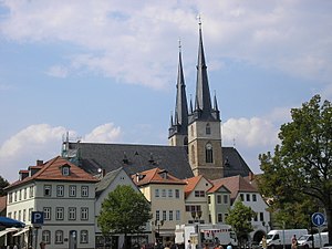
Saalfeld
Town in Thuringia, Germany
Distance: Approx. 5074 meters
Latitude and longitude: 50.65,11.36666667
Saalfeld (German: Saalfeld/Saale) is a town in Germany, capital of the Saalfeld-Rudolstadt district of Thuringia. It is best known internationally as the ancestral seat of the Saxe-Coburg and Gotha branch of the Saxon House of Wettin.

Kaulsdorf (Saale)
Municipality in Thuringia, Germany
Distance: Approx. 2446 meters
Latitude and longitude: 50.63333333,11.43333333
Kaulsdorf is a municipality in the district Saalfeld-Rudolstadt, in Thuringia, Germany.

Krölpa
Municipality in Thuringia, Germany
Distance: Approx. 5692 meters
Latitude and longitude: 50.66666667,11.51666667
Krölpa is a municipality in the district Saale-Orla-Kreis, in Thuringia, Germany.
Seisla
Municipality in Thuringia, Germany
Distance: Approx. 6838 meters
Latitude and longitude: 50.65055556,11.53472222
Seisla is a municipality in the district Saale-Orla-Kreis, in Thuringia, Germany.
Hohenwarte
Municipality in Thuringia, Germany
Distance: Approx. 6916 meters
Latitude and longitude: 50.6,11.48333333
Hohenwarte is a municipality in the district Saalfeld-Rudolstadt, in Thuringia, Germany.

Kamsdorf
Village in Saalfeld-Rudolstadt, Thuringia, Germany
Distance: Approx. 1246 meters
Latitude and longitude: 50.64472222,11.44472222
Kamsdorf is a village and a former municipality in the district Saalfeld-Rudolstadt, in Thuringia, Germany. Since July 2018, it is part of the municipality Unterwellenborn.

Unterwellenborn
Municipality in Thuringia, Germany
Distance: Approx. 476 meters
Latitude and longitude: 50.65861111,11.44194444
Unterwellenborn is a municipality in the district Saalfeld-Rudolstadt, in Thuringia, Germany. It was created on 1 February 2006 by fusion of the municipalities Birkigt, Goßwitz, Könitz, Lausnitz bei Pößneck and Unterwellenborn itself which had cooperated earlier as Verwaltungsgemeinschaft Unterwellenborn. Already on 9 April 1994, the municipalities Dorfkulm, Langenschade and Oberwellenborn had become part of the municipality of Unterwellenborn.

Saalfeld (Saale) station
Railway halt in Saalfeld, Germany
Distance: Approx. 4498 meters
Latitude and longitude: 50.65083333,11.37472222
Saalfeld station (called Saalfeld (Saale) or Saalfeld (S) by Deutsche Bahn) is the station in the city of Saalfeld in the southeast of the German state of Thuringia. It is classified by Deutsche Bahn as a category 3 station.

Loquitz
River in Germany
Distance: Approx. 4592 meters
Latitude and longitude: 50.6139,11.4349
The Loquitz is a river in Bavaria and Thuringia, Germany. It flows into the Saale in Kaulsdorf (Saale).

Sormitz
River in Thuringia, Germany
Distance: Approx. 6670 meters
Latitude and longitude: 50.59527778,11.43277778
The Sormitz is a tributary or affluent of the Loquitz in Thuringia, Germany and is 29.2 km in length. Its origin is in the town park of Wurzbach where Langwasser and Oßlabach confluence. It enters the Loquitz in Hockeroda, which is in turn a tributary of the Saale.

Saalfeld Abbey
Distance: Approx. 5626 meters
Latitude and longitude: 50.6524,11.3585
Saalfeld Abbey (German: Abtei Saalfeld, also Kloster Saalfeld) was an important medieval Benedictine monastery and Imperial Abbey in Saalfeld, Thuringia, Germany. As an imperial abbey, the monastery was under the direct auspices of the Holy Roman Emperor, and enjoyed a degree of sovereignty equivalent to a small micro state within the Empire. The monastery was founded in 1071 and existed until 1526, when it was secularised during the Reformation.

Kulm (Saalfeld)
Distance: Approx. 5781 meters
Latitude and longitude: 50.68357,11.36958
The Kulm is a hill, 481.9 m above sea level (NHN), near Saalfeld in the German state of Thuringia. It lies east of the Saale valley at the western tip of the Saale 'Knee' and is the local hill of the towns of Saalfeld and Rudolstadt. From the Kulm there is a panoramic view over the valleys of the Saale and Rinne, the Orla Basin, the Thuringian Highland and the Ilm-Saale Plateau.
Weather in this IP's area
light rain
3 Celsius
1 Celsius
1 Celsius
3 Celsius
1017 hPa
81 %
1017 hPa
962 hPa
1576 meters
2.06 m/s
2.92 m/s
349 degree
100 %