31.3.87.135 - IP Lookup: Free IP Address Lookup, Postal Code Lookup, IP Location Lookup, IP ASN, Public IP
Country:
Region:
City:
Location:
Time Zone:
Postal Code:
ISP:
ASN:
language:
User-Agent:
Proxy IP:
Blacklist:
IP information under different IP Channel
ip-api
Country
Region
City
ASN
Time Zone
ISP
Blacklist
Proxy
Latitude
Longitude
Postal
Route
db-ip
Country
Region
City
ASN
Time Zone
ISP
Blacklist
Proxy
Latitude
Longitude
Postal
Route
IPinfo
Country
Region
City
ASN
Time Zone
ISP
Blacklist
Proxy
Latitude
Longitude
Postal
Route
IP2Location
31.3.87.135Country
Region
thuringen
City
waltershausen
Time Zone
Europe/Berlin
ISP
Language
User-Agent
Latitude
Longitude
Postal
ipdata
Country
Region
City
ASN
Time Zone
ISP
Blacklist
Proxy
Latitude
Longitude
Postal
Route
Popular places and events near this IP address

Schnepfenthal Salzmann School
Public boarding school in Waltershausen, Thuringia, Germany
Distance: Approx. 2009 meters
Latitude and longitude: 50.88333333,10.57388889
The Schnepfenthal Institution (Salzmannschule Schnepfenthal) is a boarding school in the district of Gotha, Germany, founded in 1784. In addition to compulsory education in English and German, students in 6th grade choose from Arabic, Chinese and Japanese. Latin is taught in year 5, and the student may continue studying Latin throughout his education at the Salzmannschool, if he wishes.
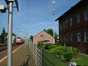
Waltershausen
Town in Thuringia, Germany
Distance: Approx. 170 meters
Latitude and longitude: 50.8975,10.55583333
Waltershausen is a town in the south-western part of the district of Gotha in the state of Thuringia, Germany.

Reinhardsbrunn
Distance: Approx. 3336 meters
Latitude and longitude: 50.86833333,10.5575
Reinhardsbrunn is a historic complex in Friedrichroda near Gotha, in the German state of Thuringia. From its founding in 1085 to 1525, it was the site of the Benedictine house monastery of the Ludovingian Landgraves of Thuringia. Later used as an administrative seat by the Ernestine dukes of Saxony, the property was turned into a castle and park erected by the Dukes of Saxe-Coburg and Gotha from 1827.

Friedrichroda
Town in Gotha, Thuringia, Germany
Distance: Approx. 3575 meters
Latitude and longitude: 50.86666667,10.56666667
Friedrichroda (German pronunciation: [fʁiːdʁɪçˈʁoːda] ) is a town in the district of Gotha, Thuringia, Germany. It is situated at the north foot of the Thuringian Forest, 21 km by rail southwest of the town of Gotha. It is surrounded by fir-clad hills and possesses numerous handsome villa residences, a Kurhaus and a sanatorium.
Fröttstädt station
Railway station in Fröttstädt, Germany
Distance: Approx. 3704 meters
Latitude and longitude: 50.93027778,10.5725
Fröttstädt is a railway station situated in Fröttstädt in the German state of Thuringia. It is situated on the Bebra to Erfurt main line, with another line branching off to Friedrichroda. A unique feature of the station is its warm water supply - the water is provided by a nearby residential building, using surplus boiler capacity.
Fröttstädt
Ortsteil of Hörsel in Thuringia, Germany
Distance: Approx. 4289 meters
Latitude and longitude: 50.93333333,10.58333333
Fröttstädt is a village and a former municipality in the district of Gotha in Thuringia, Germany. Since 1 December 2011, it is part of the municipality Hörsel. Its railway station has a unique water supply method.
Laucha, Thuringia
Ortsteil of Hörsel in Thuringia, Germany
Distance: Approx. 3372 meters
Latitude and longitude: 50.92722222,10.54361111
Laucha is a village and a former municipality in the district of Gotha in Thuringia, Germany. Since 1 December 2011, it is part of the municipality Hörsel.

Bad Tabarz
Municipality in Thuringia, Germany
Distance: Approx. 3590 meters
Latitude and longitude: 50.8825,10.51333333
Bad Tabarz is a municipality in the district of Gotha, in Thuringia, Germany. It is a winter sports resort and the terminus of the Thüringerwaldbahn rural tramway.
Hörselgau
Ortsteil of Hörsel in Thuringia, Germany
Distance: Approx. 3408 meters
Latitude and longitude: 50.9275,10.54333333
Hörselgau is a village and a former municipality in the district of Gotha in Thuringia, Germany. Since 1 December 2011 it is part of the municipality Hörsel.

Hörsel, Thuringia
Municipality in Thuringia, Germany
Distance: Approx. 2714 meters
Latitude and longitude: 50.91666667,10.58333333
is a municipality in the district of Gotha, in Thuringia, Germany. It was named after the river Hörsel, that flows through the municipality. It was formed on 1 December 2011 by the merger of the former municipalities Aspach, Ebenheim, Fröttstädt, Hörselgau, Neufrankenroda, Laucha, Mechterstädt, Metebach, Teutleben, Trügleben and Weingarten.
Reinhardsbrunn (Verwaltungsgemeinschaft)
Distance: Approx. 3575 meters
Latitude and longitude: 50.86666667,10.56666667
Reinhardsbrunn was a Verwaltungsgemeinschaft ("collective municipality") in the district of Gotha, in Thuringia, Germany. The seat of the Verwaltungsgemeinschaft was in Friedrichroda. It consisted of the following municipalities: Ernstroda Finsterbergen Friedrichroda The Verwaltungsgemeinschaft was disbanded on 1 December 2007.

Laucha (Hörsel)
River in Thuringia, Germany
Distance: Approx. 5010 meters
Latitude and longitude: 50.9417,10.539
Laucha is a river of Thuringia, Germany. It flows into the Hörsel near Mechterstädt.
Weather in this IP's area
light snow
-2 Celsius
-6 Celsius
-3 Celsius
-1 Celsius
1017 hPa
97 %
1017 hPa
966 hPa
3.13 m/s
4.67 m/s
336 degree
100 %

