31.209.153.139 - IP Lookup: Free IP Address Lookup, Postal Code Lookup, IP Location Lookup, IP ASN, Public IP
Country:
Region:
City:
Location:
Time Zone:
Postal Code:
ISP:
ASN:
language:
User-Agent:
Proxy IP:
Blacklist:
IP information under different IP Channel
ip-api
Country
Region
City
ASN
Time Zone
ISP
Blacklist
Proxy
Latitude
Longitude
Postal
Route
db-ip
Country
Region
City
ASN
Time Zone
ISP
Blacklist
Proxy
Latitude
Longitude
Postal
Route
IPinfo
Country
Region
City
ASN
Time Zone
ISP
Blacklist
Proxy
Latitude
Longitude
Postal
Route
IP2Location
31.209.153.139Country
Region
hofudborgarsvaedi
City
kopavogur
Time Zone
Atlantic/Reykjavik
ISP
Language
User-Agent
Latitude
Longitude
Postal
ipdata
Country
Region
City
ASN
Time Zone
ISP
Blacklist
Proxy
Latitude
Longitude
Postal
Route
Popular places and events near this IP address
Kópavogur
Municipality in Capital Region, Iceland
Distance: Approx. 238 meters
Latitude and longitude: 64.11083333,-21.90944444
Kópavogur (Icelandic pronunciation: [ˈkʰouːpaˌvɔːɣʏr̥] ) is a town in Iceland that is the country's second largest municipality by population. It lies immediately south of Reykjavík and is part of the Capital Region. The name literally means seal pup inlet.
Kópavogur College
Distance: Approx. 890 meters
Latitude and longitude: 64.11083333,-21.895
Kópavogur College (Icelandic: Menntaskólinn í Kópavogi Icelandic pronunciation: [ˈmɛn̥taˌskouːlɪn i ˈkʰouːpaˌvɔijɪ]) is an upper-secondary school in Kópavogur, Iceland, founded on September 22, 1973.

Kópavogskirkja
Church in Kópavogur, Iceland
Distance: Approx. 18 meters
Latitude and longitude: 64.11222222,-21.91333333
Kópavogskirkja (Icelandic pronunciation: [ˈkʰouːpaˌvɔksˌcʰɪr̥ca]) is a church in Kópavogur, Iceland. It is located on Borgarholt hill at the top of Kársnes and offers a great view over Kópavogur, Reykjavík and surrounding area. Work on it began in 1958 and it was opened on December 16, 1963.

Nauthólsvík
Distance: Approx. 1245 meters
Latitude and longitude: 64.1212,-21.9285
Nauthólsvík (Icelandic pronunciation: [ˈnœytˌhoulsˌviːk], "bull hill bay") is a Seaside resort and a small neighbourhood in Reykjavík, the capital city of Iceland, about 900 metres (3,000 ft) from Perlan. It has a beach with an artificial hot spring – hot water is pumped into a man-made lagoon. The temperature of the ocean is usually about 12 to 16 °C (54 to 61 °F) during the summer and drops down to about −2 °C (28 °F) in the winter.
Kópavogsvöllur
Stadium in Kópavogur, Iceland
Distance: Approx. 1228 meters
Latitude and longitude: 64.10388889,-21.89666667
Kópavogsvöllur (Icelandic pronunciation: [ˈkʰouːpaˌvɔksˌvœtlʏr̥], lit. 'Kópavogur Field' or more precisely 'Kópavogur Stadium') is a multi-use stadium in Kópavogur, Iceland. It is currently used mostly for football matches and is the home stadium of Breiðablik. It is also used for track and field events.
Öskjuhlíð
Distance: Approx. 1853 meters
Latitude and longitude: 64.128754,-21.918712
Öskjuhlíð (Icelandic pronunciation: [ˈœscʏˌl̥iːθ]) is a hill in the centre of Reykjavík, Iceland. It is 61 metres (200 ft) above sea level. The hill is a designated outdoors area and is covered with trees.
Kórinn
Distance: Approx. 14 meters
Latitude and longitude: 64.11222222,-21.91277778
Kórinn (Icelandic pronunciation: [ˈkʰouːrɪn]) is an indoor multipurpose auditorium located in Kópavogur and built in 2007. It includes an indoor football stadium which meets all the international standards set by the International Football Association FIFA. The auditorium covers an area of 14,457 m2 and has a seating capacity of 2000 spectators plus an additional 50 honor places. The auditorium is designed to accommodate concert acoustics and has a total standing capacity of up to 19,000 visitors.

Iceland School of Energy
Distance: Approx. 1430 meters
Latitude and longitude: 64.12361111,-21.92694444
The Iceland School of Energy (ISE; Icelandic: Íslenski Orkuháskólinn) is an international graduate school within the Department of Engineering at Reykjavik University, the largest private university in Iceland. ISE is jointly owned by Reykjavik Energy, Reykjavik University, and Iceland GeoSurvey, and specialises in the fields of Sustainable Energy and Electric Power.

Icelandic Meteorological Office
Icelandic national meteorological service
Distance: Approx. 1779 meters
Latitude and longitude: 64.12777778,-21.90388889
Icelandic Meteorological Office (IMO; Icelandic: Veðurstofa Íslands) is Iceland's national weather service and as such a government agency under the Ministry of Environment and Natural Resources. It is also active in volcano monitoring, esp.
Hof Ásatrúarfélagsins
Modern pagan religious building
Distance: Approx. 1224 meters
Latitude and longitude: 64.12259722,-21.92185556
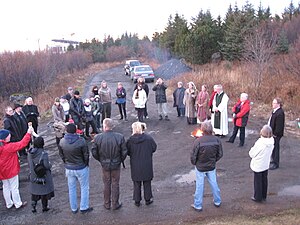
Hof Ásatrúarfélagsins is a religious building under construction in Reykjavík, Iceland. When finished it will be used by the Heathen organization Ásatrúarfélagið for religious ceremonies, concerts, exhibitions and administrative work. It is Iceland's first major hof to the Norse gods since the Viking Age.
Borgarspítalinn
Hospital in Reykjavík, Iceland
Distance: Approx. 1693 meters
Latitude and longitude: 64.1228146,-21.88782277
Borgarspítalinn (English: City Hospital) was an Icelandic hospital located in Fossvogur, Reykjavík from 1967 until 1996 when it merged with St. Jósefsspítali to form Reykjavík Hospital. Reykjavík Hospital then merged with Landspítali in 2000 to form the National University Hospital of Iceland.

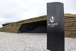
Sky Lagoon
Hot spring spa
Distance: Approx. 1804 meters
Latitude and longitude: 64.1164891,-21.9488657
Sky Lagoon is a geothermal spa in southwestern Iceland.
Weather in this IP's area
snow
1 Celsius
-3 Celsius
1 Celsius
1 Celsius
974 hPa
93 %
974 hPa
961 hPa
8000 meters
3.6 m/s
110 degree
100 %


