Country:
Region:
City:
Latitude and Longitude:
Time Zone:
Postal Code:
IP information under different IP Channel
ip-api
Country
Region
City
ASN
Time Zone
ISP
Blacklist
Proxy
Latitude
Longitude
Postal
Route
Luminati
Country
ASN
Time Zone
Europe/Berlin
ISP
Envia Tel GmbH
Latitude
Longitude
Postal
IPinfo
Country
Region
City
ASN
Time Zone
ISP
Blacklist
Proxy
Latitude
Longitude
Postal
Route
db-ip
Country
Region
City
ASN
Time Zone
ISP
Blacklist
Proxy
Latitude
Longitude
Postal
Route
ipdata
Country
Region
City
ASN
Time Zone
ISP
Blacklist
Proxy
Latitude
Longitude
Postal
Route
Popular places and events near this IP address

Chemnitzer Land
District in Saxony, Germany
Distance: Approx. 5970 meters
Latitude and longitude: 50.83333333,12.88333333
Chemnitzer Land is a former district in Saxony, Germany. It was bounded by (from the north and clockwise) the district of Mittweida, the city of Chemnitz, the districts of Stollberg and Zwickauer Land and the state of Thuringia (district Altenburger Land).

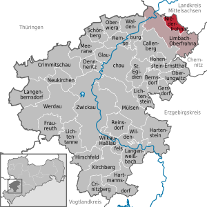
Limbach-Oberfrohna
Town in Saxony, Germany
Distance: Approx. 4235 meters
Latitude and longitude: 50.86666667,12.75
Limbach-Oberfrohna is a town in the district of Zwickau in Saxony, Germany.

Hartmannsdorf, Mittelsachsen
Municipality in Saxony, Germany
Distance: Approx. 3101 meters
Latitude and longitude: 50.88666667,12.79944444
Hartmannsdorf (Hartmannsdorf bei Chemnitz) is a small municipality in the district Mittweida, Saxony, in eastern Germany, near the city of Chemnitz. As of 2020 it has a population of 4,421.

Burgstädt
Town in Saxony, Germany
Distance: Approx. 6385 meters
Latitude and longitude: 50.91666667,12.81666667
Burgstädt (German pronunciation: [ˈbʊɐ̯kʃtɛt]) is a town in the district of Mittelsachsen, in Saxony, Germany. It is situated 12 km northwest of Chemnitz.

Splash! (festival)
Distance: Approx. 2535 meters
Latitude and longitude: 50.83694444,12.81416667
Splash! is one of Europe's biggest hip hop and reggae festivals. It first took place in 1998, in the inner city of Chemnitz, Germany.

Niederfrohna
Municipality in Saxony, Germany
Distance: Approx. 5048 meters
Latitude and longitude: 50.88055556,12.74555556
Niederfrohna is a municipality in the district of Zwickau in Saxony in Germany.
Mühlau, Germany
Municipality in Saxony, Germany
Distance: Approx. 5408 meters
Latitude and longitude: 50.9,12.76666667
Mühlau is a municipality in the district of Mittelsachsen, in Saxony, Germany. Mühlau lies in the arch mountain foothills approximately 3 kilometers to the north of Limbach-Oberfrohna, and 15 kilometers northwest of Chemnitz. The settlers of Mühlau originally came from Mehlem (currently part of Bonn) on the Rhine.

Limbach Municipal Church
Distance: Approx. 2974 meters
Latitude and longitude: 50.85805556,12.76694444
Limbach Municipal Church is a church in Limbach-Oberfrohna in Saxony (Germany), which was built in the 16th century. In 1811 it was transformed into a municipal church and in 1894 it was enlarged. In 1899 its tower was renewed after the old one was destroyed by lightning.

Botanischer Garten Chemnitz
Distance: Approx. 5721 meters
Latitude and longitude: 50.84949,12.889045
The Botanischer Garten Chemnitz (12 hectares) is a municipal botanical garden located at Leipziger Straße 147, Chemnitz, Saxony, Germany. It is open daily without charge. The garden was founded in 1898 on a 1-hectare site, and extended in 1933 with an additional 1.75 hectares of orchards.

Totenstein
Distance: Approx. 3434 meters
Latitude and longitude: 50.83333333,12.78333333
Totenstein is a mountain of Saxony, southeastern Germany.

Rabenstein Castle (Saxony)
Distance: Approx. 3006 meters
Latitude and longitude: 50.83311111,12.81824722
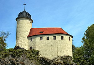
Rabenstein Castle (German:Burg Rabenstein) is the smallest Medieval castle in Saxony. It is located in the Chemnitz suburb of Rabenstein and belongs to the Chemnitz Castle Hill Museum.

Chemnitz Zoo
Zoo in Chemnitz, Germany
Distance: Approx. 4929 meters
Latitude and longitude: 50.81833333,12.835
The Chemnitz Zoo (German: Tierpark Chemnitz) is a zoo in the city Chemnitz in Sachsen, Germany. The Zoo was opened in 1964, and has a thousand animals from two hundred species, living on 10 hectares (24.7 acres). During the first decades, most species reflected the nature of the Soviet Union, and later the zoo moved into breeding endangered species.
Weather in this IP's area
clear sky
3 Celsius
0 Celsius
1 Celsius
5 Celsius
1029 hPa
86 %
1029 hPa
984 hPa
10000 meters
2.46 m/s
3.42 m/s
128 degree
2 %
07:13:06
16:32:01
