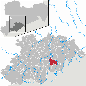
Country:
Region:
City:
Latitude and Longitude:
Time Zone:
Postal Code:
IP information under different IP Channel
ip-api
Country
Region
City
ASN
Time Zone
ISP
Blacklist
Proxy
Latitude
Longitude
Postal
Route
Luminati
Country
ASN
Time Zone
Europe/Berlin
ISP
Envia Tel GmbH
Latitude
Longitude
Postal
IPinfo
Country
Region
City
ASN
Time Zone
ISP
Blacklist
Proxy
Latitude
Longitude
Postal
Route
db-ip
Country
Region
City
ASN
Time Zone
ISP
Blacklist
Proxy
Latitude
Longitude
Postal
Route
ipdata
Country
Region
City
ASN
Time Zone
ISP
Blacklist
Proxy
Latitude
Longitude
Postal
Route
Popular places and events near this IP address

Marienberg
Town in Saxony, Germany
Distance: Approx. 3040 meters
Latitude and longitude: 50.63333333,13.15
Marienberg is a town in Germany. It was the district capital of the Mittlerer Erzgebirgskreis (Central Ore Mountains district) in the southern part of Saxony, and since August 2008 it has been part of the new district of Erzgebirgskreis. As of 2020, the town had 16,716 inhabitants.

Wolkenstein
Town in Saxony, Germany
Distance: Approx. 4030 meters
Latitude and longitude: 50.65444444,13.07472222
Wolkenstein is a town in the district Erzgebirgskreis, in Saxony, Germany. It is situated in the Ore Mountains, on the river Zschopau, 22 km southeast of Chemnitz. The town is situated on a rocky spur near the confluence of the Zschopau and Preßnitz rivers.

Mildenau
Municipality in Saxony, Germany
Distance: Approx. 4015 meters
Latitude and longitude: 50.59972222,13.06888889
Mildenau is a municipality in the district of Erzgebirgskreis, in Saxony, Germany.

Großrückerswalde
Municipality in Saxony, Germany
Distance: Approx. 844 meters
Latitude and longitude: 50.62916667,13.11916667
Großrückerswalde is a municipality in the district Erzgebirgskreis, in Saxony, Germany.
Dreibrüderhöhe
Mountain in Saxony, Germany
Distance: Approx. 3670 meters
Latitude and longitude: 50.65666667,13.12527778
Dreibrüderhöhe or short Brüderhöhe is a mountain of Saxony, southeastern Germany. It is located near Marienberg in Saxony and can reached by a road branching off Bundesstraße 171, or on hiking routes from Marienberg, Wolkenstein, Lauta, Großrückerswalde or Gehringswalde, among them the International Mountain Hiking Route Eisenach-Budapest (EB) which is now part of the E3 European long distance path.

Fuchshöhe
Mountain in Germany
Distance: Approx. 6230 meters
Latitude and longitude: 50.56944444,13.10694444
Fuchshöhe is a mountain of Saxony, southeastern Germany.

Pöhlbach
River in Germany
Distance: Approx. 3762 meters
Latitude and longitude: 50.6236,13.0556
The Pöhlbach (Czech: Polava) is a river of Saxony, Germany and of the Czech Republic. It is a right tributary of the Zschopau, which it joins near Thermalbad Wiesenbad.
Lauta (Marienberg)
Ortsteil of Marienberg in Saxony, Germany
Distance: Approx. 5437 meters
Latitude and longitude: 50.66666667,13.15
Lauta is a village in the Saxon town of Marienberg in the German district of Erzgebirgskreis.
St. Mary's Church, Marienberg
Distance: Approx. 4888 meters
Latitude and longitude: 50.65043,13.16568
St. Mary's Church (German: St. Marienkirche) in Marienberg in the German state of Saxony is an Evangelical-Lutheran church in the southeast of the county of Erzgebirgskreis.
Gehringswalde
Village of Wolkenstein in Saxony, Germany
Distance: Approx. 4051 meters
Latitude and longitude: 50.65972222,13.08972222
Gehringswalde, a so-called Waldhufendorf, is situated about 1.5 km east of Wolkenstein in the Ore Mountains. It extends for about 1.5 km along the valley of a stream which joins the Zschopau river ca. 1.5 km west of Warmbad.
Niederlauterstein
Ortsteil of Marienberg in Saxony, Germany
Distance: Approx. 5810 meters
Latitude and longitude: 50.67027778,13.15083333
Niederlauterstein is a village in Saxony which has been incorporated into the town of Marienberg in the district Erzgebirgskreis since 1996.
Mauersberg
District of Großrückerswalde in Saxony, Germany
Distance: Approx. 2256 meters
Latitude and longitude: 50.60888889,13.09027778
Mauersberg is a district of the Großrückerswalde municipality in the Erzgebirgskreis district of Saxony, Germany.
Weather in this IP's area
clear sky
4 Celsius
1 Celsius
2 Celsius
5 Celsius
1030 hPa
78 %
1030 hPa
964 hPa
10000 meters
3.01 m/s
7.01 m/s
142 degree
3 %
07:11:11
16:31:32
