Country:
Region:
City:
Latitude and Longitude:
Time Zone:
Postal Code:
IP information under different IP Channel
ip-api
Country
Region
City
ASN
Time Zone
ISP
Blacklist
Proxy
Latitude
Longitude
Postal
Route
Luminati
Country
Region
l
City
dublin
ASN
Time Zone
Europe/Dublin
ISP
Liberty Global B.V.
Latitude
Longitude
Postal
IPinfo
Country
Region
City
ASN
Time Zone
ISP
Blacklist
Proxy
Latitude
Longitude
Postal
Route
db-ip
Country
Region
City
ASN
Time Zone
ISP
Blacklist
Proxy
Latitude
Longitude
Postal
Route
ipdata
Country
Region
City
ASN
Time Zone
ISP
Blacklist
Proxy
Latitude
Longitude
Postal
Route
Popular places and events near this IP address

Lansdowne Road
Former stadium in Dublin
Distance: Approx. 184 meters
Latitude and longitude: 53.335,-6.22916667
Lansdowne Road Stadium (Irish: Bóthar Lansdún, IPA: [ˈbˠoːhəɾˠ ˈl̪ˠan̪ˠsˠd̪ˠuːn̪ˠ]) was a stadium in Dublin owned by the Irish Rugby Football Union (IRFU) that was primarily used for rugby union and association football matches. The stadium was demolished in 2007 to make way for the Aviva Stadium on the same site, which opened in 2010. The stadium took its name from the adjacent street, Lansdowne Road.
Shelbourne Road
Suburban Road in Dublin, Ireland
Distance: Approx. 324 meters
Latitude and longitude: 53.33401,-6.231969
Shelbourne Road (Irish: Bóthar Shíol Bhroin) is a road in Ballsbridge, in the southeast part of Dublin, Ireland.

Lansdowne Road railway station
Station in Dublin, Ireland
Distance: Approx. 136 meters
Latitude and longitude: 53.33382,-6.22914
Lansdowne Road railway station (Irish: Stáisiún Bhóthar Lansdúin) is a railway station in Dublin, Ireland. The station serves the Ballsbridge and Upper Baggot Street areas of Dublin 4.
Sandymount High School
School in Dublin, Ireland
Distance: Approx. 115 meters
Latitude and longitude: 53.3335,-6.2255
Sandymount High School was a coeducational secondary school on Herbert Road, Sandymount, Dublin 4 which operated for over 50 years before closing in 1999.
Newbridge Avenue
Road
Distance: Approx. 280 meters
Latitude and longitude: 53.335365,-6.22368
Newbridge Avenue (Irish: Ascaill an Droichid Nua) is a road in the Sandymount district of Dublin which links Herbert Road and Tritonville Road. In the novel Ulysses, the funeral of the character Paddy Dignam starts here at number 9 and continues on to Glasnevin Cemetery via Tritonville Road. The Dignams were said to live at number 9; the property was, in reality, vacant in 1904.

Herbert Road
Road in Ballsbridge, Ireland
Distance: Approx. 209 meters
Latitude and longitude: 53.3336,-6.224
Herbert Road (Irish: Bóthar Hoirbeaird) in Ballsbridge, Ireland is a mostly residential road that links Tritonville Road with Lansdowne Road. Newbridge Avenue joins by the bridge, in front of Marian College and the former site of Sandymount High School next door. There are several hotels on the road.

Aviva Stadium
Sports stadium in Dublin, Ireland
Distance: Approx. 174 meters
Latitude and longitude: 53.33527778,-6.22833333
Aviva Stadium, also known as Lansdowne Road (Irish: Bóthar Lansdún, IPA: [ˈbˠoːhəɾˠ ˈl̪ˠan̪ˠsˠd̪ˠuːnˠ]) or Dublin Arena (during UEFA competitions), is a sports stadium located in Dublin, Ireland, with a capacity for 51,711 spectators (all seated). It is built on the site of the former Lansdowne Road Stadium, which was demolished in 2007, and replaced it as home to its chief tenants: the Irish rugby union team and the Republic of Ireland football team. The decision to redevelop the stadium came after plans for both Stadium Ireland and Eircom Park fell through.
Mount Herbert Hotel
Hotel in Dublin, Ireland
Distance: Approx. 162 meters
Latitude and longitude: 53.333548,-6.22474
Sandymount Hotel (formerly the Mount Herbert Hotel) is a 4 star hotel in Dublin, Ireland, sited on the old Haig's Distillery. The hotel consists of 8 interconnected Victorian houses which were originally constructed in 1866 and built with bricks from the old distillery.
Institute of Public Administration (Ireland)
Distance: Approx. 189 meters
Latitude and longitude: 53.3336,-6.2299
The Institute of Public Administration (IPA) (Irish: An Foras Riaracháin) is a recognised college of the National University of Ireland. It was founded in 1957 at a meeting in Newman House where Tom Barrington became the first director and John Leydon its first president. The Institute's education, learning and development services are delivered through four key areas: the Whitaker School of Government and Management, Senior Public Service (SPS), OneLearning and Professional Development.
Lansdowne Road football riot
Riot in Dublin, Ireland by English (1995)
Distance: Approx. 186 meters
Latitude and longitude: 53.33500556,-6.22920278
The Lansdowne Road football riot occurred during a friendly football match between the Republic of Ireland and England in Lansdowne Road Stadium in Dublin, Ireland on 15 February 1995. Due to the ongoing Troubles, England fans were extremely unruly, as well as violent, and wound up forcing the match to be abandoned.
New Bridge (Dublin)
Bridge over the River Dodder in Ireland
Distance: Approx. 127 meters
Latitude and longitude: 53.334367,-6.225365
The New Bridge is a bridge over the River Dodder in Dublin, Ireland. It is also known as Herbert's Bridge or Lansdowne Bridge. The bridge is part of Lansdowne Road.
Marian College (Dublin)
Secondary school in Dublin, Ireland
Distance: Approx. 171 meters
Latitude and longitude: 53.332899,-6.229055
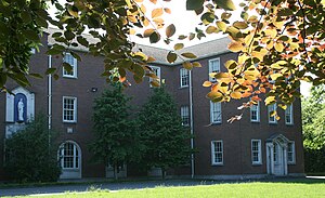
Marian College is a Marist Catholic secondary school in Ballsbridge, Dublin, Ireland that was established in 1954.
Weather in this IP's area
broken clouds
13 Celsius
13 Celsius
13 Celsius
14 Celsius
1026 hPa
86 %
1026 hPa
1025 hPa
10000 meters
2.06 m/s
150 degree
75 %
07:27:53
16:48:59

