Country:
 Poland
Region:
City:
Latitude and Longitude:
Time Zone:
Postal Code:
IP information under different IP Channel
ip-api
Country
Region
City
ASN
Time Zone
ISP
Blacklist
Proxy
Latitude
Longitude
Postal
Route
IPinfo
Country
Region
City
ASN
Time Zone
ISP
Blacklist
Proxy
Latitude
Longitude
Postal
Route
MaxMind
Country
Region
City
ASN
Time Zone
ISP
Blacklist
Proxy
Latitude
Longitude
Postal
Route
Luminati
Country
PLRegion
14
City
warsaw
ASN
Time Zone
Europe/Warsaw
ISP
Liberty Global B.V.
Latitude
Longitude
Postal
db-ip
Country
Region
City
ASN
Time Zone
ISP
Blacklist
Proxy
Latitude
Longitude
Postal
Route
ipdata
Country
Region
City
ASN
Time Zone
ISP
Blacklist
Proxy
Latitude
Longitude
Postal
Route
Popular places and events near this IP address

Stokłosy metro station
Warsaw metro station
Distance: Approx. 913 meters
Latitude and longitude: 52.15611111,21.03472222
Metro Stokłosy is a station on Line M1 of the Warsaw Metro, located in the Stokłosy neighbourhood of the Ursynów district in south Warsaw at the junction of Aleja KEN, Herbsta Street and Jarzębowskiego Street. It is situated between Imielin and Ursynów stations. The station was opened on 7 April 1995 as part of the inaugural stretch of the Warsaw Metro, between Kabaty and Politechnika.

Stokłosy
Neighbourhood in Warsaw, Poland
Distance: Approx. 606 meters
Latitude and longitude: 52.15888889,21.03444444
Stokłosy is a neighbourhood in Warsaw, Poland, located within the district of Ursynów, in the City Information System area of North Ursynów. It is a residential area, consisting of the highrise multifamily housing. It was constructed in 1977, together with Jary, as the neighbourhoods of the North Ursynów residential area.

Ursynów metro station
Warsaw metro station
Distance: Approx. 409 meters
Latitude and longitude: 52.16194444,21.02777778
Metro Ursynów is a station on Line M1 of the Warsaw Metro, located in the Ursynów district in south Warsaw, at the junction of Aleja KEN and Surowieckiego Street. The station was opened on 7 April 1995 as part of the inaugural stretch of the Warsaw Metro, between Kabaty and Politechnika.

Służew
Residential neighborhood in Warsaw, Poland
Distance: Approx. 558 meters
Latitude and longitude: 52.16916667,21.03138889
Służew, historically until 16th century known as Służewo, is a residential neighbourhood, and an area of the City Information System, in the city of Warsaw, Poland, located within the district of Mokotów.

Vistula University
Private university in Warsaw, Poland
Distance: Approx. 602 meters
Latitude and longitude: 52.15888889,21.03416667
Vistula University (VU; Polish: Akademia Finansów i Biznesu Vistula) is a non-public university based in Warsaw, Poland. It was established in 1991 as the University of Insurance and Banking. In January 1992, it was entered in the register of non-public higher education institutions of the Ministry of National Education and Sport under number 2.
Polskie Nagrania Muza
Major Polish record label
Distance: Approx. 207 meters
Latitude and longitude: 52.1628,21.0345
Polskie Nagrania "Muza" ("Polish Records 'Muse' ", official name since 2005: "Polskie Nagrania Sp. z o.o", i.e., Polskie Nagrania Ltd.) is a Polish record label based in Warsaw. It has produced records in many genres including pop, rock, jazz, folklore, classical, children.
Służew New Cemetery
Cemetery in Warsaw, Poland
Distance: Approx. 910 meters
Latitude and longitude: 52.1723,21.0343
The Służew New Cemetery (Polish: Nowy cmentarz na Służewie) is a Roman Catholic cemetery in Warsaw's Mokotów district, Poland. The cemetery is located at Wałbrzyska Street. The cemetery was established in 1900.

North Ursynów
Neighbourhood in Warsaw, Poland
Distance: Approx. 665 meters
Latitude and longitude: 52.15888889,21.02805556
North Ursynów is a neighbourhood, and a City Information System area, located in Warsaw, Poland, within the district of Ursynów. North Ursynów mostly consists of highrise multifamily housing. Two largest neighbourhoods, which make up most of its area, are Jary, and Stokłosy.
Jary, Warsaw
Neighbourhood in Warsaw, Poland
Distance: Approx. 808 meters
Latitude and longitude: 52.15888889,21.02444444
Jary is a neighbourhood in Warsaw, Poland, located within the district of Ursynów, in the City Information System of North Ursynów. The area was incorporated into the city of Warsaw in 1951. Jary was constructed between 1971 and 1977, together with Stokłosy, as neighbourhoods of the North Ursynów residential area.

Stary Służew
Neighbourhood in Warsaw, Poland
Distance: Approx. 875 meters
Latitude and longitude: 52.16361111,21.04527778
Stary Służew is a neighbourhood, and a City Information System area, located in Warsaw, Poland, within the district of Ursynów. The area is dominated by single-family housing with an additional presence of multifamily housing. It includes the historical portion of the neighbourhood of Służew, including the 19th-century Krasiński Palace, Catholic St.

Służew Valley Park
Urban park in Warsaw, Poland
Distance: Approx. 500 meters
Latitude and longitude: 52.16861111,21.03111111
The Służew Valley Park is an urban park in Warsaw, Poland. It is located in the neighbourhood of Służew, within the district of Mokotów, between Bacha Street, Wilanów Avenue, Puławska Street, and Dolina Służewiecka Street. The park was opened in the 1970s.
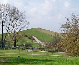
Roman Kozłowski Park
Urban park in Warsaw, Poland
Distance: Approx. 683 meters
Latitude and longitude: 52.16416667,21.0225
The Roman Kozłowski Park is an urban park in Warsaw, Poland, located in the district of Ursynów, between Koński Jar Street, Nutki Street, Rzymowskiego Street, and Puszczyka Street. It was opened in 1977.
Weather in this IP's area
clear sky
11 Celsius
10 Celsius
10 Celsius
12 Celsius
1026 hPa
57 %
1026 hPa
1014 hPa
10000 meters
5.66 m/s
140 degree
07:06:19
17:35:18