31.177.48.223 - IP Lookup: Free IP Address Lookup, Postal Code Lookup, IP Location Lookup, IP ASN, Public IP
Country:
Region:
City:
Location:
Time Zone:
Postal Code:
ISP:
ASN:
language:
User-Agent:
Proxy IP:
Blacklist:
IP information under different IP Channel
ip-api
Country
Region
City
ASN
Time Zone
ISP
Blacklist
Proxy
Latitude
Longitude
Postal
Route
db-ip
Country
Region
City
ASN
Time Zone
ISP
Blacklist
Proxy
Latitude
Longitude
Postal
Route
IPinfo
Country
Region
City
ASN
Time Zone
ISP
Blacklist
Proxy
Latitude
Longitude
Postal
Route
IP2Location
31.177.48.223Country
Region
la rioja
City
najera
Time Zone
Europe/Madrid
ISP
Language
User-Agent
Latitude
Longitude
Postal
ipdata
Country
Region
City
ASN
Time Zone
ISP
Blacklist
Proxy
Latitude
Longitude
Postal
Route
Popular places and events near this IP address

Nájera
Town in La Rioja, Spain
Distance: Approx. 245 meters
Latitude and longitude: 42.41666667,-2.73083333
Nájera (Spanish pronunciation: [ˈna.xe.ɾa]) is a small town, former bishopric and now Latin Catholic titular see, former capital of the Kingdom of Najera-Pamplona, located in the "Rioja Alta" region of La Rioja, northern Spain, on the river Najerilla. Nájera is a stopping point on the French Way the most popular path on the Way of St James.

Battle of Nájera
Battle of the Castilian Civil War
Distance: Approx. 2576 meters
Latitude and longitude: 42.4275,-2.7
The Battle of Nájera, also known as the Battle of Navarrete, was fought on 3 April 1367 to the northeast of Nájera, in the province of La Rioja, Castile. It was an episode of the first Castilian Civil War which confronted King Peter of Castile with his half-brother Count Henry of Trastámara who aspired to the throne; the war involved Castile in the Hundred Years' War. Castilian naval power, far superior to that of France or England, encouraged the two polities to take sides in the civil war, to gain control over the Castilian fleet.
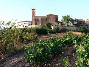
Alesón
Municipality in La Rioja, Spain
Distance: Approx. 3517 meters
Latitude and longitude: 42.40472222,-2.69
Alesón is a town and municipality in the province and autonomous community of La Rioja, Spain. The municipality covers an area of 6.49 square kilometres (2.51 sq mi) and as of 2011 had a population of 117 people. In 2023 the population is estimated to drop to 98 people.
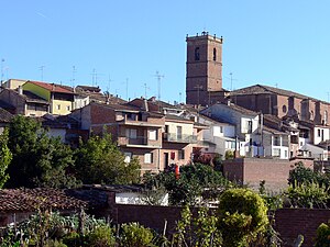
Arenzana de Abajo
Municipality in La Rioja, Spain
Distance: Approx. 3632 meters
Latitude and longitude: 42.38638889,-2.71888889
Arenzana de Abajo is a village in the province and autonomous community of La Rioja, Spain. The municipality covers an area of 8.39 square kilometres (3.24 sq mi) and as of 2011 had a population of 274 people.
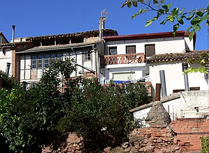
Hormilla
Municipality in La Rioja, Spain
Distance: Approx. 4325 meters
Latitude and longitude: 42.43777778,-2.77416667
Hormilla is a village in the province and autonomous community of La Rioja, Spain. The municipality covers an area of 15.86 square kilometres (6.12 sq mi) and as of 2011 had a population of 453 people.
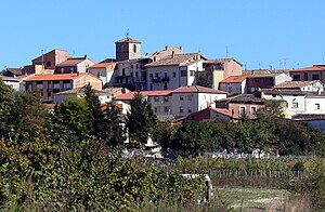
Hormilleja
Municipality in La Rioja, Spain
Distance: Approx. 4162 meters
Latitude and longitude: 42.45555556,-2.73083333
Hormilleja is a village in the province and autonomous community of La Rioja, Spain. The municipality covers an area of 7.44 square kilometres (2.87 sq mi) and as of 2011 had a population of 175 people.

Huércanos
Municipality in La Rioja, Spain
Distance: Approx. 3065 meters
Latitude and longitude: 42.42861111,-2.69416667
Huércanos is a village in the province and autonomous community of La Rioja, Spain. The municipality covers an area of 21.48 square kilometres (8.29 sq mi) and as of 2011 had a population of 917 people.

Tricio
Municipality in La Rioja, Spain
Distance: Approx. 2066 meters
Latitude and longitude: 42.40111111,-2.71888889
Tricio (Spanish pronunciation: [ˈtɾiθjo]) is a village in the province and autonomous community of La Rioja, Spain. The municipality covers an area of 6.35 square kilometres (2.45 sq mi) and as of 2011 had a population of 393 people.
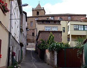
Uruñuela
Municipality in La Rioja, Spain
Distance: Approx. 3204 meters
Latitude and longitude: 42.44222222,-2.70722222
Uruñuela is a village in the province and autonomous community of La Rioja, Spain. The municipality covers an area of 13.9 square kilometres (5.4 sq mi) and as of 2011 had a population of 952 people.

Comarca de Nájera
Comarca in Spain
Distance: Approx. 3729 meters
Latitude and longitude: 42.391167,-2.7555
Nájera is a comarca in La Rioja province in Spain.

Basilica of Saint Mary of the Arches
Historic site in Tricio
Distance: Approx. 2251 meters
Latitude and longitude: 42.4029,-2.7108
The Basilica of Saint Mary of the Arches, Spanish: Basílica de Santa María de Arcos, is a paleochristian temple, which dates back to the 5th century, located on the outskirts of Tricio, in La Rioja (Spain). Other historians like Caballero, Arce and Utrero propose the hypothesis that it was built during the Reconquista in the 9th or 10th century based on technical and historical considerations. It was built over a Roman mausoleum of the 3rd century, reusing a number of pieces of this and other buildings of the ancient Roman city of Tritium Megalon.
La Salera
Football stadium in Nájera, Spain
Distance: Approx. 1201 meters
Latitude and longitude: 42.413,-2.7415
La Salera is a football stadium located in Nájera, Spain.
Weather in this IP's area
light rain
12 Celsius
11 Celsius
12 Celsius
12 Celsius
1005 hPa
76 %
1005 hPa
925 hPa
10000 meters
4.94 m/s
10.92 m/s
262 degree