Country:
Region:
City:
Latitude and Longitude:
Time Zone:
Postal Code:
IP information under different IP Channel
ip-api
Country
Region
City
ASN
Time Zone
ISP
Blacklist
Proxy
Latitude
Longitude
Postal
Route
Luminati
Country
Region
pac
City
marseille
ASN
Time Zone
Europe/Paris
ISP
Hardis Groupe SAS
Latitude
Longitude
Postal
IPinfo
Country
Region
City
ASN
Time Zone
ISP
Blacklist
Proxy
Latitude
Longitude
Postal
Route
db-ip
Country
Region
City
ASN
Time Zone
ISP
Blacklist
Proxy
Latitude
Longitude
Postal
Route
ipdata
Country
Region
City
ASN
Time Zone
ISP
Blacklist
Proxy
Latitude
Longitude
Postal
Route
Popular places and events near this IP address
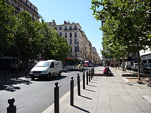
Canebière
Thoroughfare in Marseille, France
Distance: Approx. 523 meters
Latitude and longitude: 43.2975,5.38055556
La Canebière is a historic high street in the old quarter of Marseille, France.
Académie de Marseille
Distance: Approx. 245 meters
Latitude and longitude: 43.29722222,5.38530833
The Académie de Marseille, officially the Académie des sciences, lettres et arts de Marseille, is a French learned society based in Marseille. It was founded in 1726 and includes those in the city involved in the arts, letters, and sciences.

1st arrondissement of Marseille
Municipal arrondissement in Provence-Alpes-Côte d'Azur, France
Distance: Approx. 498 meters
Latitude and longitude: 43.2976,5.381
The 1st arrondissement of Marseille is one of the 16 arrondissements of Marseille. It is governed locally together with the 7th arrondissement, with which it forms the 1st sector of Marseille.

Cours Saint-Louis
Street in Marseille, France
Distance: Approx. 661 meters
Latitude and longitude: 43.29611111,5.37805556
The Cours Saint-Louis is a street in Marseille, named after Louis of Toulouse (elder brother of Robert of Naples) rather than Saint Louis. It is the location of small pavilions to designs by Pascal Coste from which flowers are sold. It is located just off a crossroads, with the route to the Place Castellane (via the Rue de Rome) leading off from one side, the route to the Porte d'Aix and its triumphal arch, completed in 1839 (the route also passes near the library Bibliothèque de L'Alcazar) leading off from the opposite side, two routes leading towards the Old Port (one of which being the famous La Canebière built in 1666 by King Louis XIV), a route towards Palais Longchamp (with a simple right turn onto the Canebèire).

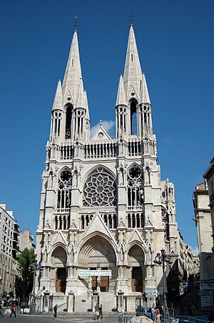
Église Saint-Vincent-de-Paul
Church in Provence-Alpes-Côte d'Azur, France
Distance: Approx. 412 meters
Latitude and longitude: 43.2988,5.3859
The Église Saint-Vincent-de-Paul (Les Réformés) is a Roman Catholic church in Marseille, France.

Église Notre-Dame-du-Mont
Church in Marseille
Distance: Approx. 384 meters
Latitude and longitude: 43.2917,5.3853
The Église Notre-Dame-du-Mont is a Roman Catholic church in Marseille.
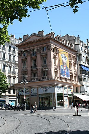
Place Jean-Jaurès
Historic square in Marseille, France
Distance: Approx. 34 meters
Latitude and longitude: 43.295,5.3865
The Place Jean-Jaurès, also known as La Plaine, is a historic square in Marseille, France. As early as the 13th century, it was a camping ground for Christian Crusaders on their way to the Holy Land. It later became a meeting place to welcome dignitaries and members of the French royal family.

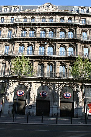
Hôtel Louvre et Paix
Distance: Approx. 648 meters
Latitude and longitude: 43.2969,5.3785
The Hôtel Louvre et Paix (a.k.a. Hôtel de la Marine) is a historic building in Marseille, France. Dedicated in 1863 as a luxury hotel, it was used by the Kriegsmarine during World War II. It now houses city administration offices and a C&A store.

Couvent des Bernardines
Convent in Marseille, France
Distance: Approx. 385 meters
Latitude and longitude: 43.2964,5.3817
The Couvent des Bernardines is a historic building in the 1st arrondissement of Marseille, France. It was a Roman Catholic convent for the Bernardines from its construction in 1743 to the French Revolution. It has been home to a high school, the Lycée Thiers, since 1802.

Boulevard d'Athènes
Distance: Approx. 712 meters
Latitude and longitude: 43.3002,5.3808
The Boulevard d'Athènes is a historic boulevard in Marseille, France. Situated in the 1st arrondissement of Marseille, it runs from the Rue Marcel Sembat (off the Gare de Marseille-Saint-Charles) to the Allée Léon Gambetta, where it becomes the Boulevard Dugommier and finally meets the Canebière.

Maison du Figaro
Building in Marseille, France
Distance: Approx. 654 meters
Latitude and longitude: 43.29635,5.37821
The Maison du Figaro is a historic building in the 1st arrondissement of Marseille in France. It was designed by architect Pierre Pavillon, and it was completed in 1675. It has been listed as an official historical monument since 1992.
Thiers, Marseille
Administrative quarter of the 1st arrondissement of Marseille, Provence-Alpes-Côte d'Azur, France
Distance: Approx. 357 meters
Latitude and longitude: 43.29694444,5.3825
Thiers is a neighbourhood (French: quartier) of the 1st arrondissement of Marseille. A cultural and student quarter in the centre of Marseille, it is located between Place Jean-Jaurès and La Canebière, near the Vieux-Port.
Weather in this IP's area
overcast clouds
19 Celsius
18 Celsius
17 Celsius
20 Celsius
1022 hPa
65 %
1022 hPa
1016 hPa
10000 meters
4.16 m/s
7.83 m/s
108 degree
87 %
07:22:56
17:21:34

