31.172.160.4 - IP Lookup: Free IP Address Lookup, Postal Code Lookup, IP Location Lookup, IP ASN, Public IP
Country:
Region:
City:
Location:
Time Zone:
Postal Code:
IP information under different IP Channel
ip-api
Country
Region
City
ASN
Time Zone
ISP
Blacklist
Proxy
Latitude
Longitude
Postal
Route
Luminati
Country
ASN
Time Zone
Europe/Paris
ISP
Free Pro SAS
Latitude
Longitude
Postal
IPinfo
Country
Region
City
ASN
Time Zone
ISP
Blacklist
Proxy
Latitude
Longitude
Postal
Route
IP2Location
31.172.160.4Country
Region
hauts-de-france
City
vendeville
Time Zone
Europe/Paris
ISP
Language
User-Agent
Latitude
Longitude
Postal
db-ip
Country
Region
City
ASN
Time Zone
ISP
Blacklist
Proxy
Latitude
Longitude
Postal
Route
ipdata
Country
Region
City
ASN
Time Zone
ISP
Blacklist
Proxy
Latitude
Longitude
Postal
Route
Popular places and events near this IP address
Wattignies
Commune in Hauts-de-France, France
Distance: Approx. 2644 meters
Latitude and longitude: 50.5856,3.0439
Wattignies (French pronunciation: [watiɲi]; Dutch: Wattenijs) is a commune in the Nord department of northern France. It lies in the south-western part of the Lille conurbation. It covers an area of 6.31 square kilometres (2.44 sq mi), and as of 2019 its population was 15,075.

Lille Airport
Airport in Lesquin, France
Distance: Approx. 1619 meters
Latitude and longitude: 50.56333333,3.08694444
Lille Airport (French: Aéroport de Lille) (IATA: LIL, ICAO: LFQQ) is an airport located in Lesquin, 7 km (4 mi) south-southeast of Lille, a city in northern France. It is also known as Lille-Lesquin Airport or Lesquin Airport. Lille is the principal city of the Lille Métropole, the capital of the Hauts-de-France region and the prefecture of the Nord department.

Faches-Thumesnil
Commune in Hauts-de-France, France
Distance: Approx. 2523 meters
Latitude and longitude: 50.5994,3.0744
Faches-Thumesnil (French pronunciation: [faʃ tymenil]) is a commune in the Nord department in northern France. It is a suburb south of Lille and forms part of the Métropole Européenne de Lille.
Lesquin
Commune in Hauts-de-France, France
Distance: Approx. 2787 meters
Latitude and longitude: 50.5906,3.1117
Lesquin (French pronunciation: [lekɛ̃]) is a commune in the department of Nord, northern France.
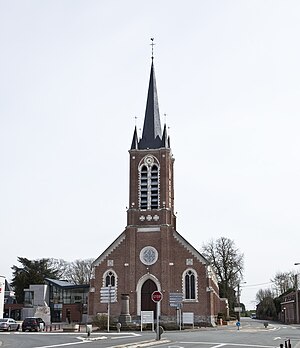
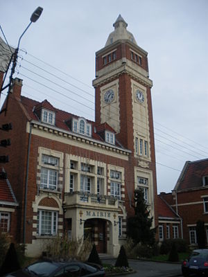
Vendeville
Commune in Hauts-de-France, France
Distance: Approx. 96 meters
Latitude and longitude: 50.5761,3.0792
Vendeville (French pronunciation: [vɑ̃dvil]) is a commune in the Nord department in northern France. It is part of the Métropole Européenne de Lille.
Templemars
Commune in Hauts-de-France, France
Distance: Approx. 1693 meters
Latitude and longitude: 50.5747,3.055
Templemars (French pronunciation: [tɑ̃pləmaʁ]) is a commune in the Nord department in northern France. It is part of the Métropole Européenne de Lille. The commune has the head office of Castorama.
Ronchin
Commune in Hauts-de-France, France
Distance: Approx. 3238 meters
Latitude and longitude: 50.6053,3.0886
Ronchin (French pronunciation: [ʁɔ̃ʃɛ̃]) is a commune in the Nord department, Hauts-de-France, France. It is part of the European Metropolis of Lille.

Avelin
Commune in Hauts-de-France, France
Distance: Approx. 4050 meters
Latitude and longitude: 50.5406,3.0825
Avelin (French pronunciation: [avlɛ̃]) is a commune in the Nord department in northern France. It is 10 km (6.2 mi) south of the centre of Lille. The village's name is of Germanic origin.
Jardin botanique de la Faculté de Pharmacie
Botanical garden and arboretum in Nord-Pas-de-Calais, France
Distance: Approx. 4137 meters
Latitude and longitude: 50.6058,3.0419
The Jardin botanique de la Faculté de Pharmacie (2 hectares), more formally the Jardin de la Faculté des Sciences Pharmaceutiques et Biologiques de l'Université de Lille 2, is a botanical garden and arboretum operated by the Faculty of Pharmacy of the Université de Lille 2. It is located at 3 Rue du Professeur Laguesse, Lille, Nord, Nord-Pas-de-Calais, France, and open weekdays except university holidays; an admission fee is charged. It is one of three botanical gardens in Lille, the others being the Jardin des Plantes de Lille and the Jardin botanique Nicolas Boulay at the Université Catholique de Lille.
Mélantois
Distance: Approx. 783 meters
Latitude and longitude: 50.5833,3.0833
The Mélantois (French pronunciation: [melɑ̃twa]) is an inland area of northern France, at south-east of Lille. Between the Deûle and the Marque, it is bounded to the north by a line from Willems to La Madeleine. It is a chalky plateau at an altitude of between 20 and 45 metres (66 and 148 ft), with gentle slopes (below 5 %).

Lycée Faidherbe
Distance: Approx. 4249 meters
Latitude and longitude: 50.615,3.075
Lycée Faidherbe is a senior high school/sixth-form college in Lille, France. It includes a boarding facility for Classe préparatoire aux grandes écoles (CPGE) students.
Canton of Faches-Thumesnil
Distance: Approx. 2644 meters
Latitude and longitude: 50.6,3.07
The canton of Faches-Thumesnil is an administrative division of the Nord department, northern France. It was created at the French canton reorganisation which came into effect in March 2015. Its seat is in Faches-Thumesnil.
Weather in this IP's area
fog
3 Celsius
1 Celsius
2 Celsius
4 Celsius
1033 hPa
89 %
1033 hPa
1028 hPa
500 meters
2.06 m/s
40 degree
100 %


