Country:
 Romania
Region:
City:
Latitude and Longitude:
Time Zone:
Postal Code:
IP information under different IP Channel
ip-api
Country
Region
City
ASN
Time Zone
ISP
Blacklist
Proxy
Latitude
Longitude
Postal
Route
IPinfo
Country
Region
City
ASN
Time Zone
ISP
Blacklist
Proxy
Latitude
Longitude
Postal
Route
MaxMind
Country
Region
City
ASN
Time Zone
ISP
Blacklist
Proxy
Latitude
Longitude
Postal
Route
Luminati
Country
ROASN
Time Zone
Europe/Bucharest
ISP
AdalysNET SRL
Latitude
Longitude
Postal
db-ip
Country
Region
City
ASN
Time Zone
ISP
Blacklist
Proxy
Latitude
Longitude
Postal
Route
ipdata
Country
Region
City
ASN
Time Zone
ISP
Blacklist
Proxy
Latitude
Longitude
Postal
Route
Popular places and events near this IP address

Ploiești
City in Prahova, Romania
Distance: Approx. 6675 meters
Latitude and longitude: 44.94111111,26.0225
Ploiești (UK: ploy-ESH-tee, US: plaw-YESHT-ee, Romanian: [ploˈjeʃtʲ]), formerly spelled Ploești, is a city and county seat in Prahova County, Romania. Part of the historical region of Muntenia, it is located 56 km (35 mi) north of Bucharest. The area of Ploiești is around 60 km2 (23 sq mi), and it borders the Blejoi commune in the north, Bărcănești and Brazi communes in the south, Târgșoru Vechi commune in the west, and Bucov and Berceni communes in the east.

Republic of Ploiești
1870 revolt against the Romanian monarchy in Ploiești
Distance: Approx. 6159 meters
Latitude and longitude: 44.93333333,26.03333333
The Republic of Ploiești (Romanian: Republica de la Ploiești) was a revolt against the princely Romanian monarchy in the city of Ploiești, Romania, on 8 August, 1870.

Operation Tidal Wave
1943 U.S. strategic bombing campaign of oil refineries in Ploiești, Romania during WWII
Distance: Approx. 5723 meters
Latitude and longitude: 44.93333333,26.01666667
Operation Tidal Wave was an air attack by bombers of the United States Army Air Forces (USAAF) based in Libya on nine oil refineries around Ploiești, Romania, on 1 August 1943, during World War II. It was a strategic bombing mission and part of the "oil campaign" to deny petroleum-based fuel to the Axis powers. The mission resulted in "no curtailment of overall product output". This operation was one of the costliest for the USAAF in the European Theater, with 53 aircraft and 500 aircrewmen lost.
Bărcănești, Prahova
Commune in Prahova, Romania
Distance: Approx. 3944 meters
Latitude and longitude: 44.88333333,26.05
Bărcănești is a commune in Prahova County, Muntenia, Romania. It is composed of five villages: Bărcănești, Ghighiu, Pușcași, Românești, and Tătărani.

Brazi
Commune in Prahova, Romania
Distance: Approx. 4 meters
Latitude and longitude: 44.88333333,26
Brazi is a commune in Prahova County, Muntenia, Romania. It is composed of six villages: Bătești, Brazii de Jos, Brazii de Sus (the commune centre), Negoiești, Popești, and Stejaru. Its name translates to "firs" as in the tree.
Petrom Brazi Power Station
Distance: Approx. 340 meters
Latitude and longitude: 44.880334,25.99896
The Petrom Brazi Power Station is one of the largest electricity producers in Romania, having 2 natural gas-fired groups of 430 MW each, totalling an installed capacity of 860 MW and an electricity generation capacity of around 6 TWh/year. The power plant is situated in Prahova County (southern Romania) near Petrom's refinery in Brazi. The construction of the power plant began in 2009 and was completed in 2011 at a total cost of 530 million Euros.

Târgșoru Vechi
Commune in Prahova, Romania
Distance: Approx. 6573 meters
Latitude and longitude: 44.88333333,25.91666667
Târgșoru Vechi is a commune in Prahova County, Muntenia, Romania. It is composed of four villages: Stăncești, Strejnicu (commune seat), Târgșoru Vechi, and Zahanaua. There is an aerodrome for general aviation in Strejnicu, mostly used by Aeroclubul României.

Stadionul Prahova
Distance: Approx. 4707 meters
Latitude and longitude: 44.91389167,26.04121389
Prahova Stadium was a football-only stadium in Ploieşti, Romania. It was the home ground of Prahova Ploieşti. It was used mostly for football matches and is the home ground of the reserve and youth teams of football teams of Astra Ploieşti.
Castra of Târgșoru Vechi
Fort in the Roman province of Dacia
Distance: Approx. 6573 meters
Latitude and longitude: 44.88333333,25.91666667
It was a fort in the Roman province of Dacia.
Tinosu (archaeological site)
Distance: Approx. 6539 meters
Latitude and longitude: 44.8252,26.0122
Tinosu or Pisculeşti was a Dacian fortified town, occupied sometime between the 2nd century BCE to 1st century CE. On the eastern bank of the Prahova River, it was fortified with a fosse and palisade-topped wall. The site was excavated by Cezar Bolliac in the 1860s. Discoveries of Getic and Roman coins from the reign of Claudius allowed archaeologists to date its occupation.

Târgșor
Distance: Approx. 5821 meters
Latitude and longitude: 44.889125,25.92665833
Târgșor is a former medieval market town in what is now Prahova County, Romania. The town peaked around 1600, after which it declined to become the village of Târgșoru Vechi, located about 7 km (4.3 mi) southwest of Ploiești.
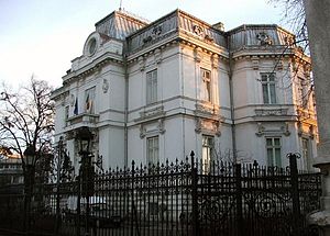
Ploiești Art Museum
Distance: Approx. 6424 meters
Latitude and longitude: 44.938093,26.0255592
The Ploiești Art Museum, officially the Ion Ionescu-Quintus Prahova County Art Museum (Romanian: Muzeul Județean de Artă Prahova „Ion Ionescu-Quintus”), is an art museum located at 1 Independenței Boulevard, Ploiești, Romania.
Weather in this IP's area
clear sky
6 Celsius
4 Celsius
6 Celsius
7 Celsius
1031 hPa
88 %
1031 hPa
1013 hPa
10000 meters
2.01 m/s
2.77 m/s
42 degree
07:38:09
18:23:01