Country:
 Romania
Region:
City:
Latitude and Longitude:
Time Zone:
Postal Code:
IP information under different IP Channel
ip-api
Country
Region
City
ASN
Time Zone
ISP
Blacklist
Proxy
Latitude
Longitude
Postal
Route
IPinfo
Country
Region
City
ASN
Time Zone
ISP
Blacklist
Proxy
Latitude
Longitude
Postal
Route
MaxMind
Country
Region
City
ASN
Time Zone
ISP
Blacklist
Proxy
Latitude
Longitude
Postal
Route
Luminati
Country
RORegion
bz
City
ziduri
ASN
Time Zone
Europe/Bucharest
ISP
Orange Romania S.A.
Latitude
Longitude
Postal
db-ip
Country
Region
City
ASN
Time Zone
ISP
Blacklist
Proxy
Latitude
Longitude
Postal
Route
ipdata
Country
Region
City
ASN
Time Zone
ISP
Blacklist
Proxy
Latitude
Longitude
Postal
Route
Popular places and events near this IP address
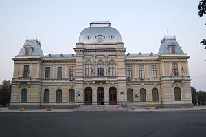
Râmnicu Sărat
City in Buzău County, Romania
Distance: Approx. 865 meters
Latitude and longitude: 45.38,27.06
Râmnicu Sărat (also spelled Rîmnicu Sărat, Romanian pronunciation: [ˌrɨmniku səˈrat], German: Rümnick or Rebnick; Turkish: Remnik) is a city in Buzău County, Romania, in the historical region of Muntenia. It was first attested in a document of 1439, and raised to the rank of municipiu in 1994. The city rises from a marshy plain, east of the Carpathian Mountains, and west of the cornlands of southern Moldavia.

Battle of Rymnik
1789 battle of the Russo-Turkish War (1787–1792)
Distance: Approx. 697 meters
Latitude and longitude: 45.3917,27.0611
The Battle of Rymnik or Rimnik, also Battle of Mărtinești (Turkish: Boze Savaşı [Battle of the Boze]; Russian: Рымникское сражение [Battle of the Rymnik]; German: Schlacht am Rimnik), on September 22 [O.S. September 11] 1789, took place in Wallachia, at the Râmnicul Sărat River, known as the Rymnik, near Râmnicu Sărat or Rymnik (now in Romania) during the Russo-Turkish War of 1787–1792 and the Austro-Turkish War of 1788–1791. The Russian general Alexander Suvorov, acting together with the Habsburg general Prince Josias of Coburg, attacked the main Ottoman army under Grand Vizier Cenaze Hasan Pasha, which was much larger. The result was a crushing Russo-Austrian victory.

Ziduri
Commune in Buzău, Romania
Distance: Approx. 9932 meters
Latitude and longitude: 45.3,27.08333333
Ziduri is a commune in Buzău County, Muntenia, Romania. It is composed of six villages: Costieni, Cuculeasa, Heliade Rădulescu, Lanurile, Ziduri and Zoița.

Grebănu
Commune in Buzău, Romania
Distance: Approx. 6140 meters
Latitude and longitude: 45.37777778,26.97777778
Grebănu is a commune in Buzău County, Muntenia, Romania. It is composed of six villages: Grebănu, Homești, Livada, Livada Mică, Plevna and Zăplazi.

Podgoria
Commune in Buzău, Romania
Distance: Approx. 5709 meters
Latitude and longitude: 45.43333333,27.02388889
Podgoria is a commune in Buzău County, Muntenia, Romania. It is composed of five villages: Coțatcu, Oratia, Pleșești, Podgoria and Tăbăcari.

Râmnicelu, Buzău
Commune in Buzău, Romania
Distance: Approx. 5313 meters
Latitude and longitude: 45.36666667,27.11666667
Râmnicelu is a commune in Buzău County, Muntenia, Romania. It is composed of four villages: Colibași, Fotin, Râmnicelu and Știubei. At the 2011 census, 57.1% of inhabitants were Romanians and 42.7% were Roma.

Topliceni
Commune in Buzău, Romania
Distance: Approx. 3738 meters
Latitude and longitude: 45.4,27.01111111
Topliceni is a commune in Buzău County, Muntenia, Romania. It is composed of seven villages: Băbeni, Ceairu, Dedulești, Gura Făgetului, Poșta, Răducești and Topliceni. The commune is located in the northern part of the county, right next to the city of Râmnicu Sărat, some 40 km (25 mi) north of the county seat, Buzău.

Valea Râmnicului
Commune in Buzău, Romania
Distance: Approx. 3300 meters
Latitude and longitude: 45.35833333,27.04444444
Valea Râmnicului is a commune in Buzău County, Muntenia, Romania. It is composed of three villages: Oreavu, Rubla and Valea Râmnicului.
Greabăn
River in Buzău County, Romania
Distance: Approx. 1606 meters
Latitude and longitude: 45.38277778,27.03555556
The Greabăn is a right tributary of the river Râmnicul Sărat in Romania. It discharges into the Râmnicul Sărat in the city Râmnicu Sărat. Its length is 14 km (8.7 mi) and its basin size is 22 km2 (8.5 sq mi).
Cireș (Coțatcu)
River in Vrancea, Romania
Distance: Approx. 9454 meters
Latitude and longitude: 45.44888889,27.13805556
The Cireș is a left tributary of the river Coțatcu in Romania. It discharges into the Coțatcu in Voetin. Its length is 12 km (7.5 mi) and its basin size is 34 km2 (13 sq mi).

Râmnicu Sărat Prison
Distance: Approx. 408 meters
Latitude and longitude: 45.38333333,27.05527778
Râmnicu Sărat Prison is a former prison located in Râmnicu Sărat, Buzău County, Romania. The building is listed as a historic monument by Romania's Ministry of Culture and Religious Affairs.

Alexandru Vlahuță National College
High school in Romania
Distance: Approx. 1194 meters
Latitude and longitude: 45.3777,27.0476
Alexandru Vlahuță National College (Romanian: Colegiul Național Alexandru Vlahuță) is a high school located at 13 Tudor Vladimirescu Street, Râmnicu Sărat, Romania. The school opened as a boys’ gymnasium in September 1889. It initially had a single grade with two teachers, and was located in the former town hall.
Weather in this IP's area
clear sky
13 Celsius
12 Celsius
13 Celsius
13 Celsius
1018 hPa
65 %
1018 hPa
1003 hPa
10000 meters
1.86 m/s
1.79 m/s
270 degree
07:17:35
18:41:13