Country:
 Ukraine
Region:
City:
Latitude and Longitude:
Time Zone:
Postal Code:
IP information under different IP Channel
ip-api
Country
Region
City
ASN
Time Zone
ISP
Blacklist
Proxy
Latitude
Longitude
Postal
Route
IPinfo
Country
Region
City
ASN
Time Zone
ISP
Blacklist
Proxy
Latitude
Longitude
Postal
Route
MaxMind
Country
Region
City
ASN
Time Zone
ISP
Blacklist
Proxy
Latitude
Longitude
Postal
Route
Luminati
Country
UARegion
56
City
rivne
ASN
Time Zone
Europe/Kyiv
ISP
Private Joint Stock Company datagroup
Latitude
Longitude
Postal
db-ip
Country
Region
City
ASN
Time Zone
ISP
Blacklist
Proxy
Latitude
Longitude
Postal
Route
ipdata
Country
Region
City
ASN
Time Zone
ISP
Blacklist
Proxy
Latitude
Longitude
Postal
Route
Popular places and events near this IP address

Volyn Oblast
Oblast (region) of Ukraine
Distance: Approx. 2152 meters
Latitude and longitude: 50.74138889,25.35388889
Volyn Oblast (Ukrainian: Волинська область, romanized: Volynska oblast) or simply Volyn (Ukrainian: Волинь), is an oblast (province) in northwestern Ukraine. It borders Rivne Oblast to the east, Lviv Oblast to the south, Poland to the west and Belarus to the north. Its administrative centre is Lutsk.

Volhynia
Historical region in Central and Eastern Europe
Distance: Approx. 2639 meters
Latitude and longitude: 50.73888889,25.32333333
Volhynia (also spelled Volynia) ( voh-LIN-ee-ə; Ukrainian: Волинь, romanized: Volynʹ, Polish: Wołyń, Russian: Волынь, romanized: Volynʹ, Yiddish: װאָלין, romanized: Volin) is a historic region in Central and Eastern Europe, between southeastern Poland, southwestern Belarus, and northwestern Ukraine. The borders of the region are not clearly defined, but in Ukraine it is roughly equivalent to Volyn and Rivne Oblasts; the territory that still carries the name is Volyn Oblast. Volhynia has changed hands numerous times throughout history and been divided among competing powers.
Volhynian Voivodeship (1569–1795)
Voivodeship of the Grand Duchy of Lithuania then of the Kingdom of Poland
Distance: Approx. 2246 meters
Latitude and longitude: 50.744814,25.320212
Volhynian Voivodeship (Polish: Województwo wołyńskie, Latin: Palatinatus Volhynensis, Ukrainian: Волинське воєводство, Volynske voievodstvo) was a unit of administrative division and local government in the Grand Duchy of Lithuania from 1566 until 1569 and of the Polish Crown within the Polish–Lithuanian Commonwealth from the 1569 Union of Lublin until the Third Partition of Poland in 1795. It was part of the Ruthenian lands in the Lesser Poland Province.

Lutsk
City and administrative center of Volyn Oblast, Ukraine
Distance: Approx. 1134 meters
Latitude and longitude: 50.75,25.33583333
Lutsk (Ukrainian: Луцьк, IPA: [lut͡sʲk] ; see below for other names) is a city on the Styr River in northwestern Ukraine. It is the administrative center of Volyn Oblast and the administrative center of Lutsk Raion within the oblast. Lutsk has a population of 220,986 (2022 estimate).

Lutsk Air Base
Ukrainian Air Force base
Distance: Approx. 2728 meters
Latitude and longitude: 50.78333333,25.35
Lutsk (ICAO: UKLC) is an air base of the Ukrainian Air Force located near Lutsk, Volyn Oblast, Ukraine. Previously closed in 2006, the air base was reopened for works in 2014 and since 2018 housed the 204th Tactical Aviation Brigade that currently operates Mikoyan MiG-29M/UB and Aero L-39C Albatross aircraft.

Wołyń Voivodeship (1921–1939)
Former voivodeship of Poland
Distance: Approx. 2246 meters
Latitude and longitude: 50.744814,25.320212
Wołyń Voivodeship or Wołyń Province was an administrative region of interwar Poland (1918–1939) with an area of 35,754 km², 22 cities, and provincial capital in Łuck. The province was divided into 11 counties (powiaty). The area comprised part of the historical region of Volhynia.

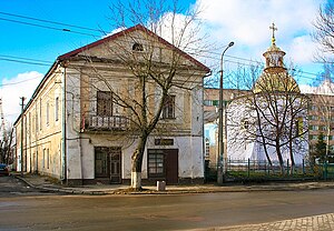
Ukrainian Catholic Archiepiscopal Exarchate of Lutsk
Ukrainian Catholic missionary jurisdiction in north western Ukraine
Distance: Approx. 2085 meters
Latitude and longitude: 50.75,25.3167
The Archiepiscopal Exarchate of Lutsk (Lutsk of the Ukrainians) is an Archiepiscopal Exarchate (rare Eastern Catholic pre-diocesan jurisdiction, comparable to a Patriarchal exarchate, Apostolic exarchate or Latin Apostolic vicariate; both other cases are also Ukrainian Catholic) in Ukraine of the Ukrainian Greek Catholic Church (Byzantine Rite in Ukrainian language). Its cathedral episcopal see is the Cathedral of the Nativity of the Theotokos, in Lutsk (Луцьк), Volyn Oblast.

Lubart's Castle
14th century castle in Lutsk, Ukraine
Distance: Approx. 2639 meters
Latitude and longitude: 50.73888889,25.32333333
Lutsk Castle (Ukrainian: Луцький замок, romanized: Lutskyi zamok;, Polish: Zamek w Łucku), also locally known as Liubart's Castle (Lithuanian: Liubarto pilis, Замок Любарта, Zamok Liubarta) or Upper Castle (Lithuanian: Lucko aukštutinė pilis, Верхній замок, Verkhnii zamok), began its life in the mid-14th century as the fortified seat of Gediminas' son Liubartas (Lubart), the last ruler of united Galicia-Volhynia. It is the most prominent landmark of Lutsk, Ukraine and as such appears on the 200 hryvnia bill. (Another city castle, called Lower Castle, built by the Czartoryski family since the 14th century, is now a ruin).
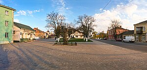
Market Square (Lutsk)
Distance: Approx. 2797 meters
Latitude and longitude: 50.73972222,25.3175
Market Square is one of the oldest squares in Lutsk, Ukraine, dating back to the 14th century. The square was developed after Lutsk received Magdeburg Rights. Over the years, Market Square has been the commercial, social and political center of the city.
Lutsk Orthodox Fellowship of the True Cross
Church in Lutsk, Ukraine
Distance: Approx. 2760 meters
Latitude and longitude: 50.740512,25.316839
The Lutsk Orthodox Fellowship of the True Cross is an architectural and historical complex consisting of a church and a monastery and located on the border of the market and Bratskiy Mist squares in Lutsk, Ukraine. The buildings were constructed during the 1630s and 1640s, and were the political center of the Orthodox people of Volyn. The Lutsk fellowship began to decline at the turn of the 18th century, and the buildings deteriorated.
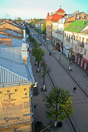
Lesya Ukrainka street, Lutsk
Distance: Approx. 2266 meters
Latitude and longitude: 50.74388889,25.32138889
Lesya Ukrainka street (formerly known as Jagiellońska - Jagiellon street) is a central pedestrian street in Lutsk, Ukraine, running from Fellowship Bridge Square to the city's central Theatre Square. The street is 730 metres long, and is the main street of the northern and eastern areas of the Glushets suburb of Lutsk. There have been at least ten churches and monasteries located on the street.

Holy Trinity Orthodox Cathedral, Lutsk
Church in Lutsk, Ukraine
Distance: Approx. 1861 meters
Latitude and longitude: 50.746205,25.325972
The Holy Trinity Orthodox Cathedral in Lutsk, Ukraine, forms part of the Bernardine Monastery and Church. It is located on Theatre Square in the center of the city. The monastery was built in 1721.
Weather in this IP's area
broken clouds
12 Celsius
12 Celsius
12 Celsius
12 Celsius
1027 hPa
89 %
1027 hPa
1004 hPa
10000 meters
0.45 m/s
0.45 m/s
22 degree
81 %
07:00:34
19:24:14