Country:
Region:
City:
Latitude and Longitude:
Time Zone:
Postal Code:
IP information under different IP Channel
ip-api
Country
Region
City
ASN
Time Zone
ISP
Blacklist
Proxy
Latitude
Longitude
Postal
Route
Luminati
Country
Region
mh
City
badlapur
ASN
Time Zone
Asia/Kolkata
ISP
JETWAY BROADBAND INDIA PVT LTD
Latitude
Longitude
Postal
IPinfo
Country
Region
City
ASN
Time Zone
ISP
Blacklist
Proxy
Latitude
Longitude
Postal
Route
db-ip
Country
Region
City
ASN
Time Zone
ISP
Blacklist
Proxy
Latitude
Longitude
Postal
Route
ipdata
Country
Region
City
ASN
Time Zone
ISP
Blacklist
Proxy
Latitude
Longitude
Postal
Route
Popular places and events near this IP address

Thane
Metropolis in Maharashtra, India
Distance: Approx. 507 meters
Latitude and longitude: 19.19722222,72.97222222
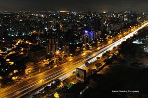
Thane (Marathi: [ˈʈʰaːɳeː]; previously known as Thana, the official name until 1996) is a metropolitan city located on the northwestern side of the state of Maharashtra in India and on the northeastern side of Mumbai. It is an immediate neighbour of Mumbai city proper, and a part of the Mumbai Metropolitan Region. It is situated in the north-eastern portion of the Salsette Island.

Thane district
District in Maharashtra, India
Distance: Approx. 489 meters
Latitude and longitude: 19.2,72.97
Thane district (Pronunciation: [ʈʰaːɳe], previously named Taana or Thana) is a district in the Konkan Division of Maharashtra, India. At the 2011 Census it was the most populated district in the country, with 11,060,148 inhabitants; however, in August 2014 the district was split into two with the creation of a new Palghar district, leaving the reduced Thane district with a 2011 census population of 8,070,032. The headquarters of the district is the city of Thane.
Chandanwadi, Thane
Locality in Maharashtra, India
Distance: Approx. 421 meters
Latitude and longitude: 19.196932,72.971449
Chandanwadi is a neighbourhood in Thane city of Maharashtra state in India. There are three lakes nearby, namely Kachrali Lake, Makhmali Lake, and Siddeshwar Lake. These lakes have been beautified as part of the cleansing and beautification of lakes in Thane city.
Smt. Sulochanadevi Singhania School
Private dayschool in Thane, Maharashtra, India
Distance: Approx. 1275 meters
Latitude and longitude: 19.2077146,72.96654
Smt. Sulochanadevi Singhania School is a private co-educational LKG-15 dayschool in Mumbai, Maharashtra, India, built by Gopal Krishna Singhania and named after his wife. The school started operating in 1969 and has expanded from 400 students then to more than 6500 now, under principals Dr S.R.N. Rao, Dr M.D. Jani, Dr Vijayam Ravi and Mrs Revathi Srinivasan.
St. John the Baptist High School, Thane
School
Distance: Approx. 842 meters
Latitude and longitude: 19.195228,72.975424
St. John the Baptist High School and Junior College is a Catholic school in the city of Thane, Maharashtra, India dedicated to St. John the Baptist.

Thane Assembly constituency
Constituency of the Maharashtra legislative assembly in India
Distance: Approx. 507 meters
Latitude and longitude: 19.19722222,72.97222222
Thane Assembly constituency is one of the 288 Vidhan Sabha (Assembly) constituencies of Maharashtra, India. It is one of the six assembly seats which make up Thane Lok Sabha constituency. Thane is near Mumbai.

Kopineshwar Mandir, Thane
Ancient Hindu temple in Thane (India)
Distance: Approx. 1064 meters
Latitude and longitude: 19.193,72.977
Kopineshwar Mandir (also Kaupīnēśvar Mandir) (Marathi: कौपिनेश्वर मंदिर) is a temple dedicated to the Hindu god Shiva and is considered the patron god of Thane. The Shivalinga inside the temple is considered one of the largest in Maharashtra, India.
Panchpakhadi
Locality in Maharashtra, India
Distance: Approx. 254 meters
Latitude and longitude: 19.1954727,72.9652491
Pachpakhadiपाचपाखडी is an upmarket and affluent locality of Thane city of Maharashtra state in India. It is known for Kachrali lake, the head office of Thane Municipal Corporation, S.E.S. High School and Junior College, few temples and several food outlets.
Korum Mall
Shopping mall in Maharashtra, India
Distance: Approx. 687 meters
Latitude and longitude: 19.202,72.965
Korum Mall is a shopping mall located in Thane city of Maharashtra state in India. It is a home to a number of branded shops. It is a project of Kalpataru Limited.
Khopat, Thane
Place in Maharashtra, India
Distance: Approx. 542 meters
Latitude and longitude: 19.20055556,72.97
Khopat (Devnagari:खोपट) is an area located in the city of Thane, Maharashtra, India.
Dnyaneshwar Dnyan Mandir High School And Junior College
Private school in Thane, Maharashtra, India
Distance: Approx. 812 meters
Latitude and longitude: 19.1985423,72.9748449
Dnyaneshwar Dnyan Mandir English High School, Thane was established in the year 1975, and in 2010, the new management of Goodwill International Foundation Trust (GIFT) took over the school. The President of the Trust and Board of Governors is Mrs. Nandini R. Vichare.

Masunda Lake
Lake in Thane, India
Distance: Approx. 776 meters
Latitude and longitude: 19.193,72.974
Masunda Lake, also known as Talavpali Lake, is a lake in Thane in the state of Maharashtra, India. The lake is home to a small island with a Shiv temple on it and also a Chhatrapati Shivaji Maharaj Statue behind it. It is one of the biggest lakes and ideal places to visit in Thane at night.
Weather in this IP's area
smoke
28 Celsius
29 Celsius
28 Celsius
28 Celsius
1011 hPa
57 %
1011 hPa
1008 hPa
2500 meters
20 %
06:40:35
18:02:51