Country:
Region:
City:
Latitude and Longitude:
Time Zone:
Postal Code:
IP information under different IP Channel
ip-api
Country
Region
City
ASN
Time Zone
ISP
Blacklist
Proxy
Latitude
Longitude
Postal
Route
Luminati
Country
Region
vic
City
pakenham
ASN
Time Zone
Australia/Melbourne
ISP
CNTCorp
Latitude
Longitude
Postal
IPinfo
Country
Region
City
ASN
Time Zone
ISP
Blacklist
Proxy
Latitude
Longitude
Postal
Route
db-ip
Country
Region
City
ASN
Time Zone
ISP
Blacklist
Proxy
Latitude
Longitude
Postal
Route
ipdata
Country
Region
City
ASN
Time Zone
ISP
Blacklist
Proxy
Latitude
Longitude
Postal
Route
Popular places and events near this IP address
Officer South, Victoria
Suburb of Melbourne, Victoria, Australia
Distance: Approx. 5173 meters
Latitude and longitude: -38.0924,145.4237
Officer South is a suburb and rural locality in Melbourne, Victoria, Australia, 50 km (31 mi) south-east of Melbourne's Central Business District, located within the Shire of Cardinia local government area. Officer South recorded a population of 1,159 at the 2021 census.

Pakenham, Victoria
Suburb of Melbourne, Victoria, Australia
Distance: Approx. 1043 meters
Latitude and longitude: -38.0712,145.4878
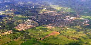
Pakenham ( PAK-ə-nəm) is a suburb of Melbourne in Victoria, Australia, 53 km (33 mi) south-east of Melbourne's Central Business District and the most populous in the Shire of Cardinia. Pakenham recorded a population of 54,118 at the 2021 census. Pakenham has become a major growth area in south-eastern Melbourne as new housing developments have boosted its population and infrastructure, as exemplified in the development of the Lakeside, Heritage Springs and Cardinia Lakes estates.

Pakenham railway station
Railway station in Melbourne, Australia
Distance: Approx. 1381 meters
Latitude and longitude: -38.0803,145.4859
Pakenham railway station is a commuter and regional railway station on the suburban Pakenham line and regional Gippsland line, part of the Melbourne and Victorian railways networks. It serves the south-eastern Melbourne suburb of Pakenham in Victoria, Australia. Pakenham is an elevated premium station, featuring an island platform with two faces.
Beaconhills College
Australian independent, co-educational, school
Distance: Approx. 1247 meters
Latitude and longitude: -38.06083333,145.46916667
Beaconhills College is a co-educational, ecumenical, independent school providing education from early learning to prep to year 12. The college has 2 campuses: One located in Pakenham, Victoria and one located in Berwick, Victoria, Australia, each campus with a co-located Little Beacons Learning Centre. Beaconhills was established in 1982 by the Anglican and Uniting Churches to serve the education needs of the Christian community in the greater Pakenham area.

Pakenham Secondary College
School in Pakenham, Australia
Distance: Approx. 481 meters
Latitude and longitude: -38.07166667,145.47055556
Pakenham Secondary College is situated approximately 50 kilometres southeast of Melbourne, Australia. Established in 1968 to provide education to a largely rural community, the school now enrols over 920 students from an urban community.

Cardinia Road railway station
Railway station in Melbourne, Australia
Distance: Approx. 3366 meters
Latitude and longitude: -38.07111111,145.4375
Cardinia Road railway station is a commuter railway station on the Pakenham line, which is part of the Melbourne railway network. It serves the south-eastern suburb of Pakenham, in Melbourne, Victoria, Australia. Cardinia Road station is a ground-level unstaffed station, featuring two side platforms.

Electoral district of Pakenham
State electoral district of Victoria, Australia
Distance: Approx. 790 meters
Latitude and longitude: -38.06666667,145.48333333
Electoral district of Pakenham is an electoral district of the Legislative Assembly in the Australian state of Victoria. It was recreated in the redistribution of electoral boundaries in 2021, and was re-contested at the 2022 Victorian state election. It includes the outer eastern suburbs of Officer and Pakenham, as well as less populated regional areas to the north and south of the Pakenham railway line.

Shire of Pakenham
Local government area in Victoria, Australia
Distance: Approx. 1549 meters
Latitude and longitude: -38.08333333,145.48333333
The Shire of Pakenham was a local government area about 60 kilometres (37 mi) southeast of Melbourne, the state capital of Victoria, Australia. The shire covered an area of 874 square kilometres (337.5 sq mi), and existed from 1862 until 1994.
Lakeside College
School in Pakenham, Victoria, Australia
Distance: Approx. 1883 meters
Latitude and longitude: -38.06527778,145.45555556
Lakeside College, established in 2006, is a co-educational, private P–12 school located in Pakenham, Victoria, Australia, associated with the Lutheran Church of Australia. The founding Principal was Peter Miller. The College caters for 620 students from Foundation to Year 12.
Cardinia Motor Recreation and Education Park
Australian planned motorsport and driver education facility
Distance: Approx. 3826 meters
Latitude and longitude: -38.103,145.461
The Cardinia Motor Recreation and Education Park is a planned motorsport and driver education facility at Pakenham, an outer southeastern suburb of Melbourne, Victoria, Australia. It was proposed to have a 3.6 kilometres (2.2 mi) race track built to FIA Grade 2 standard, along with other facilities. It received approval from the Cardinia Shire Council in December 2019 and was expected to start construction within six months.

East Pakenham railway station
Railway station in Victoria, Australia
Distance: Approx. 3225 meters
Latitude and longitude: -38.08462964,145.50818069
East Pakenham railway station is a commuter railway station and the terminus of the Pakenham line, serving the south-eastern Melbourne suburb of Pakenham East in Victoria, Australia. East Pakenham is a ground-level premium station, featuring an island platform with two faces, and bypass tracks for V/Line regional services. It opened on 3 June 2024.
Pakenham East, Victoria
Suburb of Melbourne, Victoria, Australia
Distance: Approx. 4510 meters
Latitude and longitude: -38.0637,145.5266
Previously known as Pakenham East, Honora Fields is the newest suburb of the Greater Melbourne metropolitan area situated south-east of Melbourne City. Honora Fields is located in the Shire of Cardinia local government area. After community consultation, the Pakenham East PSP was renamed Honora Fields, by the Cardinia Shire and Geographic Names Victoria.
Weather in this IP's area
few clouds
16 Celsius
15 Celsius
15 Celsius
18 Celsius
1010 hPa
81 %
1010 hPa
1005 hPa
10000 meters
0.89 m/s
2.24 m/s
123 degree
14 %
06:05:20
19:58:06