27.123.236.225 - IP Lookup: Free IP Address Lookup, Postal Code Lookup, IP Location Lookup, IP ASN, Public IP
Country:
Region:
City:
Location:
Time Zone:
Postal Code:
ISP:
ASN:
language:
User-Agent:
Proxy IP:
Blacklist:
IP information under different IP Channel
ip-api
Country
Region
City
ASN
Time Zone
ISP
Blacklist
Proxy
Latitude
Longitude
Postal
Route
db-ip
Country
Region
City
ASN
Time Zone
ISP
Blacklist
Proxy
Latitude
Longitude
Postal
Route
IPinfo
Country
Region
City
ASN
Time Zone
ISP
Blacklist
Proxy
Latitude
Longitude
Postal
Route
IP2Location
27.123.236.225Country
Region
ibaraki
City
hitachiomiya
Time Zone
Asia/Tokyo
ISP
Language
User-Agent
Latitude
Longitude
Postal
ipdata
Country
Region
City
ASN
Time Zone
ISP
Blacklist
Proxy
Latitude
Longitude
Postal
Route
Popular places and events near this IP address
Urizura, Ibaraki
Distance: Approx. 6300 meters
Latitude and longitude: 36.5,140.45
Urizura (瓜連町, Urizura-machi) was a town located in Naka District, Ibaraki Prefecture, Japan. As of 2003, the town had an estimated population of 8,851 and a density of 603.75 persons per km2. The total area was 14.66 km2.

Hitachiōmiya
City in Kantō, Japan
Distance: Approx. 995 meters
Latitude and longitude: 36.54252778,140.41088889
Hitachiōmiya (常陸大宮市, Hitachiōmiya-shi) is a city located in Ibaraki Prefecture, Japan. As of 1 July 2020, the city had an estimated population of 39,281 in 16.047 households and a population density of 220 persons per km2. The percentage of the population aged over 65 was 37.6%.

Shirosato, Ibaraki
Town in Kantō, Japan
Distance: Approx. 8683 meters
Latitude and longitude: 36.47922222,140.37622222
Shirosato (城里町, Shirosato-machi) is a town located in Ibaraki Prefecture, Japan. As of 1 July 2020, the town had an estimated population of 18,128 in 7214 households and a population density of 112 persons per km2. The percentage of the population aged over 65 was 37.6%.

Ibaraki Botanical Garden
Distance: Approx. 8626 meters
Latitude and longitude: 36.474134,140.436623
The Ibaraki Botanical Garden (茨城県植物園, Ibaraki-ken Shokubutsuen) is a botanical garden and arboretum located at 4589 To, Naka, Ibaraki, Japan. It is open daily except Mondays; an admission fee is charged. The garden was established in 1981, and now contains a rose garden, aquatic plant garden, rock garden; collections of camellias, conifers, and tropical fruit trees; and a tropical greenhouse.

Urizura Station
Railway station in Naka, Ibaraki Prefecture, Japan
Distance: Approx. 6542 meters
Latitude and longitude: 36.4978,140.4506
Urizura Station (瓜連駅, Urizura-eki) is a passenger railway station in the city of Naka, Ibaraki, Japan operated by East Japan Railway Company (JR East).
Shizu Station (Ibaraki)
Railway station in Naka, Ibaraki Prefecture, Japan
Distance: Approx. 5235 meters
Latitude and longitude: 36.5062,140.4383
Shizu Station (静駅, Shizu-eki) is a passenger railway station in the city of Naka, Ibaraki, Japan operated by East Japan Railway Company (JR East).

Hitachi-Ōmiya Station
Railway station in Hitachiōmiya, Ibaraki Prefecture, Japan
Distance: Approx. 488 meters
Latitude and longitude: 36.5473,140.4127
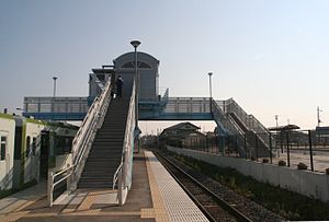
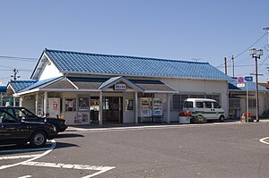
Hitachi-Ōmiya Station (常陸大宮駅, Hitachi-Ōmiya-eki) is a passenger railway station in the city of Hitachiōmiya, Ibaraki, Japan operated by East Japan Railway Company (JR East).
Tamagawamura Station
Railway station in Hitachiōmiya, Ibaraki Prefecture, Japan
Distance: Approx. 5021 meters
Latitude and longitude: 36.5791,140.3741
Tamagawamura Station (玉川村駅, Tamagawamura-eki) is a passenger railway station in the city of Hitachiōmiya, Ibaraki, Japan operated by East Japan Railway Company (JR East).

Nogamihara Station
Railway station in Hitachiōmiya, Ibaraki Prefecture, Japan
Distance: Approx. 6667 meters
Latitude and longitude: 36.6058,140.3899
Nogamihara Station (野上原駅, Nogamihara-eki) is a passenger railway station in the city of Hitachiōmiya, Ibaraki, Japan operated by East Japan Railway Company (JR East).

Yamagatajuku Station
Railway station in Hitachiōmiya, Ibaraki Prefecture, Japan
Distance: Approx. 8413 meters
Latitude and longitude: 36.6245,140.4012
Yamagatajuku Station (山方宿駅, Yamagatajuku-eki) is a passenger railway station in the city of Hitachiōmiya, Ibaraki, Japan operated by East Japan Railway Company (JR East).
Idosawa Fault
Earthquake fault system in Fukushima Prefecture, Japan
Distance: Approx. 2512 meters
Latitude and longitude: 36.57,140.43
The Idosawa Fault (井戸沢断層, Idozawa Dansō), also referred to as the Shionihara Fault, is an active earthquake fault system located in Fukushima Prefecture of Japan, to the west of Iwaki city. It mainly consists of a trace of three separate striations.

Seizansō
Building in Ibaraki, Japan
Distance: Approx. 8046 meters
Latitude and longitude: 36.54125,140.50630556
The Seizansō (西山荘), also known as the Nishiyama Goten (西山御殿) was the retirement villa of Tokugawa Mitsukuni, the second daimyō of Mito Domain under the Edo Period Tokugawa shogunate of Japan. It is located in the city of Hitachiōta, Ibaraki. The villa was designated a National Historic Site and its gardens a National Place of Scenic Beauty in 2007.
Weather in this IP's area
broken clouds
6 Celsius
4 Celsius
6 Celsius
6 Celsius
1012 hPa
87 %
1012 hPa
997 hPa
10000 meters
1.85 m/s
2.33 m/s
7 degree
75 %

