27.100.37.120 - IP Lookup: Free IP Address Lookup, Postal Code Lookup, IP Location Lookup, IP ASN, Public IP
Country:
Region:
City:
Location:
Time Zone:
Postal Code:
IP information under different IP Channel
ip-api
Country
Region
City
ASN
Time Zone
ISP
Blacklist
Proxy
Latitude
Longitude
Postal
Route
Luminati
Country
ASN
Time Zone
America/Chicago
ISP
HostUS
Latitude
Longitude
Postal
IPinfo
Country
Region
City
ASN
Time Zone
ISP
Blacklist
Proxy
Latitude
Longitude
Postal
Route
IP2Location
27.100.37.120Country
Region
south australia
City
hindmarsh
Time Zone
Australia/Adelaide
ISP
Language
User-Agent
Latitude
Longitude
Postal
db-ip
Country
Region
City
ASN
Time Zone
ISP
Blacklist
Proxy
Latitude
Longitude
Postal
Route
ipdata
Country
Region
City
ASN
Time Zone
ISP
Blacklist
Proxy
Latitude
Longitude
Postal
Route
Popular places and events near this IP address

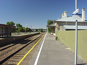
Bowden railway station
Railway station in Adelaide, South Australia
Distance: Approx. 527 meters
Latitude and longitude: -34.9061,138.5757
Bowden railway station is located on the Adelaide suburban railway line leading to the Grange, Outer Harbor and Port Dock lines, commonly known as the Port line. Situated in the inner Adelaide suburb of Bowden, it is 2.5 kilometres (1.6 miles) from Adelaide station. Originally opened in 1856, it was extensively rebuilt as part of a flying junction in 2017 and reopened in 2018.

Thebarton, South Australia
Suburb of Adelaide, South Australia
Distance: Approx. 777 meters
Latitude and longitude: -34.9,138.56666667
Thebarton ( THEB-ər-tən), formerly Theberton, on Kaurna land, is an inner-western suburb of Adelaide, South Australia in the City of West Torrens. The suburb is bounded by the River Torrens to the north, Port Road and Bonython Park to the east, Kintore Street to the south, and South Road to the west. Many buildings and landmarks that bear the name of Thebarton were in the history municipality, the Town of Thebarton, which included most of the adjoining suburb of Torrensville.
North Adelaide railway station
Railway station in Adelaide, South Australia
Distance: Approx. 803 meters
Latitude and longitude: -34.90611111,138.58166667
North Adelaide railway station is located on the Gawler line in the inner northern Adelaide suburb of North Adelaide. It is 2.5 kilometres (1.6 mi) from Adelaide station. It is the least used railway station in the Adelaide rail network.

Adelaide Entertainment Centre
Indoor arena in Adelaide, South Australia
Distance: Approx. 742 meters
Latitude and longitude: -34.9079854,138.5737253
The Adelaide Entertainment Centre (AEC) is an indoor arena located in the South Australian capital of Adelaide. It is used for sporting and entertainment events. It is the principal venue for concerts, events and attractions for audiences between 1,000 and 11,300.

Brompton, South Australia
Suburb of Adelaide, South Australia
Distance: Approx. 523 meters
Latitude and longitude: -34.897,138.577
Brompton is an inner-northern suburb of Adelaide, South Australia in the City of Charles Sturt.

Bowden, South Australia
Suburb of Adelaide, South Australia
Distance: Approx. 466 meters
Latitude and longitude: -34.904,138.579
Bowden () is an inner northern suburb of Adelaide, South Australia. It is located in the City of Charles Sturt.

Hindmarsh, South Australia
Suburb of Adelaide, South Australia
Distance: Approx. 773 meters
Latitude and longitude: -34.90696,138.56992
Hindmarsh is an inner suburb of Adelaide, South Australia. It is located in the City of Charles Sturt. The suburb is located between South Road to the west and North Adelaide.

Bowden development
South Australian urban development
Distance: Approx. 643 meters
Latitude and longitude: -34.902,138.582
The Bowden development is an urban development in the Australian state of South Australia on a site formerly owned by the Clipsal corporation in the suburb of Bowden, within the City of Charles Sturt, in the Adelaide metropolitan area 2 kilometres from the city centre. The site covers an area of 10.25 hectares (25.3 acres) and is bounded by Park Terrace to the south, the Outer Harbor railway line to the west, Drayton Street to the north and Sixth and Seventh Streets to the east. The Government also acquired the adjoining 5.9-hectare site which had been owned by Origin Energy (known as the Brompton Gasworks site).
Electoral district of Thebarton
Former South Australian state electoral district
Distance: Approx. 777 meters
Latitude and longitude: -34.9,138.56666667
Thebarton was an electoral district of the House of Assembly in the Australian state of South Australia from 1938 to 1956. It was abolished and replaced by the seat of West Torrens for the 1956 election.
Hindmarsh Incinerator
Incinerator in South Australia, Australia
Distance: Approx. 489 meters
Latitude and longitude: -34.897228,138.573321
The Hindmarsh Incinerator is a decommissioned incinerator located in the Adelaide suburb of Brompton in South Australia, Australia. Designed by Walter Burley Griffin, the architect and designer of Canberra, the incinerator was built in 1935 by the Reverberatory Incinerator and Engineering Co. Pty Ltd.
District Council of Hindmarsh
Local government area in South Australia
Distance: Approx. 778 meters
Latitude and longitude: -34.907,138.5699
The District Council of Hindmarsh was a local government area in South Australia from 1853 to 1875, seated at the inner north west Adelaide suburb of Hindmarsh. At the time of its establishment the population was approximately 3,500.

Town of Hindmarsh
Local government area in South Australia
Distance: Approx. 778 meters
Latitude and longitude: -34.907,138.5699
The Town of Hindmarsh was a local government area in South Australia from 1874 to 1993, encompassing on the inner north west Adelaide suburbs of Hindmarsh, Bowden and Brompton.
Weather in this IP's area
overcast clouds
30 Celsius
28 Celsius
29 Celsius
32 Celsius
1011 hPa
27 %
1011 hPa
997 hPa
10000 meters
3.58 m/s
7.15 m/s
211 degree
100 %

