24.97.202.56 - IP Lookup: Free IP Address Lookup, Postal Code Lookup, IP Location Lookup, IP ASN, Public IP
Country:
Region:
City:
Location:
Time Zone:
Postal Code:
ISP:
ASN:
language:
User-Agent:
Proxy IP:
Blacklist:
IP information under different IP Channel
ip-api
Country
Region
City
ASN
Time Zone
ISP
Blacklist
Proxy
Latitude
Longitude
Postal
Route
db-ip
Country
Region
City
ASN
Time Zone
ISP
Blacklist
Proxy
Latitude
Longitude
Postal
Route
IPinfo
Country
Region
City
ASN
Time Zone
ISP
Blacklist
Proxy
Latitude
Longitude
Postal
Route
IP2Location
24.97.202.56Country
Region
new york
City
ozone park
Time Zone
America/New_York
ISP
Language
User-Agent
Latitude
Longitude
Postal
ipdata
Country
Region
City
ASN
Time Zone
ISP
Blacklist
Proxy
Latitude
Longitude
Postal
Route
Popular places and events near this IP address

Howard Beach
Neighborhood in New York City
Distance: Approx. 1364 meters
Latitude and longitude: 40.658,-73.84
Howard Beach is a neighborhood in the southwestern portion of the New York City borough of Queens. It is bordered to the north by the Belt Parkway and Conduit Avenue in Ozone Park, to the south by Jamaica Bay in Broad Channel, to the east by 102nd–104th Streets in South Ozone Park, and to the west by 75th Street in East New York, Brooklyn. The area consists mostly of low-rise single-family detached houses.

Aqueduct Racetrack
Horseracing venue in New York City
Distance: Approx. 775 meters
Latitude and longitude: 40.67222222,-73.82972222
Aqueduct Racetrack is a Thoroughbred horse racing facility and casino in the South Ozone Park and Jamaica neighborhoods of Queens, New York City, United States. Aqueduct is the only racetrack located within New York City limits. Its racing meets are usually from late October/early November through April.

Howard Beach–JFK Airport station
New York City Subway station in Queens
Distance: Approx. 1292 meters
Latitude and longitude: 40.6604,-73.8303
The Howard Beach–JFK Airport station is a subway/people mover station complex located at Coleman Square between 159th Avenue and 103rd Street in Howard Beach, Queens. The New York City Subway portion of the station is on the IND Rockaway Line and is served by the Rockaway branch of the A train at all times and the Rockaway Park Shuttle during summer weekends. The AirTrain JFK portion of the station complex is served by the AirTrain's Howard Beach branch at all times.
Aqueduct Racetrack station
New York City Subway station in Queens
Distance: Approx. 303 meters
Latitude and longitude: 40.672086,-73.835914
The Aqueduct Racetrack station is a station on the IND Rockaway Line of the New York City Subway. Located on the west side of Aqueduct Racetrack near Pitkin Avenue in the South Ozone Park neighborhood of Queens, it is served by northbound A trains at all times and by the northbound Rockaway Park Shuttle during summer weekends. The station contains four tracks, of which the outer two are in passenger service; the two center express tracks have been disconnected from the line and permanently removed.

Rockaway Boulevard station
New York City Subway station in Queens
Distance: Approx. 1224 meters
Latitude and longitude: 40.680459,-73.843703
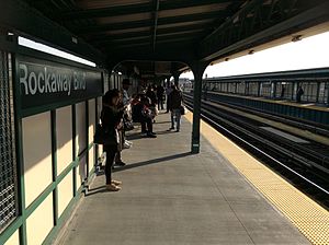
The Rockaway Boulevard station is a station on the IND Fulton Street Line of the New York City Subway. Located at the intersection of Rockaway Boulevard, Woodhaven and Cross Bay Boulevards, and Liberty Avenue in Ozone Park, Queens, it is served by the A train at all times and the Rockaway Park Shuttle during summer weekends.
Count Fleet Stakes
American Thoroughbred horse race
Distance: Approx. 689 meters
Latitude and longitude: 40.672306,-73.830829
The Count Fleet Stakes is an American Thoroughbred horse race run at Aqueduct Racetrack, located in Jamaica, New York, at the beginning of January each year. It is the first stakes race of the year run in New York City for three-year-olds. Named after Count Fleet, the 1943 Triple Crown winner, the race is open to three-year-olds willing to race one mile and seventy yards on the inner dirt track.

Aqueduct–North Conduit Avenue station
New York City Subway station in Queens
Distance: Approx. 431 meters
Latitude and longitude: 40.668325,-73.834034
The Aqueduct–North Conduit Avenue station (announced as the Aqueduct-North Conduit station on trains) is a station on the IND Rockaway Line of the New York City Subway. Served at all times by the A train and during summer weekends by the Rockaway Park Shuttle, it is located at North Conduit Avenue near the intersection of Cohancy Street in South Ozone Park, Queens, with the southbound platform partially in Ozone Park, Queens.

104th Street station (IND Fulton Street Line)
New York City Subway station in Queens
Distance: Approx. 1343 meters
Latitude and longitude: 40.682233,-73.837352
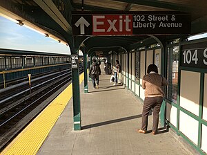
The 104th Street station (signed as the 104th Street–Oxford Avenue station) is a station on the IND Fulton Street Line of the New York City Subway, located on Liberty Avenue at 104th Street in South Ozone Park, and partially in South Richmond Hill, Queens. The station is served by the Lefferts Boulevard A train at all times.

John Adams High School (Queens)
Public school in New York City
Distance: Approx. 976 meters
Latitude and longitude: 40.67888889,-73.83694444
John Adams High School (H.S. 480; often referred to locally as John Adams) is a public high school in the Ozone Park neighborhood of Queens, New York City, New York, United States. Planning for the school began in 1927 and classes commenced in September 1930. At around the same time the city built several other high schools from the same plans, including Samuel J. Tilden High School, Far Rockaway High School, Abraham Lincoln High School, Bayside High School, and Grover Cleveland High School.
Magna Institute of Dental Technology
Distance: Approx. 853 meters
Latitude and longitude: 40.67687,-73.84347
The Magna Institute of Dental Technology is a dental school located in New York City.
Walter J. Wetzel Triangle
Green space in Queens, New York
Distance: Approx. 792 meters
Latitude and longitude: 40.663469,-73.835467
Walter J. Wetzel Triangle is a small park bound by Cohancy Street, 156th Avenue, 99th Street, and 157th Avenue, in the Howard Beach neighborhood of Queens, New York City. Walter 'Jo' Wetzel was born on September 16, 1944, and grew up in Howard Beach. An avid athlete, he attended the local grammar school (Our Lady of Grace) where he starred in both baseball and basketball.

New Park Pizza
Pizzeria in New York, U.S.
Distance: Approx. 844 meters
Latitude and longitude: 40.66275,-73.84036111
New Park Pizza is a pizzeria in Queens, NY.
Weather in this IP's area
broken clouds
-9 Celsius
-16 Celsius
-11 Celsius
-8 Celsius
1035 hPa
53 %
1035 hPa
1034 hPa
10000 meters
5.14 m/s
310 degree
75 %
