Country:
 USA
USARegion:
City:
Latitude and Longitude:
Time Zone:
Postal Code:
IP information under different IP Channel
ip-api
Country
Region
City
ASN
Time Zone
ISP
Blacklist
Proxy
Latitude
Longitude
Postal
Route
IPinfo
Country
Region
City
ASN
Time Zone
ISP
Blacklist
Proxy
Latitude
Longitude
Postal
Route
MaxMind
Country
Region
City
ASN
Time Zone
ISP
Blacklist
Proxy
Latitude
Longitude
Postal
Route
Luminati
Country
USRegion
co
City
denver
ASN
Time Zone
America/Denver
ISP
GREAT-PLAINS-COMMUNICATIONS
Latitude
Longitude
Postal
db-ip
Country
Region
City
ASN
Time Zone
ISP
Blacklist
Proxy
Latitude
Longitude
Postal
Route
ipdata
Country
Region
City
ASN
Time Zone
ISP
Blacklist
Proxy
Latitude
Longitude
Postal
Route
Popular places and events near this IP address
Edgewater, Colorado
City in Colorado, United States
Distance: Approx. 817 meters
Latitude and longitude: 39.75082,-105.062615
The City of Edgewater is a home rule municipality located in Jefferson County, Colorado, United States. The city population was 5,005 at the 2020 United States Census. Edgewater is surrounded by Denver to the east, Lakewood to the south and west, and Wheat Ridge to the north.
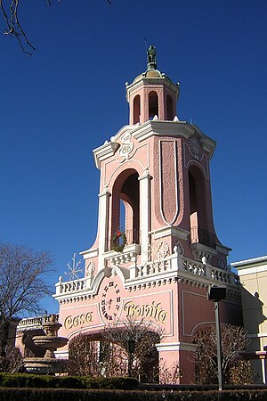
Casa Bonita
Mexican-themed restaurant in Lakewood, Colorado
Distance: Approx. 784 meters
Latitude and longitude: 39.741927,-105.070828
Casa Bonita (lit. 'pretty house' in Spanish) is a Mexican restaurant in Lakewood, Colorado, located within the Lamar Station Plaza. It first opened in 1974, and was originally part of a chain of Mexican entertainment restaurants that started in Oklahoma City. The restaurant attracted a cult following among Coloradans since its opening, and is considered by many to be an iconic establishment of Lakewood and the greater Denver metropolitan area.
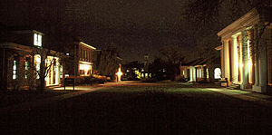
Rocky Mountain College of Art and Design
For-profit art school in Lakewood, Colorado
Distance: Approx. 693 meters
Latitude and longitude: 39.74361111,-105.07
The Rocky Mountain College of Art + Design (RMCAD) is a private for-profit art school in Lakewood, Colorado. The college was founded in 1963 by Philip J. Steele, an artist and teacher.

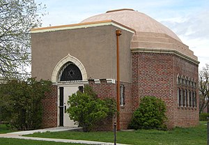
Yeshiva Toras Chaim
All-male, Lithuanian (Litvish)-style Talmudic academy
Distance: Approx. 1613 meters
Latitude and longitude: 39.74179,-105.04319
Yeshiva Toras Chaim (YTC) is an all-male, Lithuanian (Litvish)-style Talmudic academy in the West Colfax neighborhood of Denver, Colorado. YTC was founded in Denver in 1967. It is headed by the Roshei Yeshiva, Rav Yisroel Meir Kagan, and Rav Yitzchok Wasserman, both students of Rabbi Aharon Kotler, founder and Rosh Yeshiva of Beth Medrash Govoha in Lakewood, New Jersey.
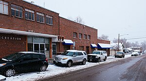
Jefferson High School (Edgewater, Colorado)
Public secondary school in Edgewater, Colorado, United States
Distance: Approx. 1203 meters
Latitude and longitude: 39.750786,-105.072276
Jefferson High School is a high school located in Edgewater, Colorado, United States. It is operated by Jefferson County Public Schools.

Sloan Lake (Colorado)
Lake in Denver County, Colorado
Distance: Approx. 1371 meters
Latitude and longitude: 39.748876,-105.047483
Sloan Lake, also known as Sloan's Lake and Sloans Lake, is a body of water, park, and neighborhood in Denver, Colorado, US. The neighborhood is located on the northwest side of Denver. The lake is the central feature of Sloan's Lake Park, which is managed by the Parks and Recreation division of the City and County of Denver.

Lakewood–Wadsworth station
Light rail station in Lakewood, Colorado
Distance: Approx. 1837 meters
Latitude and longitude: 39.7366,-105.0814
Lakewood–Wadsworth (sometimes stylized as Lakewood•Wadsworth) is an elevated light rail station on the W Line of the RTD Rail system. It is located alongside West 13th Avenue on a bridge over Wadsworth Boulevard, in Lakewood, Colorado, after which the station is named. The station opened on April 26, 2013, on the West Corridor, built as part of the Regional Transportation District (RTD) FasTracks public transportation expansion plan and voter-approved sales tax increase for the Denver metropolitan area.

Lamar station (RTD)
Light rail station in Lakewood, Colorado, United States
Distance: Approx. 857 meters
Latitude and longitude: 39.7367,-105.0666
Lamar is an at-grade light rail station on the W Line of the RTD Rail system. It is located near the intersection of West 13th Avenue and Lamar Street, after which the station is named, in Lakewood, Colorado. The station is located within Lakewood's 40 West Arts District, not far from the businesses on West Colfax Avenue and about 0.7 miles (1.1 km) from the campus of the Rocky Mountain College of Art and Design.

Sheridan station (RTD)
Light rail station in Denver, Colorado
Distance: Approx. 1180 meters
Latitude and longitude: 39.7351,-105.0535
Sheridan is a below grade light rail station on the W Line of the RTD Rail system. It is located alongside the banks of the Lakewood Gulch under Sheridan Boulevard, after which the station is named. The station straddles the border between Denver and Lakewood, Colorado, but RTD lists the station as being in the city of Denver.

Bliss House (Denver, Colorado)
United States historic place
Distance: Approx. 1705 meters
Latitude and longitude: 39.7383,-105.04316
The Bliss House in the West Colfax neighborhood of Denver, Colorado, is a Queen Anne-style house built in 1890. It was listed on the National Register of Historic Places in 1982 as Building at 1389 Stuart Street. It is a two-and-a-half-story house designed by architects Lang & Pugh with exterior mostly covered by fishscale shingles.
Jewish Consumptives' Relief Society
Hospital in Colorado, U.S.
Distance: Approx. 685 meters
Latitude and longitude: 39.7435,-105.0699
The Jewish Consumptives' Relief Society (JCRS) was a non-sectarian sanatorium to treat tuberculosis patients in Lakewood, Colorado. Founded in 1904, the sanatorium campus was also home to the first synagogue in Jefferson County, Colorado. In 1954 the institution changed its mission to cancer research and became The American Medical Center at Denver.

Denver Eagle
Gay bar in Denver, Colorado
Distance: Approx. 886 meters
Latitude and longitude: 39.740222,-105.052473
The Denver Eagle is a gay bar in Denver, Colorado, United States. It is one of many unaffiliated gay bars in dozens of different cities using the "Eagle" name. It caters primarily to the leather and bear subcultures.
Weather in this IP's area
clear sky
18 Celsius
17 Celsius
15 Celsius
20 Celsius
1015 hPa
47 %
1015 hPa
842 hPa
10000 meters
1.54 m/s
190 degree
06:35:27
19:20:22