Country:
Region:
City:
Latitude and Longitude:
Time Zone:
Postal Code:
IP information under different IP Channel
ip-api
Country
Region
City
ASN
Time Zone
ISP
Blacklist
Proxy
Latitude
Longitude
Postal
Route
IPinfo
Country
Region
City
ASN
Time Zone
ISP
Blacklist
Proxy
Latitude
Longitude
Postal
Route
MaxMind
Country
Region
City
ASN
Time Zone
ISP
Blacklist
Proxy
Latitude
Longitude
Postal
Route
Luminati
Country
Region
co
City
denver
ASN
Time Zone
America/Denver
ISP
GREAT-PLAINS-COMMUNICATIONS
Latitude
Longitude
Postal
db-ip
Country
Region
City
ASN
Time Zone
ISP
Blacklist
Proxy
Latitude
Longitude
Postal
Route
ipdata
Country
Region
City
ASN
Time Zone
ISP
Blacklist
Proxy
Latitude
Longitude
Postal
Route
Popular places and events near this IP address

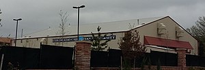
Colorado Christian Event Center
Arena in Lakewood, Colorado, US
Distance: Approx. 3138 meters
Latitude and longitude: 39.7145,-105.06225
The Colorado Christian University Event Center is the home arena of the Colorado Christian Cougars, who play basketball in the Rocky Mountain Athletic Conference. In addition to university activities, the Event Center has served as the home arena for the American Basketball Association Colorado Storm in 2004 and the International Basketball League Colorado Crossover in 2006–2007.
Abraham Lincoln High School (Colorado)
Public school in Denver, Colorado, United States
Distance: Approx. 2310 meters
Latitude and longitude: 39.67607778,-105.02704444
Abraham Lincoln High School is a public high school, founded in 1959, in Denver, Colorado, United States, and is named after former President Abraham Lincoln. The school's colors are blue and grey, representing the colors worn by the soldiers during the US Civil War; blue represents the North, and grey represents the South. The original shade used in the school's colors was royal blue, distinguishing it from Manual High School's Carolina blue & John F. Kennedy's navy blue in the Denver Public School District.
KLDC
Radio station in Denver, Colorado
Distance: Approx. 2777 meters
Latitude and longitude: 39.68333333,-105.00666667
KLDC (1220 AM) is a licensed radio station in Denver, Colorado. The station is currently owned by Crawford Broadcasting Company, DBA KLZ Radio, Inc. KLDC, along with sister station 670 KLTT, broadcasts a Christian talk and teaching radio format.

Alameda station (RTD)
Light rail station in Denver, Colorado
Distance: Approx. 3823 meters
Latitude and longitude: 39.708511,-104.993028
Alameda station is a RTD light rail station in Denver, Colorado, United States. Operating as part of the D, E and H Lines, the station was opened on October 8, 1994, and is operated by the Regional Transportation District.

Athmar Park, Denver
Neighborhood in Denver, Colorado
Distance: Approx. 2217 meters
Latitude and longitude: 39.70388889,-105.01083333
Athmar Park is a residential neighborhood in southwest Denver, Colorado. It consists mostly of all-brick ranches and bungalow-style homes built in the 1940s and 1950s.
Humanex Academy
Private alternative school in Englewood, Colorado, United States
Distance: Approx. 3587 meters
Latitude and longitude: 39.66739,-105.01534
Humanex Academy is an accredited, private, non-profit middle and high school in Englewood, Colorado, United States, for neurodivergent students, including those with Autism, Anxiety, learning disabilities, and ADHD. The small, supportive, and individualized environment provided at Humanex enables students to be themselves and find success through built-in accommodations, differentiated curriculum, and embedded social coaching. Serving students in grades 6–12, Humanex Academy typically has around 40 students total.
Valverde, Denver
Neighborhood in Denver, Colorado
Distance: Approx. 2842 meters
Latitude and longitude: 39.7166,-105.015
Valverde is a neighborhood of Denver, Colorado. It is in the area known as West Denver or the "West Side". According to the Piton Foundation, in 2007, the population of the neighborhood was 4,093, and there were 1,276 housing units.
Barnum, Denver
Distance: Approx. 2462 meters
Latitude and longitude: 39.71805556,-105.0325
Barnum is a neighborhood of Denver, Colorado. The neighborhood is located in the area known as West Denver. According to the Piton Foundation, in 2007, the population of the neighborhood was 6,456, and there were 1,924 housing units.
Ruby Hill Terrain Park
Artificial snow park in Denver, Colorado
Distance: Approx. 2820 meters
Latitude and longitude: 39.68448,-105.00528
Ruby Hill Rail Yard is a ski and snowboard terrain park located in Denver, Colorado at the intersection of Platte River Drive and Jewell Avenue, in Ruby Hill Park near downtown Denver. Ruby Hill Rail Yard is made possible by Winter Park Resort, Denver Parks and Recreation, Christy Sports, TechnoAlpin, Denver Water, Choose Outdoors, The North Face, Wahoo's Fish Tacos, Snowboard Outreach Society (SOS), and over 30 volunteers.
KDCO (AM)
Radio station in Denver, Colorado
Distance: Approx. 2777 meters
Latitude and longitude: 39.68333333,-105.00666667
KDCO (1340 kHz) is a noncommercial AM radio station licensed to Denver, Colorado. The station is owned by El Sembrador Ministries and carries its ESNE Radio network, featuring Spanish-language Catholic radio programming.
Ruby Hill, Denver
Neighborhood of Denver, Colorado, US
Distance: Approx. 2721 meters
Latitude and longitude: 39.68361111,-105.00722222
Ruby Hill is a neighborhood of Denver, Colorado. The neighborhood takes its name from Ruby Hill, a 5,390 ft (1,640 m) elevation hill in the neighborhood that overlooks much of South Denver. The hill itself was named for red stones found in the area by early miners, stones that turned out to be garnets.

Un Corrido Para la Gente
Sculpture in Denver, Colorado, U.S.
Distance: Approx. 1585 meters
Latitude and longitude: 39.697344,-105.053018
Un Corrido Para la Gente (English: A Ballad for the People) is a sculpture by Carlos Frésquez, installed in Denver, Colorado, U.S.
Weather in this IP's area
clear sky
18 Celsius
18 Celsius
16 Celsius
20 Celsius
1016 hPa
48 %
1016 hPa
842 hPa
10000 meters
0.89 m/s
3.13 m/s
100 degree
8 %
06:35:23
19:20:13


