Country:
 Canada
Region:
City:
Latitude and Longitude:
Time Zone:
Postal Code:
IP information under different IP Channel
ip-api
Country
Region
City
ASN
Time Zone
ISP
Blacklist
Proxy
Latitude
Longitude
Postal
Route
IPinfo
Country
Region
City
ASN
Time Zone
ISP
Blacklist
Proxy
Latitude
Longitude
Postal
Route
MaxMind
Country
Region
City
ASN
Time Zone
ISP
Blacklist
Proxy
Latitude
Longitude
Postal
Route
Luminati
Country
CARegion
qc
City
becancour
ASN
Time Zone
America/Toronto
ISP
CC-3272
Latitude
Longitude
Postal
db-ip
Country
Region
City
ASN
Time Zone
ISP
Blacklist
Proxy
Latitude
Longitude
Postal
Route
ipdata
Country
Region
City
ASN
Time Zone
ISP
Blacklist
Proxy
Latitude
Longitude
Postal
Route
Popular places and events near this IP address

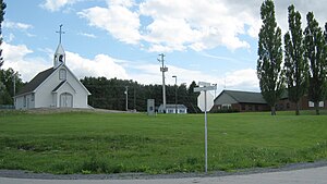
Bécancour, Quebec
City in Quebec, Canada
Distance: Approx. 400 meters
Latitude and longitude: 46.33333333,-72.43333333
Bécancour (French pronunciation: [bekɑ̃kuʁ]) is a city in the Centre-du-Québec region of Quebec, Canada; it is the seat of the Bécancour Regional County Municipality. It is located on the south shore of the Saint Lawrence River at the confluence of the Bécancour River, opposite Trois-Rivières. Wôlinak, an Abenaki Indian reserve, is an enclave within the town of Bécancour.
Wôlinak
First Nations reserve in Quebec, Canada
Distance: Approx. 2427 meters
Latitude and longitude: 46.31666667,-72.41666667
Wôlinak is an Abenaki First Nations reserve in the Centre-du-Québec region, Quebec, Canada. An enclave within the city of Bécancour, it was one of the Seven Nations of Canada. The Wôlinak Reserve covers an area of 80.4 hectares.

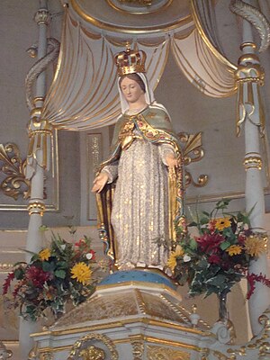
Notre-Dame-du-Cap Basilica
Church in Quebec, Canada
Distance: Approx. 6251 meters
Latitude and longitude: 46.36805556,-72.4975
The Basilica of Notre-Dame-du-Cap is a minor basilica in Trois-Rivières, Quebec, Canada. It is Canada's national shrine to the Blessed Virgin Mary, and one of the country's six national shrines. Each year, the site is visited by thousands of Catholic pilgrims.

Bécancour River
Canadian river in Quebec
Distance: Approx. 4183 meters
Latitude and longitude: 46.37222222,-72.44638889
The Bécancour River is a river flowing in the administrative region of Centre-du-Québec, in Quebec, Canada.
Précieux-Sang, Quebec
Distance: Approx. 5279 meters
Latitude and longitude: 46.29305556,-72.40222222
Précieux-Sang (French pronunciation: [pʁesjø sɑ̃]) is a community of the city of Bécancour, Quebec.

Bécancour, Quebec (community)
Distance: Approx. 849 meters
Latitude and longitude: 46.34386111,-72.43188889
Bécancour (French pronunciation: [bekɑ̃kuʁ]) is a community of the city of Bécancour, Quebec, Canada. It is one of the major population centres within the city. It is home to Quebec's only nuclear power generator.
Léon-Provancher Ecological Reserve
Distance: Approx. 4428 meters
Latitude and longitude: 46.312,-72.476
Léon-Provancher Ecological Reserve is an ecological reserve in Quebec, Canada. It was established in 1999.
Our Lady of the Cape
Distance: Approx. 6251 meters
Latitude and longitude: 46.36805556,-72.4975
Our Lady of the Cape (Notre-Dame-du-Cap in French) is a title given to Mary the Mother of God in Cap-de-la-Madeleine, Quebec Canada. The title refers specifically to a statue of the Blessed Mother which is currently located in the Old Shrine.
Mauricie–Bois-Francs
Quebecois administrative unit
Distance: Approx. 5241 meters
Latitude and longitude: 46.38333333,-72.43333333
Mauricie–Bois-Francs was a former administrative region of Quebec. It ceased to exist on July 30, 1997 (or August 20, 1997, upon publication in the Gazette officielle du Québec) when it was split into the modern-day administrative regions of Mauricie and Centre-du-Québec. It consisted of the following regional county municipalities: Francheville Le Centre-de-la-Mauricie Le Haut-Saint-Maurice Maskinongé Mékinac which became part of Mauricie, and: Arthabaska Bécancour Drummond L'Érable Nicolet-Yamaska which became part of Centre-du-Québec.
Judith River (Bécancour River tributary)
River in Centre-du-Québec, Quebec (Canada)
Distance: Approx. 2075 meters
Latitude and longitude: 46.35333,-72.44139
The rivière Judith is a tributary of the Bécancour River. It flows in the city of Bécancour, in Bécancour Regional County Municipality, in the administrative region of Centre-du-Québec, in Quebec, in Canada.
Gagnon River
River in Centre-du-Québec, Quebec (Canada)
Distance: Approx. 2015 meters
Latitude and longitude: 46.32472,-72.45055
The Gagnon River is a tributary of the Upper Channel which flows into Lake Saint-Paul (which flows into the St. Lawrence River via the Godefroy River). The "Gagnon River" flows through the town of Bécancour, in the Bécancour Regional County Municipality, in the administrative region of Centre-du-Québec, in Quebec, in Canada.

Blanche River (Bécancour River tributary, Daveluyville)
River in Centre-du-Québec, Quebec (Canada)
Distance: Approx. 6112 meters
Latitude and longitude: 46.2914793,-72.3844843
The rivière Blanche (formerly designated "rivière Saint-Wenceslas") is a watercourse on the South shore of St. Lawrence River, in the administrative region of Centre-du-Québec, in the province of Quebec, in Canada. This river flows in the regional county municipalities of: Nicolet-Yamaska Regional County Municipality: municipalities of Sainte-Eulalie, Aston-Jonction, Saint-Wenceslas, Saint-Léonard-d'Aston and Saint-Célestin; Bécancour Regional County Municipality: city of Bécancour.
Weather in this IP's area
clear sky
27 Celsius
28 Celsius
26 Celsius
28 Celsius
1022 hPa
59 %
1022 hPa
1020 hPa
10000 meters
5.66 m/s
8.23 m/s
220 degree
06:29:37
18:59:23