24.39.110.239 - IP Lookup: Free IP Address Lookup, Postal Code Lookup, IP Location Lookup, IP ASN, Public IP
Country:
Region:
City:
Location:
Time Zone:
Postal Code:
IP information under different IP Channel
ip-api
Country
Region
City
ASN
Time Zone
ISP
Blacklist
Proxy
Latitude
Longitude
Postal
Route
Luminati
Country
Region
ny
City
middletown
ASN
Time Zone
America/New_York
ISP
TWC-12271-NYC
Latitude
Longitude
Postal
IPinfo
Country
Region
City
ASN
Time Zone
ISP
Blacklist
Proxy
Latitude
Longitude
Postal
Route
IP2Location
24.39.110.239Country
Region
new york
City
maybrook
Time Zone
America/New_York
ISP
Language
User-Agent
Latitude
Longitude
Postal
db-ip
Country
Region
City
ASN
Time Zone
ISP
Blacklist
Proxy
Latitude
Longitude
Postal
Route
ipdata
Country
Region
City
ASN
Time Zone
ISP
Blacklist
Proxy
Latitude
Longitude
Postal
Route
Popular places and events near this IP address

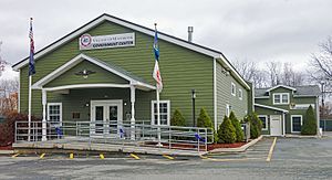
Maybrook, New York
Village in New York, United States
Distance: Approx. 147 meters
Latitude and longitude: 41.48916667,-74.21333333
Maybrook is a village in Orange County, New York, United States. The population was 3,150 at the 2020 census. It is part of the Poughkeepsie–Newburgh–Middletown, NY Metropolitan Statistical Area as well as the larger New York–Newark–Bridgeport, NY-NJ-CT-PA Combined Statistical Area.

African-American Cemetery (Montgomery, New York)
Historic cemetery in New York, United States
Distance: Approx. 3681 meters
Latitude and longitude: 41.50444444,-74.25444444
The African-American Cemetery, known historically as the Colored Cemetery, in the town of Montgomery, New York, United States, holds the graves of roughly 100 humans. It is located on NY 416 a tenth of a mile (160 m) north of the Interstate 84 crossing, near the Wallkill River. All the originally marked graves that have been identified have had the stones used to mark them supplemented with small pipes.

Patchett House
Historic house in New York, United States
Distance: Approx. 4172 meters
Latitude and longitude: 41.52583333,-74.22777778
The Patchett House is located at Ward Street (NY 17K), on the junction with Factory Street, in Montgomery, New York. It was originally built in the early 19th century as a tavern serving travelers on the Newburgh–Cochecton Turnpike, whose eastern half 17K follows today. Arthur Patchett, at the time co-owner of the Montgomery Worsted Mills at the end of Factory Street on the Wallkill River, moved into the house sometime in the 1890s.

Montgomery Water Works
United States historic place
Distance: Approx. 4089 meters
Latitude and longitude: 41.52527778,-74.22666667
The Montgomery Water Works is located along NY 17K in the village of Montgomery, New York. The two small brick buildings were built in 1895 on land sold to the village by Arthur Patchett, whose own house still stands across the road. It was added to the National Register of Historic Places in 2005.

Harrison Meeting House Site and Cemetery
Historic cemetery in Orange County, New York, US
Distance: Approx. 3939 meters
Latitude and longitude: 41.51138889,-74.25222222
The Harrison Meeting House Site and Cemetery, also known as the Germantown Church Site and Cemetery or just the Germantown Cemetery, is located on New York State Route 416 (NY 416) right at its northern terminus with NY 211, across from Orange County Airport just outside the village of Montgomery, New York. The first settlers of what would eventually become the Town of Montgomery came here and built their church on this site in the early 18th century. It would later be surrounded with their houses.

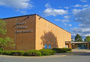
Valley Central High School
School in Montgomery, NY, United States
Distance: Approx. 3881 meters
Latitude and longitude: 41.52444444,-74.21666667
Valley Central High School is located in Montgomery, New York. It educates students in grades 9-12 in the Valley Central School District, which includes much of the town of Montgomery, portions of neighboring Wallkill and Newburgh and the three villages of Maybrook, Montgomery and Walden as well as parts of Campbell Hall and Coldenham.

Gideon Pelton Farm
Historic house in New York, United States
Distance: Approx. 2770 meters
Latitude and longitude: 41.50444444,-74.24166667
The Gideon Pelton Farm is a Registered Historic Place located on Rockafellow Lane in the Town of Montgomery in Orange County, New York. Pelton settled the area in the 1770s and built the house soon afterwards. A stone wing was built on it before the end of the century, and in the 1830s a large frame section was added in the then-popular Greek Revival style that gave the house its current character.

Tweddle Farmstead
Historic house in New York, United States
Distance: Approx. 2397 meters
Latitude and longitude: 41.50583333,-74.23388889
The Tweddle Farmstead is a Registered Historic Place located on Beaverdam Road in the Town of Montgomery in Orange County, New York. Built in the early 19th century by Bercoon van Alst, it was added to significantly in the 1830s in the Greek Revival style. This gave the house its current front.

John Blake House
Historic house in New York, United States
Distance: Approx. 643 meters
Latitude and longitude: 41.49361111,-74.20944444
The John Blake House is located on Homestead Avenue (NY 208) in Maybrook, New York, United States. It is a brick building from the late 18th century, one of the oldest houses in the village John Blake, a prominent local politician, built the house around an earlier log cabin. A wing was added in the mid-19th century, but it has not otherwise been altered.

Johannes Miller House
Historic house in New York, United States
Distance: Approx. 4050 meters
Latitude and longitude: 41.51194444,-74.25333333
The Johannes Miller House is a Registered Historic Place in the Orange County, New York, Town of Montgomery. It is located on NY 211 just opposite its junction with NY 416 and another Registered Historic Place, the Harrison Meeting House Site and Cemetery. Orange County Airport is nearby.

Peale's Barber Farm Mastodon Exhumation Site
United States historic place
Distance: Approx. 4102 meters
Latitude and longitude: 41.52638889,-74.21777778
The Peale's Barber Farm Mastodon Exhumation Site, near Montgomery, New York, is one of three sites of an 1801 exhumation of a mastodon which became "the world's first fully articulated prehistoric skeleton". The exhumation was led by artist/scientist Charles Willson Peale, owner of the Philadelphia Museum. The site was listed on the U.S. National Register of Historic Places on October 20, 2009.
Maybrook Yard
Rail yard in Maybrook, New York
Distance: Approx. 1241 meters
Latitude and longitude: 41.49847,-74.20598
Maybrook Yard was a major rail yard located in Maybrook, New York. It was the western gateway of its long-time owner, the New York, New Haven and Hartford Railroad and its predecessors. It was here that freight cars were interchanged between railroads from the west and the New Haven, whose Maybrook Line headed east over the Poughkeepsie Bridge to the railroad's main freight yard at Cedar Hill Yard in New Haven, Connecticut.
Weather in this IP's area
few clouds
-4 Celsius
-11 Celsius
-5 Celsius
-3 Celsius
1017 hPa
63 %
1017 hPa
997 hPa
10000 meters
7.72 m/s
10.29 m/s
300 degree
20 %
