24.39.107.95 - IP Lookup: Free IP Address Lookup, Postal Code Lookup, IP Location Lookup, IP ASN, Public IP
Country:
Region:
City:
Location:
Time Zone:
Postal Code:
IP information under different IP Channel
ip-api
Country
Region
City
ASN
Time Zone
ISP
Blacklist
Proxy
Latitude
Longitude
Postal
Route
Luminati
Country
Region
ny
City
wurtsboro
ASN
Time Zone
America/New_York
ISP
TWC-12271-NYC
Latitude
Longitude
Postal
IPinfo
Country
Region
City
ASN
Time Zone
ISP
Blacklist
Proxy
Latitude
Longitude
Postal
Route
IP2Location
24.39.107.95Country
Region
new york
City
wurtsboro
Time Zone
America/New_York
ISP
Language
User-Agent
Latitude
Longitude
Postal
db-ip
Country
Region
City
ASN
Time Zone
ISP
Blacklist
Proxy
Latitude
Longitude
Postal
Route
ipdata
Country
Region
City
ASN
Time Zone
ISP
Blacklist
Proxy
Latitude
Longitude
Postal
Route
Popular places and events near this IP address

Bloomingburg, New York
Village in New York, United States
Distance: Approx. 5381 meters
Latitude and longitude: 41.55,-74.43333333
Bloomingburg, previously Bloomingburgh, is a village in the Sullivan County town of Mamakating, New York, United States. The population was 1,032 at the 2020 census.

Mamakating, New York
Town in New York, United States
Distance: Approx. 792 meters
Latitude and longitude: 41.58333333,-74.48333333
Mamakating is a town in the southeastern section of Sullivan County, New York, United States. The population was 12,655 at the 2020 census.

Wurtsboro, New York
Village in New York, United States
Distance: Approx. 150 meters
Latitude and longitude: 41.57611111,-74.48555556
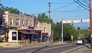
Wurtsboro is a village located on U.S. Route 209 in the town of Mamakating in Sullivan County, New York, United States, near its junction with New York State Route 17 (which is being upgraded to interstate standards and will be renumbered as interstate 86). The population was 1,124 at the 2020 census. Since 1927 the area has been served by Wurtsboro-Sullivan County Airport.
WZAD
Radio station in New York, United States
Distance: Approx. 6187 meters
Latitude and longitude: 41.601,-74.554
WZAD (97.3 FM The Wolf) is country music radio station licensed to Wurtsboro, New York, that serves the Catskill Mountains region, Orange County, New York, and Pike County, Pennsylvania. The station is owned by Townsquare Media and broadcasts with 620 watts ERP from a tower between Wurtsboro and Monticello. Its studios are in Poughkeepsie, New York.
Summitville, New York
Hamlet in New York, United States
Distance: Approx. 5810 meters
Latitude and longitude: 41.62138889,-74.45083333
Summitville is a hamlet in the town of Mamakating in Sullivan County, New York, United States. The hamlet is located along U.S. Route 209. The postal ZIP code is 12781; the telephone exchange is predominantly 888 and overlaid 647 in Area code 845.

Basha Kill Wildlife Management Area
Conservation Area in Sullivan County, New York
Distance: Approx. 5806 meters
Latitude and longitude: 41.5325,-74.52388889
The Basha Kill Wildlife Management Area (also known as the Bashakill Wildlife Management Area) is a 2,213-acre (8.96 km2) conservation area consisting of wetlands and uplands along the Basher Kill in Sullivan County, New York. The primary purposes of Bashakill Wildlife Management Area (WMA) are for wildlife management, wildlife habitat management, and wildlife-dependent recreation. This 3,107-acre WMA contains the largest freshwater wetland in southeastern New York, and is a state designated Bird Conservation Area.
Haven, New York
Hamlet in New York, United States
Distance: Approx. 5018 meters
Latitude and longitude: 41.5412,-74.52405556
Haven is a hamlet south of Wurtsboro, New York, on route 209 and Haven Road which crosses the Basha Kill to the South Rd. The area is known by the old Moose Lodge which now appears to be closed. The Brownsville cemetery is at the end of Tow Path Road, a cemetery from the 1830s situated in the woods above the Basha Kill.

Masten-Quinn House
Historic house in New York, United States
Distance: Approx. 499 meters
Latitude and longitude: 41.57694444,-74.48111111
The Masten-Quinn House is located on First Street in the village of Wurtsboro, New York, United States. It is a wooden Greek Revival house built in two phases in the 1820s, the center of a farm that remained working until the mid-20th century. Today it is one of the few remainders from the area's agricultural past as a canal town.

Mamakating Park Historic District
Historic district in New York, United States
Distance: Approx. 5691 meters
Latitude and longitude: 41.61222222,-74.53638889
The Mamakating Park Historic District is located on the ridge north of Masten Lake on the highest ground in the Town of Mamakating, New York, United States. It is a Catskill vacation community, originally intended to be the much larger Sullivan County Club, built in the 1890s. It includes several dozen Late Victorian cottages, most of which are as they were originally built, arranged around the site of a former hotel building, and some other buildings from the mid-20th century.
Wurtsboro Hills, New York
Hamlet and CDP. in New York, United States
Distance: Approx. 2179 meters
Latitude and longitude: 41.59277778,-74.50222222
Wurtsboro Hills is a hamlet (and census-designated place) in the town of Mamakating in Sullivan County, New York, United States. The hamlet is located along old NY 17, west of the Village of Wurtsboro. The telephone exchange is primarily 888 and along with 647 in Area Code 845.
Wurtsboro Hills
Mountain range in New York, United States
Distance: Approx. 2908 meters
Latitude and longitude: 41.6025936,-74.4926587
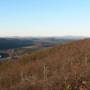
Wurtsboro Hills is a mountain range in Sullivan County, New York. It is located north-northeast of Wurtsboro. Shawangunk Mountains are located southeast of Wurtsboro Hills.
New Vernon, New York
Distance: Approx. 8367 meters
Latitude and longitude: 41.50166667,-74.48444444
New Vernon is a hamlet in Orange County, in the U.S. state of New York.
Weather in this IP's area
mist
-3 Celsius
-3 Celsius
-5 Celsius
-3 Celsius
1014 hPa
96 %
1014 hPa
981 hPa
4023 meters
100 %