24.39.105.85 - IP Lookup: Free IP Address Lookup, Postal Code Lookup, IP Location Lookup, IP ASN, Public IP
Country:
Region:
City:
Location:
Time Zone:
Postal Code:
IP information under different IP Channel
ip-api
Country
Region
City
ASN
Time Zone
ISP
Blacklist
Proxy
Latitude
Longitude
Postal
Route
Luminati
Country
Region
ny
City
middletown
ASN
Time Zone
America/New_York
ISP
TWC-12271-NYC
Latitude
Longitude
Postal
IPinfo
Country
Region
City
ASN
Time Zone
ISP
Blacklist
Proxy
Latitude
Longitude
Postal
Route
IP2Location
24.39.105.85Country
Region
new york
City
liberty
Time Zone
America/New_York
ISP
Language
User-Agent
Latitude
Longitude
Postal
db-ip
Country
Region
City
ASN
Time Zone
ISP
Blacklist
Proxy
Latitude
Longitude
Postal
Route
ipdata
Country
Region
City
ASN
Time Zone
ISP
Blacklist
Proxy
Latitude
Longitude
Postal
Route
Popular places and events near this IP address

Liberty (village), New York
Village in New York, United States
Distance: Approx. 1109 meters
Latitude and longitude: 41.8,-74.73333333
Liberty is a village in Sullivan County, New York, United States. The population was 4,700 at the 2020 census. The Village of Liberty is centrally located in the Town of Liberty and is adjacent to New York Route 17.

Liberty, New York
Town in New York, United States
Distance: Approx. 22 meters
Latitude and longitude: 41.80138889,-74.74666667
Liberty is a town in Sullivan County, New York, United States. The population was 10,159 at the 2020 census. The village is bisected by NY 52 and NY 55, and is crossed by NY 17.
Grossinger's Catskill Resort Hotel
Hotel in Liberty, New York
Distance: Approx. 2334 meters
Latitude and longitude: 41.7898,-74.723
Grossinger's Catskill Resort Hotel was a resort in the Catskill Mountains in the Town of Liberty, near the village of Liberty, New York. It was a kosher establishment that catered primarily to Jewish clients from New York City. Under the direction of hostess Jennie Grossinger, it became one of the largest Borscht Belt resorts.
St. Paul's Evangelical Lutheran Church (Liberty, New York)
Historic church in New York, United States
Distance: Approx. 262 meters
Latitude and longitude: 41.79888889,-74.74722222
St. Paul's Evangelical Lutheran Church is a historic Evangelical Lutheran church in Liberty, Sullivan County, New York. It was built in 1908 and is a modest Late Gothic Revival style building.

Liberty Downtown Historic District (Liberty, New York)
Historic district in New York, United States
Distance: Approx. 41 meters
Latitude and longitude: 41.80083333,-74.74666667
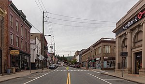
Liberty Downtown Historic District is a historic district located at Liberty in Sullivan County, New York. The district includes 112 contributing buildings and comprises the village's commercial core. It subsumes the Liberty Village Historic District listed in 1978, which had 12 contributing buildings.
Shelburne Playhouse
United States historic place
Distance: Approx. 2720 meters
Latitude and longitude: 41.77722222,-74.74027778
Shelburne Playhouse is a historic theatre located at Ferndale in Sullivan County, New York. It was built in 1922 as part of a small resort known as the Shelburne Hotel and used as the hotel social hall. It is a long, rectangular wood-frame building, 95 feet long and 35 feet wide.

Town and Country Building
Historic commercial building in New York, United States
Distance: Approx. 176 meters
Latitude and longitude: 41.79972222,-74.74583333
The Town and Country Building (also known as the Lyric Theatre (before 1913) and New Lyric Theatre (ca. 1913-ca. 1925) is a historic commercial building located at Liberty in Sullivan County, New York.

Munson Diner
Historic commercial building in New York, United States
Distance: Approx. 537 meters
Latitude and longitude: 41.79638889,-74.74611111
Munson Diner is a historic diner located at Liberty in Sullivan County, New York. It was manufactured in 1945 by the Kullman Dining Car Company of Lebanon, New Jersey. It has a riveted steel frame and exterior of stainless steel and porcelain enamel.
Liberty High School (Liberty, New York)
Public school in the United States
Distance: Approx. 826 meters
Latitude and longitude: 41.80666667,-74.75333333
Liberty High School is a public high school based in Liberty, New York. Its school gymnasium is most famous for hosting an episode of WWF Monday Night Raw in 1994.
Chuck Hill
Mountain in New York, United States
Distance: Approx. 2442 meters
Latitude and longitude: 41.7959222,-74.7751618
Chuck Hill is a mountain in Sullivan County, New York. It is located west-southwest of Liberty. Walnut Mountain is located southeast and Revonah Hill is located north-northeast of Chuck Hill.
Revonah Hill
Mountain in New York, United States
Distance: Approx. 2296 meters
Latitude and longitude: 41.8184223,-74.7618278
Revonah Hill is a mountain in Sullivan County, New York. It is located northwest of Liberty. Grants Hill is located northwest and Chuck Hill is located south-southwest of Revonah Hill.
Walnut Mountain
Mountain in New York, United States
Distance: Approx. 2386 meters
Latitude and longitude: 41.7873112,-74.7684951
Walnut Mountain is a mountain in Sullivan County, New York. It is located southwest of Liberty. Columbia Hill is located southeast and Chuck Hill is located northwest of Walnut Mountain.
Weather in this IP's area
broken clouds
8 Celsius
8 Celsius
7 Celsius
9 Celsius
1003 hPa
67 %
1003 hPa
947 hPa
10000 meters
0.89 m/s
2.24 m/s
165 degree
51 %
