24.39.105.166 - IP Lookup: Free IP Address Lookup, Postal Code Lookup, IP Location Lookup, IP ASN, Public IP
Country:
Region:
City:
Location:
Time Zone:
Postal Code:
IP information under different IP Channel
ip-api
Country
Region
City
ASN
Time Zone
ISP
Blacklist
Proxy
Latitude
Longitude
Postal
Route
Luminati
Country
Region
ny
City
queens
ASN
Time Zone
America/New_York
ISP
TWC-12271-NYC
Latitude
Longitude
Postal
IPinfo
Country
Region
City
ASN
Time Zone
ISP
Blacklist
Proxy
Latitude
Longitude
Postal
Route
IP2Location
24.39.105.166Country
Region
new york
City
woodside
Time Zone
America/New_York
ISP
Language
User-Agent
Latitude
Longitude
Postal
db-ip
Country
Region
City
ASN
Time Zone
ISP
Blacklist
Proxy
Latitude
Longitude
Postal
Route
ipdata
Country
Region
City
ASN
Time Zone
ISP
Blacklist
Proxy
Latitude
Longitude
Postal
Route
Popular places and events near this IP address

61st Street–Woodside station
New York City Subway station in Queens
Distance: Approx. 158 meters
Latitude and longitude: 40.74560833,-73.90296667
The 61st Street–Woodside station (announced as the Woodside–61st Street station on trains) is an express station on the IRT Flushing Line of the New York City Subway located at 61st Street and Roosevelt Avenue in Woodside, Queens. It is served by the 7 train, with additional peak-direction <7> service during rush hours. 61st Street–Woodside opened on April 21, 1917 as Woodside, as part of an extension of the IRT Flushing Line.

69th Street station (IRT Flushing Line)
New York City Subway station in Queens
Distance: Approx. 679 meters
Latitude and longitude: 40.74625833,-73.89685
The 69th Street station (also known as the 69th Street–Fisk Avenue station) is a local station on the IRT Flushing Line of the New York City Subway. Located at 69th Street and Roosevelt Avenue in the Woodside, Queens, it is served by the 7 train at all times.

52nd Street station (IRT Flushing Line)
New York City Subway station in Queens
Distance: Approx. 694 meters
Latitude and longitude: 40.74403611,-73.91286389
The 52nd Street station (also known as the 52nd Street–Lincoln Avenue station) is a local station on the IRT Flushing Line of the New York City Subway. Located at the intersection of 52nd Street and Roosevelt Avenue in Woodside, Queens, it is served by the 7 train at all times.
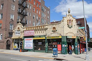
Woodside, Queens
Neighborhood in New York City
Distance: Approx. 37 meters
Latitude and longitude: 40.745,-73.905
Woodside is a neighborhood in the western portion of the borough of Queens in New York City. It is bordered on the south by Maspeth, on the north by Astoria, on the west by Sunnyside, and on the east by Elmhurst, Jackson Heights, and East Elmhurst. Some areas are widely residential and very quiet, while other parts, especially the ones around Roosevelt Avenue, are busier.

Woodside station (LIRR)
Long Island Rail Road station in Queens, New York
Distance: Approx. 160 meters
Latitude and longitude: 40.746072,-73.903201
The Woodside station is a station on the Main Line and Port Washington Branch of the Long Island Rail Road (LIRR), located in the Woodside neighborhood of Queens in New York City. It is the first station passed by eastward trains from Penn Station and Grand Central Madison, and it is the only station in Queens shared by the Port Washington Branch and other LIRR branches. East of Woodside the two-track Port Washington Branch turns northeastward, while the four-track Main Line continues southeast to Jamaica station.

65th Street station (IND Queens Boulevard Line)
New York City Subway station in Queens
Distance: Approx. 780 meters
Latitude and longitude: 40.7494,-73.8973
The 65th Street station is a local station on the IND Queens Boulevard Line of the New York City Subway, located at the intersection of 65th Street and Broadway in Queens. It is served by the M train on weekdays, the R train at all times except nights, and the E and F trains at night. The station opened on August 19, 1933, as part of the Independent Subway System's Queens Boulevard Line.

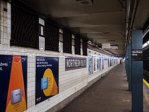
Northern Boulevard station
New York City Subway station in Queens
Distance: Approx. 902 meters
Latitude and longitude: 40.753239,-73.906918
The Northern Boulevard station is a local station on the IND Queens Boulevard Line of the New York City Subway. Located at the intersection of Northern Boulevard and Broadway, it is served by the M train on weekdays, the R train at all times except nights, and the E and F trains at night.

Winfield Reformed Church
Distance: Approx. 683 meters
Latitude and longitude: 40.74263889,-73.8975
Winfield Reformed Church (Chinese: 恩惠歸正教會) is a Protestant church founded in 1880, located in Woodside, Queens, New York City. The church was originally located on Queens Boulevard and moved to its current location in 1910. The current building was built in 1914.

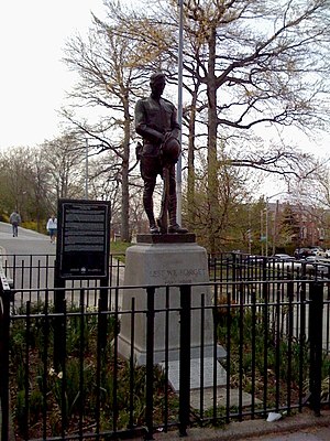
Doughboy Park
Public park in Queens, New York
Distance: Approx. 351 meters
Latitude and longitude: 40.74627222,-73.90875556
Doughboy Park is a 1.71-acre (6,900 m2) New York City public park in the Woodside neighborhood of Queens. It is located on a hilly parcel of land between Skillman Avenue and Woodside Avenue, and between 54th Street and 56th Street. The park was named in 1971.

St. Sebastian Roman Catholic Church (Queens)
Distance: Approx. 152 meters
Latitude and longitude: 40.74497222,-73.90655556
St. Sebastian Roman Catholic Church is a Roman Catholic parish church in the Diocese of Brooklyn, located at Woodside, Queens, New York City. Although the parish of St.

Razi School
School in New York, U.S.A.
Distance: Approx. 527 meters
Latitude and longitude: 40.74241,-73.90975
Razi School is an Islamic school in Woodside, New York. The school has partnered with NYC Department of Early Childhood Education in offering tuition-free full day Pre-Kindergarten classes for all 4-year-old children. Razi School is in the same building as the Islamic Institute of New York.

Phipps Garden Apartments
Distance: Approx. 799 meters
Latitude and longitude: 40.74916667,-73.91277778
Phipps Garden Apartments is an apartment complex in Sunnyside Gardens, Queens, New York City. It was built in 1931 (1931) by Phipps Houses, a philanthropic organization of the Phipps family to build model tenements for working-class families, along with Henry Wright of Sunnyside Gardens. It is located on 39th Avenue between 50th and 52nd Streets, adjacent to Sunnyside Gardens Park and Sunnyside Yard.
Weather in this IP's area
light rain
14 Celsius
12 Celsius
13 Celsius
14 Celsius
1004 hPa
51 %
1004 hPa
1003 hPa
10000 meters
9.26 m/s
12.86 m/s
270 degree
20 %
