24.39.104.44 - IP Lookup: Free IP Address Lookup, Postal Code Lookup, IP Location Lookup, IP ASN, Public IP
Country:
Region:
City:
Location:
Time Zone:
Postal Code:
IP information under different IP Channel
ip-api
Country
Region
City
ASN
Time Zone
ISP
Blacklist
Proxy
Latitude
Longitude
Postal
Route
Luminati
Country
Region
ny
City
middletown
ASN
Time Zone
America/New_York
ISP
TWC-12271-NYC
Latitude
Longitude
Postal
IPinfo
Country
Region
City
ASN
Time Zone
ISP
Blacklist
Proxy
Latitude
Longitude
Postal
Route
IP2Location
24.39.104.44Country
Region
new york
City
brooklyn
Time Zone
America/New_York
ISP
Language
User-Agent
Latitude
Longitude
Postal
db-ip
Country
Region
City
ASN
Time Zone
ISP
Blacklist
Proxy
Latitude
Longitude
Postal
Route
ipdata
Country
Region
City
ASN
Time Zone
ISP
Blacklist
Proxy
Latitude
Longitude
Postal
Route
Popular places and events near this IP address

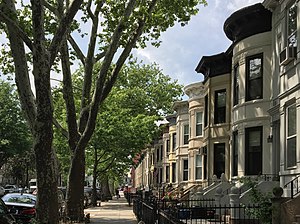
Bay Ridge, Brooklyn
Neighborhood in New York City
Distance: Approx. 827 meters
Latitude and longitude: 40.63138889,-74.02777778
Bay Ridge is a neighborhood in the southwest corner of the New York City borough of Brooklyn. It is bounded by Sunset Park to the north, Dyker Heights to the east, the Narrows and the Belt Parkway to the west, and Fort Hamilton Army Base and the Verrazzano-Narrows Bridge to the south. The section of Bay Ridge south of 86th Street is sometimes considered part of a sub-neighborhood called Fort Hamilton.

86th Street station (BMT Fourth Avenue Line)
New York City Subway station in Brooklyn
Distance: Approx. 262 meters
Latitude and longitude: 40.62277778,-74.02833333
The 86th Street station is a station on the BMT Fourth Avenue Line of the New York City Subway, located at 86th Street and Fourth Avenue in Bay Ridge, Brooklyn. It is served by the R train at all times. The 86th Street station was constructed as part of the Fourth Avenue Line.

Fort Hamilton High School
Public school in New York City
Distance: Approx. 807 meters
Latitude and longitude: 40.62722222,-74.03944444
Fort Hamilton High School (HS 490) is a public high school in Brooklyn, New York, United States, under the jurisdiction of the New York City Department of Education. Students in Bay Ridge, Sunset Park and Dyker Heights are zoned to Fort Hamilton HS. It is named for the Army garrison at Fort Hamilton. Ground was broken by then mayor Fiorello LaGuardia on September 23, 1940 and the school opened at 8301 Shore Road on September 8, 1941 at the location of the former Crescent Athletic Club.

77th Street station (BMT Fourth Avenue Line)
New York City Subway station in Brooklyn
Distance: Approx. 705 meters
Latitude and longitude: 40.62944444,-74.02583333
The 77th Street station is a station on the BMT Fourth Avenue Line of the New York City Subway. Located at 77th Street and Fourth Avenue in Bay Ridge, Brooklyn, it is served by the R train at all times. The 77th Street station was constructed as part of the Fourth Avenue Line, which was approved in 1905 and subsequently modified.

Bay Ridge–95th Street station
New York City Subway station in Brooklyn
Distance: Approx. 906 meters
Latitude and longitude: 40.61616667,-74.03122222
The Bay Ridge–95th Street station (originally 95th Street–Fort Hamilton station) is the southern terminal station on the BMT Fourth Avenue Line of the New York City Subway. Despite the name, the station is located in the neighborhood of Fort Hamilton (as its original name implied) at the intersection of 95th Street and Fourth Avenue in southwestern Brooklyn. It is served by the R train at all times.
Fontbonne Hall Academy
Private high school in Brooklyn, NY, USA
Distance: Approx. 1255 meters
Latitude and longitude: 40.61388889,-74.03638889
Fontbonne Hall is an all-girls, private, Roman Catholic high school in Brooklyn, New York, United States. Established in 1937 by the Sisters of St. Joseph, it is located within the Roman Catholic Diocese of Brooklyn.
Bay Ridge United Methodist Church
United States historic place
Distance: Approx. 1163 meters
Latitude and longitude: 40.63361111,-74.02444444
Bay Ridge United Methodist Church, originally known as Grace Methodist Episcopal Church, was a historic Methodist church at 7002 Fourth Avenue and Ovington Avenue in Bay Ridge, Brooklyn, New York, New York. It was designed by architect George W. Kramer. It was built in 1899 in the Romanesque Revival style.

Houses at 216–264 Ovington Ave.
United States historic place
Distance: Approx. 1216 meters
Latitude and longitude: 40.635,-74.02777778
The houses at 216–264 Ovington Ave. form a national historic district in Bay Ridge, Brooklyn, New York, New York. It consists of 20 contributing residential buildings built between 1908 and 1910.

Bay Ridge United Church
Distance: Approx. 1024 meters
Latitude and longitude: 40.62734,-74.01926
Bay Ridge United Church (BRUC) was located on Bay Ridge Parkway (636) in the Bay Ridge Section of Brooklyn, New York. The congregation was a blend of two churches from two similar but different denominations and was a member of both the Reformed Church in America and the Presbyterian Church (U.S.A.).
Victory Memorial Hospital
Defunct Brooklyn hospital
Distance: Approx. 1146 meters
Latitude and longitude: 40.61600553,-74.0226678
Victory Memorial Hospital was a 254-bed medical facility. It was announced in 2006 that they're closing; they were acquired by SUNY Downstate Medical Center in 2009 and renamed SUNY Downstate at Bay Ridge.
Shore Road Hospital
Defunct Brooklyn hospital
Distance: Approx. 806 meters
Latitude and longitude: 40.6219,-74.0397
Shore Road Hospital was a 93-bed private hospital in Brooklyn, New York City, which opened in 1924 and was demolished in 1977.
Bay Ridge Hospital
Brooklyn hospital
Distance: Approx. 1213 meters
Latitude and longitude: 40.6333,-74.0226
Bay Ridge Hospital's Brooklyn building became a nursing home.
Weather in this IP's area
haze
-2 Celsius
-9 Celsius
-2 Celsius
-1 Celsius
1017 hPa
70 %
1017 hPa
1016 hPa
10000 meters
8.75 m/s
13.89 m/s
320 degree
75 %