Country:
Region:
City:
Latitude and Longitude:
Time Zone:
Postal Code:
IP information under different IP Channel
ip-api
Country
Region
City
ASN
Time Zone
ISP
Blacklist
Proxy
Latitude
Longitude
Postal
Route
Luminati
Country
Region
ca
City
rialto
ASN
Time Zone
America/Los_Angeles
ISP
TWC-20001-PACWEST
Latitude
Longitude
Postal
IPinfo
Country
Region
City
ASN
Time Zone
ISP
Blacklist
Proxy
Latitude
Longitude
Postal
Route
db-ip
Country
Region
City
ASN
Time Zone
ISP
Blacklist
Proxy
Latitude
Longitude
Postal
Route
ipdata
Country
Region
City
ASN
Time Zone
ISP
Blacklist
Proxy
Latitude
Longitude
Postal
Route
Popular places and events near this IP address

Highland, California
City in California, United States
Distance: Approx. 435 meters
Latitude and longitude: 34.12833333,-117.20861111
Highland (inc. East Highlands) is a city in San Bernardino County, California, United States located 65 miles east of Downtown Los Angeles and roughly 50 miles west of Palm Springs, California. The city's population, inclusive to its neighboring East Highlands community was 56,999 at the 2020 census.

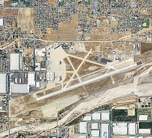
Norton Air Force Base
US Air Force base
Distance: Approx. 4794 meters
Latitude and longitude: 34.09527778,-117.235
Norton Air Force Base (IATA: SBD) (1942–1994) was a United States Air Force facility 2 miles (3.2 km) east of downtown San Bernardino in San Bernardino County, California.
KKDD
Radio station in San Bernardino, California
Distance: Approx. 3096 meters
Latitude and longitude: 34.12416667,-117.23722222
KKDD (1290 AM) is a radio station in San Bernardino, California. The station is owned by Relevant Radio, Inc. It airs a Catholic talk format for the Inland Empire region of Southern California including Riverside and San Bernardino.

Aquinas High School (California)
Private, coeducational school in San Bernardino, , California
Distance: Approx. 3905 meters
Latitude and longitude: 34.14222222,-117.24416667
Aquinas High School is a private, coeducational, Roman Catholic high school in San Bernardino, California, United States. The school is located in and operated by the Roman Catholic Diocese of San Bernardino. Aquinas is accredited by the Western Association of Schools and Colleges and the Western Catholic Educational Association.

Patton State Hospital
Hospital in California, United States
Distance: Approx. 1289 meters
Latitude and longitude: 34.1380768,-117.2145395
Patton State Hospital is a forensic psychiatric hospital in San Bernardino, California, United States. Though the hospital has a Patton, California address, it lies entirely within the San Bernardino city limits. Operated by the California Department of State Hospitals, Patton State Hospital is a forensic hospital with a licensed bed capacity of 1287 for people who have been committed by the judicial system for treatment.
San Gorgonio High School
Senior high school in San Bernardino, California, United States
Distance: Approx. 3036 meters
Latitude and longitude: 34.12777778,-117.23722222
San Gorgonio High School is a comprehensive senior high school in the San Bernardino City Unified School District. Its campus is located at the corner of Pacific Street and Arden Avenue on the border between San Bernardino and Highland, California.
Del Rosa, San Bernardino, California
Neighborhood community in San Bernardino, California, United States
Distance: Approx. 4056 meters
Latitude and longitude: 34.14666667,-117.24361111
Del Rosa (corruption of de la Rosa, Spanish for "of the Rose") is a neighborhood community in the city of San Bernardino, California.
Patton, California
Unincorporated community in California, United States
Distance: Approx. 1906 meters
Latitude and longitude: 34.13583333,-117.22388889
Patton is an unincorporated community in San Bernardino County, California, United States. Patton is 4.5 miles (7.2 km) northeast of downtown San Bernardino. Patton has a post office with ZIP code 92369, which opened in 1897.
Sand Creek (San Bernardino County, California)
Distance: Approx. 2476 meters
Latitude and longitude: 34.12333333,-117.23
Sand Creek is a tributary of Warm Creek in San Bernardino County, California.

Highland Historic District (Highland, California)
Historic district in California, United States
Distance: Approx. 425 meters
Latitude and longitude: 34.12777778,-117.20805556
The Highland Historic District is a historic district encompassing some of the oldest parts of Highland, California. The district includes the city's original townsite, which was platted in 1891, and parts of a 1904 addition; significant development in the district continued through 1938. Development in Highland was driven by the citrus industry, Southern California's dominant industry at the time; as Highland was located at the junction of the busy Palm Avenue and the newly completed Santa Fe Railroad, it became a natural industrial center.
Yaamava' Resort & Casino
Casino in San Bernardino, California
Distance: Approx. 3212 meters
Latitude and longitude: 34.1503,-117.2293
Yaamava' Resort and Casino is an Indian casino on the San Manuel Reservation located in San Bernardino, California. It is owned and operated by the San Manuel Band of Mission Indians.

Line Fire
2024 wildfire in Southern California
Distance: Approx. 4664 meters
Latitude and longitude: 34.121,-117.155
The Line Fire is a large active wildfire in San Bernardino County, Southern California. The fire began on September 5, 6:33 PM near the community of Highland and spread into the San Bernardino National Forest. The fire has forced the evacuation of multiple communities.
Weather in this IP's area
scattered clouds
24 Celsius
23 Celsius
21 Celsius
26 Celsius
1016 hPa
20 %
1016 hPa
969 hPa
10000 meters
1.34 m/s
3.13 m/s
296 degree
26 %
06:17:29
16:48:15