Country:
 USA
USARegion:
City:
Latitude and Longitude:
Time Zone:
Postal Code:
IP information under different IP Channel
ip-api
Country
Region
City
ASN
Time Zone
ISP
Blacklist
Proxy
Latitude
Longitude
Postal
Route
IPinfo
Country
Region
City
ASN
Time Zone
ISP
Blacklist
Proxy
Latitude
Longitude
Postal
Route
MaxMind
Country
Region
City
ASN
Time Zone
ISP
Blacklist
Proxy
Latitude
Longitude
Postal
Route
Luminati
Country
USRegion
ca
City
lakeelsinore
ASN
Time Zone
America/Los_Angeles
ISP
TWC-20001-PACWEST
Latitude
Longitude
Postal
db-ip
Country
Region
City
ASN
Time Zone
ISP
Blacklist
Proxy
Latitude
Longitude
Postal
Route
ipdata
Country
Region
City
ASN
Time Zone
ISP
Blacklist
Proxy
Latitude
Longitude
Postal
Route
Popular places and events near this IP address

Canyon Lake, California
American city in California, United States
Distance: Approx. 4496 meters
Latitude and longitude: 33.68416667,-117.25555556
Canyon Lake is a city and gated community in Riverside County, California, United States, located on Canyon Lake reservoir. Canyon Lake began as a master-planned community developed by the Corona Land Company in 1968. The City of Canyon Lake was incorporated on December 1, 1990.
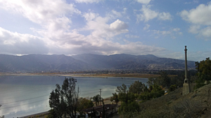
Lake Elsinore, California
City in California, United States
Distance: Approx. 4114 meters
Latitude and longitude: 33.68138889,-117.34527778
Lake Elsinore is a city in western Riverside County, California, United States. Established as a city in 1888, it is on the shore of Lake Elsinore, a natural freshwater lake about 3,000 acres (1,200 ha) in size. The city has grown from a small resort town in the late 19th and early 20th centuries to a suburban city with over 70,000 residents.

Warm Springs, California
Census-designated place in California, United States
Distance: Approx. 2954 meters
Latitude and longitude: 33.70277778,-117.3325
Warm Springs is a census-designated place in Riverside County, California. Warm Springs sits at an elevation of 1,365 feet (416 m). The 2010 United States census reported Warm Springs's population was 2,676.

Lake Elsinore Diamond
Stadium in California
Distance: Approx. 4291 meters
Latitude and longitude: 33.65416667,-117.30194444
Lake Elsinore Diamond, also referred to as Storm Stadium, is a ballpark in Lake Elsinore, California. It is the home of the Lake Elsinore Storm, a Minor League Baseball team in the California League. The field at the stadium is named Pete Lehr Field.
Temescal Canyon High School
Public high school in the United States
Distance: Approx. 4362 meters
Latitude and longitude: 33.70333333,-117.34833333
Temescal Canyon High School is a public high school part of the Lake Elsinore Unified School District. Though it is located in Lake Elsinore, California, it also serves the areas of Canyon Lake and Horsethief Canyon. The school was opened for the 1991–1992 school year, graduating its first class in 1994.

San Jacinto River (California)
River in California, United States
Distance: Approx. 5329 meters
Latitude and longitude: 33.64585,-117.31483889
The San Jacinto River is a 42-mile-long (68 km) river in Riverside County, California. The river's headwaters are in Santa Rosa and San Jacinto Mountains National Monument. The lower portion of the 765-square-mile (1,980 km2) watershed is urban and agricultural land.
Pinacate Mining District
Distance: Approx. 5401 meters
Latitude and longitude: 33.74,-117.29
The Pinacate Mining District is 5 to 8 miles southwest of Perris, California. It included the Good Hope Mine, Steele's Mine, Santa Rosa (Rosalia) Mine, Virginia or Shay Mine, Santa Fe Mine and many other smaller works like the Little Maggie Mine. It produced a total of about 104,000 ounces of gold through 1959, all from the lodes of various mines.

Good Hope Mine
Distance: Approx. 5299 meters
Latitude and longitude: 33.7382,-117.2862
Good Hope Mine was the principal gold mine in the Pinacate Mining District, Riverside County, California. Good Hope Mine was reputedly begun by a Frenchman named Mache, although the washes in the area were originally placer mined by Mexicans in the 1850s during the California Gold Rush using arrastras. The Good Hope quartz vein was found in 1874.

Canyon Lake (California)
Reservoir in Riverside County, California
Distance: Approx. 3182 meters
Latitude and longitude: 33.6876,-117.2692
Canyon Lake, sometimes referenced as Railroad Canyon Reservoir, is a reservoir created in 1928 by the construction of the Railroad Canyon Dam in Railroad Canyon or (San Jacinto Canyon) in the Temescal Mountains of southwestern Riverside County, California. The reservoir covers approximately 525 acres (212 ha), has 14.9 miles (24.0 km) of shoreline, and has a storage capacity of 11,586 acre⋅ft (14,291,000 m3). It is owned and operated by the Elsinore Valley Municipal Water District.

Meadowbrook, California
Census-designated place in California, United States
Distance: Approx. 4048 meters
Latitude and longitude: 33.72583333,-117.285
Meadowbrook is a census-designated place in Riverside County, California. Meadowbrook sits at an elevation of 1,621 feet (494 m). The 2020 United States census reported Meadowbrook's population was 3,142, down from 3,185 at the 2010 census.

Clevelin Hills
Range of hills in California
Distance: Approx. 4682 meters
Latitude and longitude: 33.68055556,-117.35138889
The Clevelin Hills are a range of hills in the Peninsular Ranges System, within the Temescal Mountains in western Riverside County, in southern California. The hills range from an elevation of over 1,400 feet (430 m) in the southeastern section, to the range's high point of 1,835 feet (559 m) in elevation, in the northwestern section. The Clevelin Hills are named for the leading developers of the Clevelin Corporation (Henry Cleveland Schultz and Abe Corlinsky) in the 1920s.
Warm Springs Valley
Valley in Riverside County, California, USA
Distance: Approx. 3761 meters
Latitude and longitude: 33.70055556,-117.3425
Warm Springs Valley is a valley located within the city of Lake Elsinore in Riverside County, California. It lies between the main body of the Temescal Mountains to the north, east and south and the Clevelin Hills to the west. The valley was named for the warm springs that used to be found flowing there.
Weather in this IP's area
overcast clouds
15 Celsius
14 Celsius
13 Celsius
16 Celsius
1009 hPa
84 %
1009 hPa
954 hPa
10000 meters
1.98 m/s
2.39 m/s
215 degree
90 %
06:55:53
18:12:38