Country:
Region:
City:
Latitude and Longitude:
Time Zone:
Postal Code:
IP information under different IP Channel
ip-api
Country
Region
City
ASN
Time Zone
ISP
Blacklist
Proxy
Latitude
Longitude
Postal
Route
Luminati
Country
Region
ca
City
losangeles
ASN
Time Zone
America/Los_Angeles
ISP
TWC-20001-PACWEST
Latitude
Longitude
Postal
IPinfo
Country
Region
City
ASN
Time Zone
ISP
Blacklist
Proxy
Latitude
Longitude
Postal
Route
db-ip
Country
Region
City
ASN
Time Zone
ISP
Blacklist
Proxy
Latitude
Longitude
Postal
Route
ipdata
Country
Region
City
ASN
Time Zone
ISP
Blacklist
Proxy
Latitude
Longitude
Postal
Route
Popular places and events near this IP address
Directors Guild of America
Film and television trade union
Distance: Approx. 930 meters
Latitude and longitude: 34.09777778,-118.3625
The Directors Guild of America (DGA) is an entertainment guild that represents the interests of film and television directors in the United States motion picture industry and abroad. Founded as the Screen Directors Guild in 1936, the group merged with the Radio and Television Directors Guild in 1960 to become the modern Directors Guild of America.
Nichols Canyon, Los Angeles
Neighborhood in Los Angeles, California, United States
Distance: Approx. 915 meters
Latitude and longitude: 34.114218,-118.36071
Nichols Canyon is a residential area in the Hollywood Hills in Los Angeles, California, bounded by Hollywood Boulevard on the south and Mulholland Drive on the north, lying between Laurel Canyon and Runyon Canyon. It was also known as Miller Canyon.

Laugh Factory
American comedy club chain
Distance: Approx. 956 meters
Latitude and longitude: 34.098,-118.36447222
Laugh Factory is a chain of comedy clubs in the United States. The chain is owned by Laugh Factory Inc., and the founder and current chief executive is Jamie Masada.

Schwab's Pharmacy
Drugstore in Hollywood, California, 1932–1983
Distance: Approx. 975 meters
Latitude and longitude: 34.098,-118.365
Schwab's Pharmacy was a drugstore located at 8024 Sunset Boulevard in Hollywood, California, and was a popular hangout for movie actors and movie industry dealmakers from the 1930s through the 1950s.
Motion Picture Editors Guild
American guild for film editors and others
Distance: Approx. 897 meters
Latitude and longitude: 34.098266,-118.357976
The Motion Picture Editors Guild (MPEG; IATSE Local 700) is the guild that represents freelance and staff motion picture and television editors and other post-production professionals and story analysts throughout the United States. The Motion Picture Editors Guild (Union Local 700) is a part of the 500 affiliated local unions of the International Alliance of Theatrical Stage Employees (IATSE), a national labor organization with 104,000-plus members. There are more than 8,000 members of the Editors Guild.

Mt. Olympus, Los Angeles
Neighborhood in Los Angeles, California, United States
Distance: Approx. 683 meters
Latitude and longitude: 34.111,-118.365
Mt. Olympus is a neighborhood in the Hollywood Hills area of the city of Los Angeles, California. Considered a subdistrict of Laurel Canyon, the 300-acre (120 ha) neighborhood is known for its upscale housing and wide streets.

Wattles Mansion
Historic house and park in Hollywood, Los Angeles
Distance: Approx. 587 meters
Latitude and longitude: 34.10430556,-118.35466667
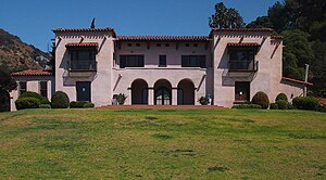
The Wattles Mansion, formally known as Jualita, is a former estate in the Hollywood area of Los Angeles, California. The mansion is a Mission Revival style mansion built in the estate in 1907 for wealthy Omaha banker Gurdon Wattles as his winter home; the estate contains a complex of gardens. It was sold to the city in 1968 and became the Wattles Garden Park, operated by the Department of Recreation and Parks.
Storer House (Los Angeles)
Historic house in California, United States
Distance: Approx. 824 meters
Latitude and longitude: 34.10086944,-118.36715
Storer House is a Frank Lloyd Wright house in the Hollywood Hills of Los Angeles built in 1923. The structure is noteworthy as one of the four Mayan Revival style textile-block houses built by Wright in the Los Angeles area from 1922 to 1924.
Rodney Bingenheimer's English Disco
Former nightclub in Los Angeles, US
Distance: Approx. 961 meters
Latitude and longitude: 34.0980527,-118.3566362
Rodney Bingenheimer's English Disco was a Los Angeles nightclub located at 7561 Sunset Boulevard on the Sunset Strip from late 1972 until early 1975. It catered to the glam rock movement. The club was infamous for widespread drug use and hosting underage girls at parties, but it was also a popular spot among rock stars, including Cherie Currie, Joan Jett, and Iggy Pop.
C.E. Toberman Estate
Historic house in California, United States
Distance: Approx. 966 meters
Latitude and longitude: 34.1049,-118.3503
The C. E. Toberman Estate, also known as Villa Las Colinas, is a gated Mission Revival mansion and estate on Camino Palmero in Hollywood, Los Angeles, California. It was listed on the National Register of Historic Places in 1983, and as a Los Angeles Historic-Cultural Monument in 1984.
Regency Plaza Suites
Hotel in Los Angeles, California, United States (1958–2007)
Distance: Approx. 596 meters
Latitude and longitude: 34.101,-118.363
The Regency Plaza Suites, also known as the Regency Hotel, the Regency Plaza, and the Plaza Suites Hotel, was an establishment located at 7940 Hollywood Boulevard in Los Angeles, California. It was built in 1958 and consisted of two wooden two-story buildings, a smaller "Garden" building (14 units) with a street address of 7926 Hollywood Blvd., and the larger "Main House" (45 units) which included the lobby and the hotel pool. A long-term residence hotel, it was eventually converted into an apartment complex before being demolished in 2007.

Thee Experience
Distance: Approx. 1042 meters
Latitude and longitude: 34.0984,-118.3541
Thee Experience was a psychedelic nightclub in Hollywood, California, United States. It was located at 7551 Sunset Boulevard, on the Sunset Strip.
Weather in this IP's area
clear sky
13 Celsius
12 Celsius
10 Celsius
15 Celsius
1011 hPa
67 %
1011 hPa
987 hPa
10000 meters
11.32 m/s
18.01 m/s
10 degree
06:15:27
16:58:30

