Country:
 USA
USARegion:
City:
Latitude and Longitude:
Time Zone:
Postal Code:
IP information under different IP Channel
ip-api
Country
Region
City
ASN
Time Zone
ISP
Blacklist
Proxy
Latitude
Longitude
Postal
Route
IPinfo
Country
Region
City
ASN
Time Zone
ISP
Blacklist
Proxy
Latitude
Longitude
Postal
Route
MaxMind
Country
Region
City
ASN
Time Zone
ISP
Blacklist
Proxy
Latitude
Longitude
Postal
Route
Luminati
Country
USRegion
ca
City
santamonica
ASN
Time Zone
America/Los_Angeles
ISP
TWC-20001-PACWEST
Latitude
Longitude
Postal
db-ip
Country
Region
City
ASN
Time Zone
ISP
Blacklist
Proxy
Latitude
Longitude
Postal
Route
ipdata
Country
Region
City
ASN
Time Zone
ISP
Blacklist
Proxy
Latitude
Longitude
Postal
Route
Popular places and events near this IP address

Saint Monica Preparatory
Private school in Santa Monica, California, United States
Distance: Approx. 665 meters
Latitude and longitude: 34.02416667,-118.49722222
Saint Monica Preparatory is a parochial, co-educational Catholic school in Santa Monica, California, consisting of students in grades Transitional kindergarten to grade 12. It is located in the Archdiocese of Los Angeles and serves the parish of St. Monica Catholic Church.

Rancho San Vicente y Santa Mónica
Pre-statehood California land grant
Distance: Approx. 457 meters
Latitude and longitude: 34.03,-118.5
Rancho San Vicente y Santa Mónica was a 33,000-acre (130 km2) Mexican land grant in present-day Los Angeles County, California given by governor Juan Alvarado in 1839 to Francisco Sepúlveda II, a soldier and citizen of Los Angeles. The rancho included what are now Santa Monica, Brentwood, Mandeville Canyon, and parts of Bel-Air and West Los Angeles.

St. Monica Catholic Church (Santa Monica, California)
Church in California, United States
Distance: Approx. 734 meters
Latitude and longitude: 34.02305556,-118.49722222
St. Monica Catholic Church is a Catholic parish in Santa Monica, California. It is one of the largest churches in the Archdiocese of Los Angeles.

Henry Weaver House
Historic house in California, United States
Distance: Approx. 885 meters
Latitude and longitude: 34.02777778,-118.51305556
Henry Weaver House, a California Bungalow, is in Santa Monica, California. It was built in 1910 by the Milwaukee Building Company for Henry Weaver, a Midwestern hotel developer. The house's broad roof overhang, prominent front porch and emphasis on natural colors and materials are unique features of the American Craftsman California Bungalow Style, which "fit the Southland landscape, Southland climate and Southland temperament," according to a 1910 Los Angeles Times article on the Weaver house.
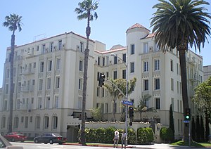
Charmont Apartments
United States historic place
Distance: Approx. 874 meters
Latitude and longitude: 34.02,-118.49944444
Charmont Apartments is an historic five-story apartment building in Santa Monica, California which was built in 1928. Designed by architect Max Maltzman with elements of both the Mission Revival-Spanish Colonial Revival style and the Art Deco style, the Charmont was a luxurious high-rise when it was built. The blending of Spanish Colonial Revival and Art Deco elements was popular style in the 1920s and is sometimes known as "Med-Deco." The main entrance is located in a walled courtyard that features a two-tiered fountain with an intricate Moorish-patterned backsplash in polychrome tile.

Sovereign Hotel (California)
Historic apartment building in Santa Monica, California, US
Distance: Approx. 773 meters
Latitude and longitude: 34.02027778,-118.50194444
The Sovereign is a large five-story, 130 unit apartment building in Santa Monica, California, United States. Built in 1928, it was designed by architect Kurt Meyer-Radon and the Anglo American Building Company in the Mission Revival-Spanish Colonial Revival styles. The building contains primarily single apartments and one bedroom apartments, many of which are currently under rent control.

Father's Office
Gastropub in Santa Monica, California
Distance: Approx. 529 meters
Latitude and longitude: 34.02916667,-118.49833333
Father's Office is a gastropub located at 1018 Montana Avenue in Santa Monica, California and has become famous for the Office Burger, which Esquire called one of the best burgers in the world.

Santa Monica Stairs
Outdoor stairways in Santa Monica, California, United States
Distance: Approx. 845 meters
Latitude and longitude: 34.03194444,-118.51055556
The "Santa Monica Stairs" refer primarily to a pair of outdoor stairways in California descending to the northwest from Adelaide Drive in Santa Monica, to Santa Monica Canyon in Los Angeles.

Palisades Park (Santa Monica)
Park in Santa Monica, California, United States
Distance: Approx. 710 meters
Latitude and longitude: 34.0231,-118.5095
Palisades Park is a 26.4-acre (10.7 ha) park in Santa Monica, California. The park is located along a 1.6-mile (2.6 km) section of Ocean Avenue on top of an uplifted unconsolidated sedimentary coastal Quaternary terrace with exposed bluffs, offering views of both the Pacific Ocean and the coastal mountains.
Albert Lewin House
House in Santa Monica, California
Distance: Approx. 848 meters
Latitude and longitude: 34.02365,-118.51169
The Albert Lewin House at 512-514 Palisades Beach Road in Santa Monica, California was designed by the Modernist architects Richard Neutra and Peter Pfisterer for the film producer Albert Lewin and built in 1938. It was built by Frank A. Hellenthal. It is 5400 sq ft in size.

Gestation III
Wooden sculpture in Santa Monica, California, U.S.
Distance: Approx. 699 meters
Latitude and longitude: 34.02257,-118.50874
Gestation III is a 1990 wooden sculpture by Baile Oakes, installed in Santa Monica, California's Palisades Park, in the United States. The sculpture measures approximately 10 ft. 7 in.
Christine Emerson Reed Park
Park in Santa Monica, California
Distance: Approx. 873 meters
Latitude and longitude: 34.0225,-118.49583333
Christine Emerson Reed Park, formerly known as Lincoln Park, is a park in Santa Monica, California. The park sits between 7th street and Lincoln Boulevard and between Wilshire Boulevard and California Avenue. It is home to the Miles Memorial Playhouse, tennis courts, and the city's tennis office, basketball courts, a playground, and CREST after school program.
Weather in this IP's area
overcast clouds
16 Celsius
16 Celsius
15 Celsius
18 Celsius
1009 hPa
89 %
1009 hPa
1003 hPa
10000 meters
0.89 m/s
1.79 m/s
326 degree
100 %
07:01:00
18:17:07