Country:
 Canada
Region:
City:
Latitude and Longitude:
Time Zone:
Postal Code:
IP information under different IP Channel
ip-api
Country
Region
City
ASN
Time Zone
ISP
Blacklist
Proxy
Latitude
Longitude
Postal
Route
IPinfo
Country
Region
City
ASN
Time Zone
ISP
Blacklist
Proxy
Latitude
Longitude
Postal
Route
MaxMind
Country
Region
City
ASN
Time Zone
ISP
Blacklist
Proxy
Latitude
Longitude
Postal
Route
Luminati
Country
CARegion
qc
City
troisrivieres
ASN
Time Zone
America/Toronto
ISP
CC-3272
Latitude
Longitude
Postal
db-ip
Country
Region
City
ASN
Time Zone
ISP
Blacklist
Proxy
Latitude
Longitude
Postal
Route
ipdata
Country
Region
City
ASN
Time Zone
ISP
Blacklist
Proxy
Latitude
Longitude
Postal
Route
Popular places and events near this IP address
Université du Québec à Trois-Rivières
University in Québec, Canada
Distance: Approx. 9285 meters
Latitude and longitude: 46.35056667,-72.57629722
The Université du Québec à Trois-Rivières (UQTR) (English: University of Quebec in Trois-Rivières), also known as "l'université du peuple", established in 1969 and mainly located in Trois-Rivières, Quebec, Canada, is a public university within the Université du Québec network. As of April 2016, the university had 14,500 students in 9 different campuses, including the main one in Trois-Rivières. About 788 of them come from overseas, from 50 countries.
Trois-Rivières-Ouest
Distance: Approx. 8666 meters
Latitude and longitude: 46.33222222,-72.59325
Trois-Rivières-Ouest is a former city in Quebec, Canada, now in the City of Trois-Rivières.

Forges du Saint-Maurice
Ironworks in Quebec, Canada
Distance: Approx. 4649 meters
Latitude and longitude: 46.39833333,-72.65777778
The Forges du Saint-Maurice ("St. Maurice Ironworks") was the first successful ironworking industry in New France. At the time of the initial formation of the forges in 1730, the Saint Maurice region near Trois-Rivières had long been known for its iron resources.

Trois-Rivières (federal electoral district)
Federal electoral district in Quebec, Canada
Distance: Approx. 6738 meters
Latitude and longitude: 46.359,-72.608
Trois-Rivières (formerly known as Three Rivers and Trois-Rivières Métropolitain) is an electoral district in Quebec, Canada that has been represented in the House of Commons of Canada from 1867 to 1892 and from 1935 to the present. It was created as "Three Rivers" riding by the British North America Act of 1867. The electoral district was abolished in 1892 when it was merged into Three Rivers and St.

Trois-Rivières Airport
Airport in Trois-Rivières, Quebec, Canada
Distance: Approx. 1907 meters
Latitude and longitude: 46.35166667,-72.68055556
Trois-Rivières Airport (IATA: YRQ, ICAO: CYRQ) is located near the city of Trois-Rivières, Quebec, Canada. The airport is classified as an airport of entry by Nav Canada and is staffed by the Canada Border Services Agency (CBSA). CBSA officers at this airport can handle general aviation aircraft only, with no more than 15 passengers.
CFOU-FM
Radio station of the Université du Québec à Trois-Rivières in Quebec, Canada
Distance: Approx. 9263 meters
Latitude and longitude: 46.34833333,-72.57722222
CFOU-FM (89.1 MHz) is a French language radio station that broadcasts in Trois-Rivières, Quebec, Canada. It is the campus radio station of the Université du Québec à Trois-Rivières.
Pointe-du-Lac
Distance: Approx. 9192 meters
Latitude and longitude: 46.28333333,-72.68333333
Pointe-du-Lac is one of the six boroughs of the city of Trois-Rivières and a former municipality in Quebec, Canada on the St. Lawrence River. It was founded in 1738 and its current church dates from 1882.
Saint-Louis-de-France
Distance: Approx. 8278 meters
Latitude and longitude: 46.42222222,-72.62547222
Saint-Louis-de-France was one of the six sectors of the City of Trois-Rivières. Prior to January 1, 2002 it was a city in Quebec of about 7,246 inhabitants. During the Quebec municipal reorganizations of 2002, it was amalgamated with the municipalities of Sainte-Marthe-du-Cap, Cap-de-la-Madeleine, Trois-Rivières, Trois-Rivières-Ouest and Pointe-du-Lac, to form the current town of Trois-Rivières.

Saint-Étienne-des-Grès, Quebec
Parish municipality in Quebec, Canada
Distance: Approx. 9334 meters
Latitude and longitude: 46.43333333,-72.76666667
Saint-Étienne-des-Grès (French pronunciation: [sɛ̃ netjɛn de gʁɛ]) is a parish municipality in the Mauricie region of the province of Quebec in Canada. Local points of interest include La Gabelle Generating Station, a power plant completed in 1924.

Stade de l'UQTR
Distance: Approx. 9285 meters
Latitude and longitude: 46.35056667,-72.57629722
Stade de l'UQTR is a multi-purpose stadium located on the Université du Québec à Trois-Rivières campus. Stade de l'UQTR is mainly used for track and field events and soccer. In addition to hosting university sports, a major tenant was the Trois-Rivières Attak of the Canadian Soccer League, then the reserve team of the Montreal Impact of the United Soccer Leagues.
Centre des loisirs Michel-Veillette
Distance: Approx. 8737 meters
Latitude and longitude: 46.28847,-72.673392
The centre des loisirs Michel-Veillette (English: Michel-Veillette recreational center) is a complex fitted out for sports and other types of leisure activities, which is located at 10607 chemin Sainte-Marguerite, in the Pointe-du-Lac borough of Trois-Rivières, Quebec, Canada. This leisure center is located behind the fire station and adjoins the Parc des Seigneurs in the city of Trois-Rivières. Since its opening in November 2014, the Michel-Veillette leisure complex has provided premises for social groups in Pointe-du-Lac.
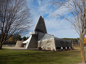
Évêques-de-Trois-Rivières Mausoleum
Mausoleum in Quebec, Canada
Distance: Approx. 9347 meters
Latitude and longitude: 46.3525,-72.575
The Évêques-de-Trois-Rivières Mausoleum is a funerary monument in Trois-Rivières, Quebec. It was built in 1965 and 1996, as part of a renovation campaign at Assumption Cathedral aimed at replacing the crypt with a community room in the basement. It is located in the Saint-Michel cemetery, which was opened in the early 1920s.
Weather in this IP's area
clear sky
8 Celsius
7 Celsius
7 Celsius
12 Celsius
1031 hPa
78 %
1031 hPa
1024 hPa
10000 meters
1.54 m/s
210 degree
07:12:39
17:58:41