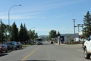
Country:
Region:
City:
Latitude and Longitude:
Time Zone:
Postal Code:
IP information under different IP Channel
ip-api
Country
Region
City
ASN
Time Zone
ISP
Blacklist
Proxy
Latitude
Longitude
Postal
Route
IPinfo
Country
Region
City
ASN
Time Zone
ISP
Blacklist
Proxy
Latitude
Longitude
Postal
Route
MaxMind
Country
Region
City
ASN
Time Zone
ISP
Blacklist
Proxy
Latitude
Longitude
Postal
Route
Luminati
Country
Region
ab
City
blackdiamond
ASN
Time Zone
America/Edmonton
ISP
EASTLINK-HSI
Latitude
Longitude
Postal
db-ip
Country
Region
City
ASN
Time Zone
ISP
Blacklist
Proxy
Latitude
Longitude
Postal
Route
ipdata
Country
Region
City
ASN
Time Zone
ISP
Blacklist
Proxy
Latitude
Longitude
Postal
Route
Popular places and events near this IP address

Turner Valley
Former town in Alberta, Canada
Distance: Approx. 4624 meters
Latitude and longitude: 50.67388889,-114.27861111
Turner Valley was a town in the Calgary Metropolitan Region of Alberta, Canada within the Town of Diamond Valley. It is on Highway 22 (Cowboy Trail), 3 km (1.9 mi) west of Black Diamond and approximately 60 km (37 mi) southwest of Calgary. It was named after Robert and John Turner who settled in the area in 1886.

Black Diamond, Alberta
Former town in Alberta, Canada
Distance: Approx. 1381 meters
Latitude and longitude: 50.68805556,-114.23333333
Black Diamond was a town in the Calgary Metropolitan Region of Alberta, Canada within the Town of Diamond Valley. It is at the intersection of Highway 22 (Cowboy Trail) and Highway 7. Its first post office opened in 1907.
Black Diamond/Cu Nim Airport
Airport in near Diamond Valley, Alberta
Distance: Approx. 4220 meters
Latitude and longitude: 50.7225,-114.17944444
Black Diamond/Cu Nim Airport (TC LID: CEH2) is located 3 nautical miles (5.6 km; 3.5 mi) northeast of Diamond Valley (formerly Black Diamond), Alberta, Canada.
Turner Valley Bar N Ranch Airport
Airport in near Turner Valley, Alberta
Distance: Approx. 9661 meters
Latitude and longitude: 50.65444444,-114.34416667
Turner Valley Bar N Ranch Airport (TC LID: CFY6) was located at Turner Valley Bar N Ranch, 2 nautical miles (3.7 km; 2.3 mi) southwest of Turner Valley, Alberta, Canada.

Millarville
Hamlet in Alberta, Canada
Distance: Approx. 9051 meters
Latitude and longitude: 50.7567,-114.3194
Millarville is a hamlet in Alberta, Canada within the Foothills County. It is located in the foothills of the Canadian Rockies at an elevation of 1,185 metres (3,888 ft). The hamlet is located northwest of the intersection of the Cowboy Trail (Highway 22) and Highway 549, approximately 11 kilometres (6.8 mi) north of Turner Valley and 35 kilometres (22 mi) southwest of Calgary's city limits.
Black Diamond/Flying R Ranch Aerodrome
Airport in near Diamond Valley, Alberta
Distance: Approx. 6350 meters
Latitude and longitude: 50.645,-114.20305556
Black Diamond/Flying R Ranch Aerodrome (TC LID: CBD8) is located 2.8 nautical miles (5.2 km; 3.2 mi) south southeast of Diamond Valley (formerly Black Diamond), Alberta, Canada.

Diamond Valley, Alberta
Town in Alberta, Canada
Distance: Approx. 3512 meters
Latitude and longitude: 50.676,-114.26
Diamond Valley is a town in the Calgary Metropolitan Region of Alberta, Canada within Foothills County. It is at the intersection of Highway 22 (Cowboy Trail) and Highway 7. It was established through the provincially approved amalgamation of the former towns of Black Diamond and Turner Valley on January 1, 2023.
Weather in this IP's area
clear sky
13 Celsius
12 Celsius
11 Celsius
14 Celsius
1012 hPa
53 %
1012 hPa
883 hPa
10000 meters
0.89 m/s
1.34 m/s
07:02:40
20:06:27