Country:
 Canada
Region:
City:
Latitude and Longitude:
Time Zone:
Postal Code:
IP information under different IP Channel
ip-api
Country
Region
City
ASN
Time Zone
ISP
Blacklist
Proxy
Latitude
Longitude
Postal
Route
IPinfo
Country
Region
City
ASN
Time Zone
ISP
Blacklist
Proxy
Latitude
Longitude
Postal
Route
MaxMind
Country
Region
City
ASN
Time Zone
ISP
Blacklist
Proxy
Latitude
Longitude
Postal
Route
Luminati
Country
CARegion
ab
City
grandeprairie
ASN
Time Zone
America/Edmonton
ISP
EASTLINK-HSI
Latitude
Longitude
Postal
db-ip
Country
Region
City
ASN
Time Zone
ISP
Blacklist
Proxy
Latitude
Longitude
Postal
Route
ipdata
Country
Region
City
ASN
Time Zone
ISP
Blacklist
Proxy
Latitude
Longitude
Postal
Route
Popular places and events near this IP address
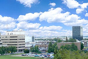
Grande Prairie
City in Alberta, Canada
Distance: Approx. 4386 meters
Latitude and longitude: 55.17083333,-118.79611111
Grande Prairie is a city in northwestern Alberta, Canada, within the southern portion of an area known as Peace River Country. It is located at the intersection of Highway 43 (part of the CANAMEX Corridor) and Highway 40 (the Bighorn Highway), approximately 456 km (283 mi) northwest of Edmonton. The city is surrounded by the County of Grande Prairie No.

Grande Prairie Airport
Airport in Alberta, Canada
Distance: Approx. 7893 meters
Latitude and longitude: 55.18194444,-118.88722222
Grande Prairie Airport (IATA: YQU, ICAO: CYQU) is a commercial airport located 3 nautical miles (5.6 km; 3.5 mi) west northwest of Grande Prairie, Alberta, Canada. It is the largest airport in the Peace River Country of northwestern Alberta and northeastern British Columbia, having served 446,000 passengers in 2014 and 436,000 in 2015, ranking among the busiest regional airports in Canada. The airport has seen passenger traffic growth due to the economic and population growth of the city.

Division No. 19, Alberta
Census division in Alberta, Canada
Distance: Approx. 5290 meters
Latitude and longitude: 55.17805556,-118.78333333
Division No. 19 is a census division in Alberta, Canada. It is located in the west-central portion of northern Alberta and surrounds the City of Grande Prairie.
Northwestern Polytechnic
Community college in Alberta, Canada
Distance: Approx. 5035 meters
Latitude and longitude: 55.17549167,-118.81840278
Northwestern Polytechnic (NWP), previously known as Grande Prairie Regional College (GPRC) is a publicly funded educational institution located in northwestern Alberta, Canada. Founded in 1966 as Grande Prairie Junior College with Dr. Henry Anderson as Dean, the institution officially honoured the first student body of 101 charter students on April 21, 1967.
Bonnetts Energy Centre
Distance: Approx. 4182 meters
Latitude and longitude: 55.169,-118.796
Bonnetts Energy Centre, formerly known as Revolution Place, Canada Games Arena and Crystal Centre, is a 2,960-seat (plus standing) multi-purpose arena in Grande Prairie, Alberta, Canada. The arena was built in 1995, for the Canada Games. It is home to the Grande Prairie Storm of the Alberta Junior Hockey League.
O'Brien Provincial Park
Provincial park in Alberta, Canada
Distance: Approx. 7716 meters
Latitude and longitude: 55.06361111,-118.82444444
O'Brien Provincial Park is a provincial park in Alberta, Canada, located 15 km (9.3 mi) south from Grande Prairie, on Highway 666. The park is situated in the Wapiti River valley, at an elevation of 520 m (1,710 ft) and has a surface of 0.6 km2 (0.23 sq mi). It was established on June 29, 1954 and is maintained by Alberta Tourism, Parks and Recreation.

Grande Prairie Transit
Distance: Approx. 4288 meters
Latitude and longitude: 55.16972222,-118.79166667
Grande Prairie Transit (colloquially referred to as GP Transit) is the public transportation system in the city of Grande Prairie in northwestern Alberta, Canada. For most of its history, the bus service was operated by private contractors. During that time the Public Works Department was responsible for GP Transit and the vehicles were still owned by the city.
Wedgewood, Alberta
Hamlet in Alberta, Canada
Distance: Approx. 1884 meters
Latitude and longitude: 55.11638889,-118.81333333
Wedgewood is a hamlet in northern Alberta, Canada within the County of Grande Prairie No. 1. It is immediately adjacent to the City of Grande Prairie on the west side of Resources Road (Range Road 60), approximately 2.4 kilometres (1.5 mi) east of Highway 40 and 0.8 kilometres (0.50 mi) north of Highway 668.
Flyingshot Lake, Alberta
Unincorporated community in Alberta, Canada
Distance: Approx. 4181 meters
Latitude and longitude: 55.14,-118.864
Flyingshot Lake, or Flyingshot Lake Settlement, is an unincorporated community in Alberta, Canada within the County of Grande Prairie No. 1 that is recognized as a designated place by Statistics Canada. It is located approximately 2.4 km (1.5 mi) west of Highway 40, and 3.2 km (2.0 mi) south of Highway 43.
Weather in this IP's area
overcast clouds
8 Celsius
5 Celsius
8 Celsius
8 Celsius
1006 hPa
46 %
1006 hPa
931 hPa
10000 meters
7.2 m/s
140 degree
100 %
08:31:57
18:48:10