24.213.188.72 - IP Lookup: Free IP Address Lookup, Postal Code Lookup, IP Location Lookup, IP ASN, Public IP
Country:
Region:
City:
Location:
Time Zone:
Postal Code:
ISP:
ASN:
language:
User-Agent:
Proxy IP:
Blacklist:
IP information under different IP Channel
ip-api
Country
Region
City
ASN
Time Zone
ISP
Blacklist
Proxy
Latitude
Longitude
Postal
Route
db-ip
Country
Region
City
ASN
Time Zone
ISP
Blacklist
Proxy
Latitude
Longitude
Postal
Route
IPinfo
Country
Region
City
ASN
Time Zone
ISP
Blacklist
Proxy
Latitude
Longitude
Postal
Route
IP2Location
24.213.188.72Country
Region
new hampshire
City
littleton
Time Zone
America/New_York
ISP
Language
User-Agent
Latitude
Longitude
Postal
ipdata
Country
Region
City
ASN
Time Zone
ISP
Blacklist
Proxy
Latitude
Longitude
Postal
Route
Popular places and events near this IP address
Littleton (CDP), New Hampshire
Census-designated place in New Hampshire, United States
Distance: Approx. 13 meters
Latitude and longitude: 44.30611111,-71.77
Littleton is a census-designated place (CDP) and the main village in the town of Littleton in Grafton County, New Hampshire, United States. The population of the CDP was 4,467 at the 2020 census, out of 6,005 in the entire town.

Littleton, New Hampshire
Town in New Hampshire, United States
Distance: Approx. 13 meters
Latitude and longitude: 44.30611111,-71.77
Littleton is a town in Grafton County, New Hampshire, United States. The population was 6,005 at the 2020 census. Situated at the northern edge of the White Mountains, Littleton is bounded on the northwest by the Connecticut River.

White Mountain School
Private, boarding and coeducational school in Bethlehem, NH, US
Distance: Approx. 3034 meters
Latitude and longitude: 44.28027778,-71.75833333
The White Mountain School, often called White Mountain or WMS, was a co-educational, independent boarding school located in Bethlehem, New Hampshire, United States. Established in 1886 as St. Mary's School in Concord, New Hampshire, the school moved to its second location in 1936, situated just north of the White Mountains of New Hampshire.
WLTN (AM)
Radio station in New Hampshire, United States
Distance: Approx. 781 meters
Latitude and longitude: 44.31311667,-71.76842222
WLTN is an American radio station licensed by the Federal Communications Commission (FCC) to serve the community of Littleton, New Hampshire, where the transmitter is also located.

WMTK
Radio station in New Hampshire, United States
Distance: Approx. 5869 meters
Latitude and longitude: 44.354,-71.739
WMTK (106.3 MHz 106.3 The Notch) is a classic rock formatted station located in northern New Hampshire. It is licensed to Littleton, and is owned by the Vermont Broadcast Associates, Inc., along with WSTJ, WKXH, and WGMT. Programming is also simulcast on 1490/103.1 WIKE in Newport, Vermont.
Littleton High School (New Hampshire)
Public high school in Littleton, New Hampshire , United States
Distance: Approx. 484 meters
Latitude and longitude: 44.31,-71.77305556
Littleton High School is a high school located in the town of Littleton, New Hampshire, Grafton County, New Hampshire, United States. During the 2016–2017 year, the school had 224 students.

Littleton Town Building
United States historic place
Distance: Approx. 42 meters
Latitude and longitude: 44.30583333,-71.77
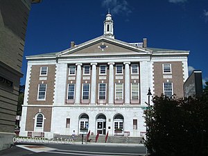
The Littleton Town Building, also known as the Littleton Opera House, is a historic municipal building at 1 Union Street in Littleton, New Hampshire. Built on a steep embankment overlooking the Ammonoosuc River in 1894–5, it is a good example of a Late Victorian municipal building, which continues to serve that purpose today. The building was listed on the National Register of Historic Places in 1973.
United States Post Office and Courthouse–Littleton Main
United States historic place
Distance: Approx. 407 meters
Latitude and longitude: 44.30722222,-71.775
The U.S. Post Office and Courthouse-Littleton Main, now serving exclusively as the Littleton Main Post Office, is a historic federal building at 134 Main Street in Littleton, New Hampshire. Built in 1933, it is one of the more architecturally sophisticated and imposing federal buildings built in New Hampshire in the 20th century. The building was listed on the National Register of Historic Places in 1986.

Burt–Cheney Farm
Historic farm in New Hampshire, US
Distance: Approx. 1863 meters
Latitude and longitude: 44.2925,-71.75666667
The Burt–Cheney Farm is a historic farmstead on U.S. Route 302 in Bethlehem, New Hampshire. The main farm house, built in part about 1818, is a rare early Cape-style house, and is one of the oldest surviving buildings in the town. The property was listed on the National Register of Historic Places in 1982.

Edward H. Lane House
Historic house in New Hampshire, United States
Distance: Approx. 246 meters
Latitude and longitude: 44.305,-71.7675
The Edward H. Lane House is an historic house located at 16 Cottage Street in Littleton, New Hampshire, United States. With a construction history dating to about 1830, it is a good architectural catalog of changing trends in local styles and economic circumstances. Its front portion, dating to the late 19th century, is a good example of Queen Anne Victorian architecture.
Thayer's Hotel
United States historic place
Distance: Approx. 347 meters
Latitude and longitude: 44.30638889,-71.77444444
Thayer's Hotel is a historic hotel building at 136 Main Street in downtown Littleton, New Hampshire, United States. Built in 1843, it is a prominent precursor to the region's later grand resort hotels, and a distinctive example of Greek Revival architecture with a monumental temple front. The building was listed on the National Register of Historic Places in 1982.

The Rocks (New Hampshire)
Historic house in New Hampshire, United States
Distance: Approx. 4000 meters
Latitude and longitude: 44.28111111,-71.73416667
The Rocks Estate, also known as the John Jacob Glessner Estate, is a historic summer estate in Bethlehem, New Hampshire. The large estate, covering more than 1,300 acres (530 ha), is located near the junction of U.S. Route 302 and Interstate 93, and includes some twenty buildings. The estate was assembled by John Jacob Glessner (whose Chicago residence is a National Historic Landmark designed by H. H. Richardson) in the 1880s, and is one of the largest and best-preserved surviving private estates in the state.
Weather in this IP's area
overcast clouds
0 Celsius
-4 Celsius
-0 Celsius
0 Celsius
998 hPa
54 %
998 hPa
951 hPa
10000 meters
4.02 m/s
10.28 m/s
175 degree
100 %


