24.213.187.55 - IP Lookup: Free IP Address Lookup, Postal Code Lookup, IP Location Lookup, IP ASN, Public IP
Country:
Region:
City:
Location:
Time Zone:
Postal Code:
IP information under different IP Channel
ip-api
Country
Region
City
ASN
Time Zone
ISP
Blacklist
Proxy
Latitude
Longitude
Postal
Route
Luminati
Country
Region
ny
City
fayetteville
ASN
Time Zone
America/New_York
ISP
TWC-11351-NORTHEAST
Latitude
Longitude
Postal
IPinfo
Country
Region
City
ASN
Time Zone
ISP
Blacklist
Proxy
Latitude
Longitude
Postal
Route
IP2Location
24.213.187.55Country
Region
new york
City
fayetteville
Time Zone
America/New_York
ISP
Language
User-Agent
Latitude
Longitude
Postal
db-ip
Country
Region
City
ASN
Time Zone
ISP
Blacklist
Proxy
Latitude
Longitude
Postal
Route
ipdata
Country
Region
City
ASN
Time Zone
ISP
Blacklist
Proxy
Latitude
Longitude
Postal
Route
Popular places and events near this IP address

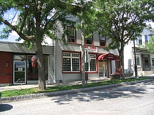
Fayetteville, New York
Village in New York, United States
Distance: Approx. 134 meters
Latitude and longitude: 43.02861111,-76.00416667
Fayetteville is a village located in Onondaga County, New York, United States. As of the 2020 U.S. Census, the population was 4,225. The village is named after the Marquis de Lafayette, a national hero of both France and the United States.

Manlius (village), New York
Village in New York, United States
Distance: Approx. 3706 meters
Latitude and longitude: 43.00222222,-75.97888889
Manlius is a village in Onondaga County, New York, United States, and a southeast suburb of Syracuse. As of the 2020 census, the population was 4,662. The Village of Manlius is located near the southern boundary of the Town of Manlius.

Manlius, New York
Town in New York, United States
Distance: Approx. 2688 meters
Latitude and longitude: 43.04805556,-75.98277778
Manlius is a town to the south east of Syracuse in Onondaga County. As of the 2020 Census, the population was 33,712, making it the third largest suburb in metropolitan Syracuse. In 2005, the town was ranked 98th on CNN's list of Best Places to Live.

Green Lakes State Park
State park in New York state, United States
Distance: Approx. 3331 meters
Latitude and longitude: 43.049,-75.973
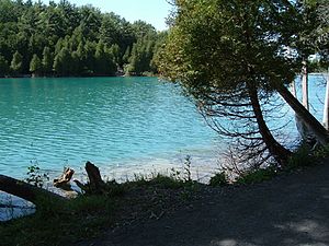
Green Lakes State Park is a New York State Park located east of Syracuse in the Town of Manlius. The park is strikingly scenic, and has a "masterpiece" golf course designed by Robert Trent Jones very early in his career. Green Lake itself is perhaps the most studied meromictic lake—one in which layers of water do not mix—in the world.

Round Lake National Natural Landmark
Distance: Approx. 3102 meters
Latitude and longitude: 43.04777778,-75.97527778
Round Lake National Natural Landmark lies within Green Lakes State Park, which lies a few miles east of the city of Syracuse, New York and adjoining the village of Fayetteville. Round Lake itself and the adjoining 59 acres (24 ha) of old-growth forest were designated a National Natural Landmark in 1973 by the U.S. Department of the Interior. Hubert W. Vogelmann, a professor of botany at the University of Vermont, wrote the evaluation to the National Park Service that concurred with the recommendation of National Natural Landmark status for the region around Round Lake.
High Bridge, New York
Distance: Approx. 1864 meters
Latitude and longitude: 43.014,-76.012
High Bridge is a former hamlet located in the town of Manlius, New York in Onondaga County, just east of the city of Syracuse. High Bridge was founded around 1833 but was defunct less than a century later.

New York (state)
U.S. state
Distance: Approx. 3337 meters
Latitude and longitude: 43,-76
New York, also called New York State, is a state in the Northeastern United States. One of the Mid-Atlantic states, it borders the Atlantic Ocean, New Jersey, Pennsylvania, New England, Canada, and the Great Lakes. With approximately 20 million residents, it is the fourth-most populous state in the United States, and the 27th-largest state by area, with a total area of 54,556 square miles (141,300 km2).

Wellington House (Fayetteville, New York)
Historic house in New York, United States
Distance: Approx. 1370 meters
Latitude and longitude: 43.02833333,-76.02111111
Wellington House, also known as Charles Estabrook Mansion, is a historic home located at Fayetteville, Onondaga County, New York. It was designed by Ward Wellington Ward built in 1922–1923. The main house is a two-story, brick, stone, and half-timber Tudor Revival style mansion topped by a prominent slate roof.

Levi Snell House
Historic house in New York, United States
Distance: Approx. 635 meters
Latitude and longitude: 43.03472222,-76.00833333
The Levi Snell House is a house with Greek Revival and Italianate architecture in Fayetteville, New York. It was built in 1855 and was listed on the National Register of Historic Places in 1987. It's a "substantial, largely intact, mid-nineteenth century brick residence which illustrates the residential designs frequently favored by the prosperous but conservative merchant classes in small upstate New York communities of that period.

Genesee Street Hill–Limestone Plaza Historic District
Historic district in New York, United States
Distance: Approx. 457 meters
Latitude and longitude: 43.02944444,-76.01
The Genesee Street Hill–Limestone Plaza Historic District is a historic district in Fayetteville, New York that was listed on the National Register of Historic Places in 1982. The western border of the district is Limestone Creek. The district includes multiple Greek Revival houses, as well as Italianate and Federal architecture styles, along East Genesee Street as it rises from Limestone Plaza to Chapel Street, near the top of East Genesee Street Hill (which is the village center of Fayetteville).

Manlius Village Historic District
Historic district in New York, United States
Distance: Approx. 3806 meters
Latitude and longitude: 43.00305556,-75.97527778
The Manlius Village Historic District is a 15-acre (6.1 ha) historic district on the east side of the Village of Manlius, in the Town of Manlius, New York, about 9.5 miles from the downtown of Syracuse. The village was bypassed by later transportation—Genesee Street/Route 5, which took a flatter course to the north, the Erie Canal, which generated growth of Syracuse, railroads, and the NYS Thruway in the 1950s—and "thus retains much of the flavor of the turnpike era to which this small Onondaga County village owes its existence.": 7 The historic district was listed on the National Register of Historic Places in 1973. The district includes four churches and one commercial block building on the western edge of the district.

Jamesville-DeWitt High School
Public school in DeWitt, New York, United States
Distance: Approx. 3539 meters
Latitude and longitude: 43.019411,-76.045496
Jamesville-DeWitt High School (JDHS) is a New York state public education facility located in the town of DeWitt, serving high school students (grades 9–12) in the Jamesville-Dewitt Central School District.
Weather in this IP's area
overcast clouds
-4 Celsius
-7 Celsius
-5 Celsius
-2 Celsius
1031 hPa
75 %
1031 hPa
1009 hPa
10000 meters
2.06 m/s
10 degree
100 %