24.213.187.201 - IP Lookup: Free IP Address Lookup, Postal Code Lookup, IP Location Lookup, IP ASN, Public IP
Country:
Region:
City:
Location:
Time Zone:
Postal Code:
IP information under different IP Channel
ip-api
Country
Region
City
ASN
Time Zone
ISP
Blacklist
Proxy
Latitude
Longitude
Postal
Route
Luminati
Country
Region
ny
City
rochester
ASN
Time Zone
America/New_York
ISP
TWC-11351-NORTHEAST
Latitude
Longitude
Postal
IPinfo
Country
Region
City
ASN
Time Zone
ISP
Blacklist
Proxy
Latitude
Longitude
Postal
Route
IP2Location
24.213.187.201Country
Region
new york
City
clinton
Time Zone
America/New_York
ISP
Language
User-Agent
Latitude
Longitude
Postal
db-ip
Country
Region
City
ASN
Time Zone
ISP
Blacklist
Proxy
Latitude
Longitude
Postal
Route
ipdata
Country
Region
City
ASN
Time Zone
ISP
Blacklist
Proxy
Latitude
Longitude
Postal
Route
Popular places and events near this IP address

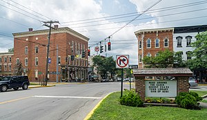
Clinton, Oneida County, New York
Village in New York, United States
Distance: Approx. 353 meters
Latitude and longitude: 43.04888889,-75.38027778
Clinton (or Ka-dah-wis-dag, "white field" in Seneca language) is a village in Oneida County, New York, United States. The population was 1,942 at the 2010 census, declining to 1,683 in the 2020 census, 13% decline). It was named for George Clinton, the first Governor of New York.

Kirkland, New York
Town in Oneida County, New York, United States
Distance: Approx. 494 meters
Latitude and longitude: 43.04805556,-75.38388889
Kirkland is a town in Oneida County, New York, United States. The population was 10,075 at the 2020 census. The town is named after Samuel Kirkland, a missionary among the Oneidas.
Clinton Central School District
School district in New York, United States
Distance: Approx. 239 meters
Latitude and longitude: 43.0499,-75.3817
The Clinton Central School District is a public school district covering the village of Clinton, Oneida County, New York, United States. It includes most of the town of Kirkland and small parts of adjoining towns. It is made up of three schools: an elementary school covering Kindergarten to 5th grade, a middle school from grades 6 to 8, and a high school from grades 9 to 12.
Clinton Arena
United States historic place
Distance: Approx. 279 meters
Latitude and longitude: 43.05306389,-75.37798889
Clinton Arena, also known as Edward W. Stanley Recreation Center, is an indoor arena in Clinton (Oneida County), New York, United States, that is listed on the National Register of Historic Places.

Elihu Root House
Historic house in New York, United States
Distance: Approx. 1927 meters
Latitude and longitude: 43.0498,-75.4046
The Elihu Root House is a historic house on College Hill Road, on the campus of Hamilton College in Clinton, New York. Built in 1817, it was the home of American statesman Elihu Root (1847-1937) from 1893 until his death. It was designated a National Historic Landmark in 1972.

Harding Farm
Distance: Approx. 1511 meters
Latitude and longitude: 43.046602,-75.398136
Harding Farm is a historic site west of the village of Clinton in Oneida County, New York, United States. It is located on New York State Route 233 (Harding Road) and is situated 0.4 miles (0.6 km) south of the junction of NY 233 and New York State Route 412. It was built by Samuel Kirkland in 1793.

Clinton Village Historic District (Clinton, New York)
Historic district in New York, United States
Distance: Approx. 1800 meters
Latitude and longitude: 43.03583333,-75.38083333
Clinton Village Village Historic District is a national historic district located at Clinton in Oneida County, New York. The district includes 144 contributing buildings, two contributing structures, two contributing sites, and six contributing objects. It includes the Clinton Historical Society, a former church building.

Alexander Hamilton Institute for the Study of Western Civilization
Conservative think tank
Distance: Approx. 312 meters
Latitude and longitude: 43.0492674,-75.3819697
The Alexander Hamilton Institute for the Study of Western Civilization is a think tank in Clinton, New York, founded in 2007. It is independent of Hamilton College in Clinton.
Azel Backus
American educator
Distance: Approx. 1796 meters
Latitude and longitude: 43.05218,-75.40318
Azel Backus (October 13, 1765 – December 28, 1816) was an American educator, born in New London County, Connecticut. After having a long preaching career, he was elected as the first President of Hamilton College in New York. He died on December 28, 1816, in Clinton, New York, at the age of 51 and is buried in Hamilton College Cemetery.

Franklin Springs, New York
Hamlet in New York, United States
Distance: Approx. 1932 meters
Latitude and longitude: 43.03666667,-75.39222222
Franklin Springs is a hamlet in Oneida County, New York, United States. The community is located along New York State Route 12B, 1.1 miles (1.8 km) southwest of Clinton. Franklin Springs has a post office with ZIP code 13341.
Christmas Knob
Mountain in New York, United States
Distance: Approx. 653 meters
Latitude and longitude: 43.0575,-75.38388889
Christmas Knob is a summit located in Central New York Region of New York located in the Town of Kirkland, north of Clinton.

Kirkland Town Library
Public library in Clinton, New York, USA
Distance: Approx. 538 meters
Latitude and longitude: 43.04777778,-75.38430556
The Kirkland Town Library is located at 55 1⁄2 College St., Clinton, New York. It was founded in 1901, with a modest 1,000 volumes, donated by the closed Houghton Seminary, and occupies what was originally the Sigma Phi fraternity house at Hamilton College. Elihu Root, a Hamilton alumnus and native of Clinton, at the time Secretary of War under President McKinley, was instrumental in helping the library get started.
Weather in this IP's area
clear sky
-7 Celsius
-10 Celsius
-8 Celsius
-6 Celsius
1033 hPa
87 %
1033 hPa
1008 hPa
10000 meters
1.55 m/s
1.66 m/s
154 degree
7 %
