24.213.185.140 - IP Lookup: Free IP Address Lookup, Postal Code Lookup, IP Location Lookup, IP ASN, Public IP
Country:
Region:
City:
Location:
Time Zone:
Postal Code:
IP information under different IP Channel
ip-api
Country
Region
City
ASN
Time Zone
ISP
Blacklist
Proxy
Latitude
Longitude
Postal
Route
Luminati
Country
Region
me
City
southportland
ASN
Time Zone
America/New_York
ISP
TWC-11351-NORTHEAST
Latitude
Longitude
Postal
IPinfo
Country
Region
City
ASN
Time Zone
ISP
Blacklist
Proxy
Latitude
Longitude
Postal
Route
IP2Location
24.213.185.140Country
Region
maine
City
south portland
Time Zone
America/New_York
ISP
Language
User-Agent
Latitude
Longitude
Postal
db-ip
Country
Region
City
ASN
Time Zone
ISP
Blacklist
Proxy
Latitude
Longitude
Postal
Route
ipdata
Country
Region
City
ASN
Time Zone
ISP
Blacklist
Proxy
Latitude
Longitude
Postal
Route
Popular places and events near this IP address

Million Dollar Bridge (Maine)
Bascule bridge connecting Portland and South Portland across the Fore River, Maine, USA
Distance: Approx. 1309 meters
Latitude and longitude: 43.644647,-70.25656
The Million Dollar Bridge was a bascule bridge built in 1916 which carried traffic on Route 77 over the Fore River in Maine between Portland and South Portland. Permits to construct the Million Dollar Bridge were issued by the Secretary of War in 1893. The bridge was designed in 1914 and opened to traffic in 1916.

Portland Fish Pier
Fishing pier
Distance: Approx. 1515 meters
Latitude and longitude: 43.6514,-70.2538
The Portland Fish Pier is a fishing pier located in Portland, Maine, on the edge of the Fore River. It is a major hub for the commercial fishing industry, and is home to the Portland Fish Exchange, where over 20 million pounds (9.1 kt) of seafood a year are bought and sold. A fishermen's memorial is also located at the pier.

Fort Preble
Distance: Approx. 1412 meters
Latitude and longitude: 43.64861111,-70.22638889
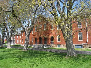
Fort Preble was a military fort in South Portland, Maine, United States, built in 1808 and progressively added to through 1906. The fort was active during all major wars from the War of 1812 through World War II. The fort was deactivated in 1950. It is now on the campus of Southern Maine Community College.
Port of Portland (Maine)
Seaport district in Portland, Maine, USA
Distance: Approx. 1248 meters
Latitude and longitude: 43.65,-70.251
The Port of Portland is a seaport located in Portland, Maine. It is the second-largest tonnage seaport in New England as well as one of the largest oil ports on the East Coast (the second-largest prior to 2016). It is the primary American port of call for Icelandic shipping company Eimskip.
Southern Maine Community College
Public community college in Maine, USA
Distance: Approx. 1266 meters
Latitude and longitude: 43.648,-70.228
Southern Maine Community College is a public community college in South Portland, Maine. It is part of the Maine Community College System.

New England Shipbuilding Corporation
Distance: Approx. 1162 meters
Latitude and longitude: 43.65083333,-70.23444444
The New England Shipbuilding Corporation was a shipyard located in the city of South Portland, Maine, United States. The yard originated as two separate entities, the Todd-Bath Iron Shipbuilding Corporation and the South Portland Shipbuilding Corporation, which were created in 1940 and 1941 respectively, in order to meet the demand created by World War II. The two merged in 1943, then continued to produce ships as the New England Shipbuilding Corporation's East Yard and West Yard. New England Shipbuilding ranked 97th among United States corporations in the value of World War II military production contracts.
Casco Bay Bridge
Bridge in Portland, Maine
Distance: Approx. 1309 meters
Latitude and longitude: 43.644647,-70.25656
The Casco Bay Bridge is a bascule bridge that spans the Fore River, connecting South Portland and Portland, Maine, United States. The bridge carries four lanes (two in each direction) of State Route 77, a bike lane in each direction, and a pedestrian sidewalk on the east side of the span.

South Portland Public Library
Distance: Approx. 1111 meters
Latitude and longitude: 43.634,-70.25
The South Portland Public Library is the public library serving South Portland, Maine. In 1965, ground was broken for the $300,579 library building. The doors were opened for service to the public in 1966.
Willard Beach
Distance: Approx. 1115 meters
Latitude and longitude: 43.64422222,-70.22758333
Willard Beach is a beach and neighborhood in South Portland, Maine. The beach, which covers 4 acres (1.6 ha), used for swimming as well as commercial and recreational boating. Southern Maine Community College abuts the beach.

Harbor Defenses of Portland
Military unit
Distance: Approx. 1412 meters
Latitude and longitude: 43.64861111,-70.22638889
The Harbor Defenses of Portland was a United States Army Coast Artillery Corps harbor defense command. It coordinated the coast defenses of Portland, Maine, the mouth of the Kennebec River, and surrounding areas from 1895 to 1950, beginning with the Endicott program. These included both coast artillery forts and underwater minefields.
Old Settlers Cemetery (South Portland, Maine)
Cemetery in South Portland, Maine, USA
Distance: Approx. 1161 meters
Latitude and longitude: 43.64558,-70.22763
Old Settlers Cemetery, also known as Thrasher Cemetery, is a historic cemetery in South Portland, Maine, United States. South Portland's oldest landmark, dating to 1658, it stands today in the grounds of Southern Maine Community College, adjacent to Willard Beach. There are eighteen marked graves in the cemetery, but it is believed there are several more unmarked burials.
South Portland Armory
Distance: Approx. 1517 meters
Latitude and longitude: 43.63367,-70.25631
The South Portland Armory is an historic armory building in South Portland, Maine, United States. The structure was built in 1941 to support nearby U.S. war production for World War II, including the building of liberty ships. It was built in the Art Deco style and was used by the Maine National Guard until 1996.
Weather in this IP's area
clear sky
-4 Celsius
-4 Celsius
-6 Celsius
-2 Celsius
1031 hPa
71 %
1031 hPa
1030 hPa
10000 meters


