24.172.250.239 - IP Lookup: Free IP Address Lookup, Postal Code Lookup, IP Location Lookup, IP ASN, Public IP
Country:
Region:
City:
Location:
Time Zone:
Postal Code:
ISP:
ASN:
language:
User-Agent:
Proxy IP:
Blacklist:
IP information under different IP Channel
ip-api
Country
Region
City
ASN
Time Zone
ISP
Blacklist
Proxy
Latitude
Longitude
Postal
Route
db-ip
Country
Region
City
ASN
Time Zone
ISP
Blacklist
Proxy
Latitude
Longitude
Postal
Route
IPinfo
Country
Region
City
ASN
Time Zone
ISP
Blacklist
Proxy
Latitude
Longitude
Postal
Route
IP2Location
24.172.250.239Country
Region
north carolina
City
elizabeth city
Time Zone
America/New_York
ISP
Language
User-Agent
Latitude
Longitude
Postal
ipdata
Country
Region
City
ASN
Time Zone
ISP
Blacklist
Proxy
Latitude
Longitude
Postal
Route
Popular places and events near this IP address

Pasquotank County, North Carolina
County in North Carolina, United States
Distance: Approx. 2876 meters
Latitude and longitude: 36.27,-76.26
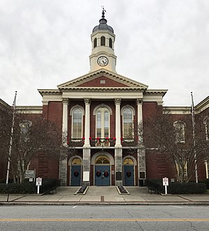
Pasquotank County (PAS-kwoh-tayngk ) is a county located in the U.S. state of North Carolina. As of the 2020 census, the population was 40,568. Its county seat is Elizabeth City.

Elizabeth City, North Carolina
City in North Carolina, United States
Distance: Approx. 1188 meters
Latitude and longitude: 36.29416667,-76.23777778
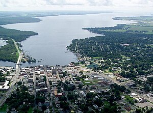
Elizabeth City is a city in Pasquotank county, United States. As of the 2020 census, it had a population of 18,629. Elizabeth City is the county seat and most populous city of Pasquotank County.

Northeastern High School (North Carolina)
American public school in North Carolina
Distance: Approx. 947 meters
Latitude and longitude: 36.2868232,-76.2546572
Northeastern High School (often abbreviated NHS) is a public school located in Elizabeth City, North Carolina, in the United States. It was founded in 1969, replacing Elizabeth City High School, P.W. Moore High School, and Central High School. Northeastern's mascot is the Eagle.

Museum of the Albemarle
History museum
Distance: Approx. 2823 meters
Latitude and longitude: 36.2964,-76.2196
The Museum of the Albemarle is located in Elizabeth City, North Carolina. It serves as the northeastern regional branch of the North Carolina Museum of History. This area of North Carolina is sometimes considered the birthplace of English North America, with close proximity to Roanoke Island and the "Lost Colony" of 1585.
Grice–Fearing House
Historic house in North Carolina, United States
Distance: Approx. 2445 meters
Latitude and longitude: 36.2992,-76.2243
The Grice–Fearing House is the oldest house (ca. 1798) in Elizabeth City, North Carolina, located at 200 South Road Street. It is a contributing property in the Shepard Street–South Road Street Historic District, which is listed on the National Register of Historic Places.
Shepard Street–South Road Street Historic District
Historic district in North Carolina, United States
Distance: Approx. 2607 meters
Latitude and longitude: 36.29444444,-76.22194444
The Shepard Street–South Road Street Historic District is a national historic district located at Elizabeth City, Pasquotank County, North Carolina. The district encompasses 161 contributing buildings in a historically African-American section of Elizabeth City. The district developed from the mid-19th to mid-20th century, and includes representative examples of Greek Revival, Gothic Revival, Italianate, Queen Anne, Colonial Revival, Bungalow, and American Foursquare style architecture.
North Carolina Potato Festival
Distance: Approx. 2733 meters
Latitude and longitude: 36.2999,-76.2212
The North Carolina Potato Festival, originally known as the Albemarle Potato Festival, is an annual tradition in northeastern North Carolina that celebrates one of the region's most important crops. The festival ran from 1940 through 1970 before it was revived in 2001. It takes place annually in mid-May in Elizabeth City, North Carolina.

Episcopal Cemetery (Elizabeth City, North Carolina)
Historic district in North Carolina, United States
Distance: Approx. 2735 meters
Latitude and longitude: 36.29611111,-76.22055556
The Episcopal Cemetery is a historic Episcopal cemetery and national historic district located at Elizabeth City, Pasquotank County, North Carolina. It is a 1.5-acre (0.61 ha) cemetery that was opened in 1825. In 1994, it included one contributing site, 26 contributing structures, and 56 contributing objects.
Southgate Mall (Elizabeth City)
Shopping mall in North Carolina, United States
Distance: Approx. 2334 meters
Latitude and longitude: 36.29555556,-76.225
Southgate Mall is the sole enclosed shopping center in the sixteen county Historic Albemarle region of northeastern North Carolina. Located on West Ehringhaus Street (US 17 Business) in Elizabeth City, North Carolina, the mall is currently anchored by Belk and until its closing in early April 2015; JCPenney. Construction of the mall started in 1967 at a cost of $3 million ($21.2 million in 2014 dollars), opening two years later as Southgate Plaza Shopping Center with senior anchors Belk-Tyler and W. T. Grant.

Northside Historic District (Elizabeth City, North Carolina)
Historic district in North Carolina, United States
Distance: Approx. 2998 meters
Latitude and longitude: 36.30638889,-76.22083333
Northside Historic District is a national historic district located at Elizabeth City, Pasquotank County, North Carolina. The district encompasses 398 contributing buildings in a predominantly residential section of Elizabeth City. The district developed from the mid-19th to mid-20th century, and includes representative examples of Greek Revival, Queen Anne, Colonial Revival, Bungalow / American Craftsman, and Classical Revival style architecture.

Elizabeth City Historic District
Historic district in North Carolina, United States
Distance: Approx. 2542 meters
Latitude and longitude: 36.29972222,-76.22333333
Elizabeth City Historic District is a national historic district located at Elizabeth City, Pasquotank County, North Carolina. The district encompasses 592 contributing buildings, 1 contributing site, 1 contributing structure, and 1 contributing object in the central business district and surrounds residential sections of Elizabeth City. The district developed after 1789, and includes representative examples of Greek Revival, Federal, and Late Victorian style architecture.

Elizabeth City station
Historic train station in North Carolina, US
Distance: Approx. 1423 meters
Latitude and longitude: 36.3025,-76.23833333
Norfolk Southern Passenger Station is a historic train station located at Elizabeth City, Pasquotank County, North Carolina. It was built in 1914 by the Norfolk Southern Railway, and is a long one-story brick building with eclectic Mission Revival-style design elements. It measures 98 feet by 36 feet, with a small projecting control booth.
Weather in this IP's area
clear sky
-4 Celsius
-10 Celsius
-4 Celsius
-2 Celsius
1034 hPa
74 %
1034 hPa
1033 hPa
10000 meters
6.17 m/s
20 degree
