24.140.158.153 - IP Lookup: Free IP Address Lookup, Postal Code Lookup, IP Location Lookup, IP ASN, Public IP
Country:
Region:
City:
Location:
Time Zone:
Postal Code:
IP information under different IP Channel
ip-api
Country
Region
City
ASN
Time Zone
ISP
Blacklist
Proxy
Latitude
Longitude
Postal
Route
Luminati
Country
Region
oh
City
wooster
ASN
Time Zone
America/New_York
ISP
MASSCOM
Latitude
Longitude
Postal
IPinfo
Country
Region
City
ASN
Time Zone
ISP
Blacklist
Proxy
Latitude
Longitude
Postal
Route
IP2Location
24.140.158.153Country
Region
ohio
City
wooster
Time Zone
America/New_York
ISP
Language
User-Agent
Latitude
Longitude
Postal
db-ip
Country
Region
City
ASN
Time Zone
ISP
Blacklist
Proxy
Latitude
Longitude
Postal
Route
ipdata
Country
Region
City
ASN
Time Zone
ISP
Blacklist
Proxy
Latitude
Longitude
Postal
Route
Popular places and events near this IP address

Wayne County, Ohio
County in Ohio, United States
Distance: Approx. 4716 meters
Latitude and longitude: 40.83,-81.89
Wayne County is a county located in the northeastern quadrant of the U.S. state of Ohio. As of the 2020 census, the population was 116,894. Its county seat is Wooster.

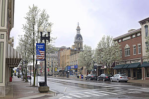
Wooster, Ohio
City in Ohio, United States
Distance: Approx. 1484 meters
Latitude and longitude: 40.79166667,-81.93722222
Wooster ( WUUST-ər) is the county seat of Wayne County, Ohio, United States. Located in northeastern Ohio, the city lies approximately 50 mi (80 km) south-southwest of Cleveland, 35 mi (56 km) southwest of Akron and 30 mi (48 km) west of Canton. The population was 27,232 at the 2020 census.
College of Wooster
Private liberal arts college in Wooster, Ohio, US
Distance: Approx. 754 meters
Latitude and longitude: 40.81167,-81.935494
The College of Wooster is a private liberal arts college in Wooster, Ohio, United States. Founded in 1866 by the Presbyterian Church as the University of Wooster, it has been officially non-sectarian since 1969. From its creation, the college has been a co-educational institution.
Ohio State University Agricultural Technical Institute
Public two-year college in Wooster, Ohio, US
Distance: Approx. 3460 meters
Latitude and longitude: 40.774887,-81.924405
The Ohio State University Agricultural Technical Institute (Ohio State ATI) is a satellite campus of Ohio State University in Wooster, Ohio. It grants associate degrees from the university's College of Food, Agricultural, and Environmental Sciences. The institute practices open admissions.
Ohio Agricultural Research and Development Center
Distance: Approx. 2970 meters
Latitude and longitude: 40.779339,-81.925006
Ohio Agricultural Research and Development Center (OARDC) is the research institution of the Ohio State University College of Food, Agricultural, and Environmental Sciences. The center is home to research projects ranging from plant and animal sciences to human ecology and medicine, and includes branches across the state covering a total of over 7,000 acres (28 km²).

Secrest Arboretum
Arboretum in Wooster, Ohio
Distance: Approx. 2970 meters
Latitude and longitude: 40.779339,-81.925006
Secrest Arboretum (110 acres) is an arboretum located on the campus of the Ohio Agricultural Research and Development Center (OARDC), at the intersection of Pine Road and Green Drive, Wooster, Ohio. It is open daily without charge and hosts an estimated 10,000 visitors each year. Secrest Arboretum is the Ohio State University's primary research arboretum, and contains over 2,000 native and introduced species and cultivars of trees, shrubs, and other plants.

Wooster Township, Wayne County, Ohio
Township in Ohio, United States
Distance: Approx. 2696 meters
Latitude and longitude: 40.78138889,-81.94277778
Wooster Township is one of the sixteen townships of Wayne County, Ohio, United States. The 2020 census found 4,615 people in the township.

Wooster High School (Ohio)
Public school in Ohio, United States
Distance: Approx. 3725 meters
Latitude and longitude: 40.837227,-81.946526
Wooster High School is a public high school in Wooster, Ohio, United States. It is the only high school in the Wooster City School District. The mascot/nickname of the school is the Generals, named after American Revolutionary War General David Wooster.

Wayne County Courthouse District
Local government building in the United States
Distance: Approx. 838 meters
Latitude and longitude: 40.79861111,-81.94055556
The Wayne County Courthouse is located in Wooster, Ohio and was constructed to Thomas Boyd's design from 1877 to 1879. The building is designed in classic Second Empire style and is composed of sandstone. The architect originally designed a symmetrical building separate from the old north annex of the previous courthouse.

Alice Noble Ice Arena
Distance: Approx. 3816 meters
Latitude and longitude: 40.837,-81.951
Alice Noble Ice Arena is a 900-seat multi-purpose arena in Wooster, Ohio. The 900-seat ice arena features an NHL size ice sheet measuring 200 feet x 85 feet. The arena also features five team locker rooms, concessions, pro shop, and meeting rooms.
The Wooster Book Company
Distance: Approx. 952 meters
Latitude and longitude: 40.79805,-81.94186
The Wooster Book Company was a publishing firm and bookstore located in Wooster, Ohio.
Wooster Municipal Airport
Airport in Wooster, Ohio
Distance: Approx. 4443 meters
Latitude and longitude: 40.84,-81.91
The Wooster Municipal Airport was a general aviation airport serving Wooster, Ohio, USA. It was built in the 1920s and was closed sometime between 1968 and 1972 and was replaced by Wayne County Airport 3 miles away on North Honeytown Road near Smithville, Ohio. The airport originally had sod runways but received a 3,100 foot paved runway in the 1950s. After closing, the runway was retained as a city street, now named Old Airport Road in Wooster.
Weather in this IP's area
mist
-7 Celsius
-10 Celsius
-8 Celsius
-6 Celsius
1019 hPa
91 %
1019 hPa
977 hPa
8047 meters
1.54 m/s
150 degree