24.140.156.167 - IP Lookup: Free IP Address Lookup, Postal Code Lookup, IP Location Lookup, IP ASN, Public IP
Country:
Region:
City:
Location:
Time Zone:
Postal Code:
IP information under different IP Channel
ip-api
Country
Region
City
ASN
Time Zone
ISP
Blacklist
Proxy
Latitude
Longitude
Postal
Route
Luminati
Country
Region
oh
City
wooster
ASN
Time Zone
America/New_York
ISP
MASSCOM
Latitude
Longitude
Postal
IPinfo
Country
Region
City
ASN
Time Zone
ISP
Blacklist
Proxy
Latitude
Longitude
Postal
Route
IP2Location
24.140.156.167Country
Region
ohio
City
massillon
Time Zone
America/New_York
ISP
Language
User-Agent
Latitude
Longitude
Postal
db-ip
Country
Region
City
ASN
Time Zone
ISP
Blacklist
Proxy
Latitude
Longitude
Postal
Route
ipdata
Country
Region
City
ASN
Time Zone
ISP
Blacklist
Proxy
Latitude
Longitude
Postal
Route
Popular places and events near this IP address

Massillon, Ohio
City in Ohio, United States
Distance: Approx. 2799 meters
Latitude and longitude: 40.78555556,-81.52527778
Massillon is a city in western Stark County, Ohio, United States, along the Tuscarawas River. The population was 32,146 at the 2020 census. Massillon is a principal city of the Canton–Massillon metropolitan area, which includes all of Stark and Carroll counties and had a population of 401,574 in 2020.
WTIG
Radio station in Massillon, Ohio
Distance: Approx. 3933 meters
Latitude and longitude: 40.8325,-81.56083333
WTIG is an AM radio station in Massillon, Ohio operating on 990 kHz and featuring sports talk programming from ESPN Radio. The station is an affiliate of the Cincinnati Reds, Cincinnati Bengals, and the Columbus Blue Jackets radio networks.
Tuslaw High School
Public school in Massillon, Ohio, United States
Distance: Approx. 4155 meters
Latitude and longitude: 40.8079498,-81.6018388
Tuslaw High School is a public high school located in Tuscarawas Township, Ohio near the city of Massillon and serves all high school students in the Tuslaw Local School district. Tuslaw High School is a member of the Stark County Area Vocational School District allowing its high school students to attend the R.G. Drage Vocational Center located in Massillon. The school's mascot is the Mustang and the school colors are blue and white with a little red trim.

Massillon Christian School
Distance: Approx. 2134 meters
Latitude and longitude: 40.785097,-81.535195
Massillon Christian School is a private Christian school in Massillon, Ohio. It is a ministry of the Massillon Baptist Temple.
Tuscarawas Township, Stark County, Ohio
Township in Ohio, United States
Distance: Approx. 2707 meters
Latitude and longitude: 40.79055556,-81.58527778
Tuscarawas Township is one of the seventeen townships of Stark County, Ohio, United States. The 2020 census found 5,801 people in the township.
First Methodist Episcopal Church (Massillon, Ohio)
Historic church in Ohio, United States
Distance: Approx. 2980 meters
Latitude and longitude: 40.79725,-81.51913889
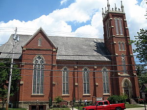
First Methodist Episcopal Church (now known as First United Methodist Church) is a historic church in Massillon, Ohio, United States, located at 301 Lincoln Way East. It is of stone and sandstone construction with a copper roof in the Richardsonian Romanesque style. The building was dedicated in June 1895 and was added to the U.S. National Register of Historic Places on August 22, 1985.

Indian River High School (Ohio)
Juvenile correctional facility school in Massillon, , Ohio, United States
Distance: Approx. 4183 meters
Latitude and longitude: 40.767054,-81.525424
Indian River High School is a high school in Massillon, Ohio. It is a part of the Indian River Juvenile Correctional Facility. All youth prisoners who do not have a high school degree are required to participate in the educational program.
St. Timothy's Protestant Episcopal Church
Historic church in Ohio, United States
Distance: Approx. 3102 meters
Latitude and longitude: 40.79555556,-81.51777778
St. Timothy's Protestant Episcopal Church is a historic church at 226 SE. 3rd Street in Massillon, Ohio. It was built in 1892 and added to the National Register in 1979.

St. Mary's Catholic Church (Massillon, Ohio)
United States historic place
Distance: Approx. 2724 meters
Latitude and longitude: 40.80222222,-81.52277778
St. Mary's Catholic Church is a historic Catholic church building in the city of Massillon, Ohio, United States. Constructed in 1876 for a congregation composed largely of European immigrants, it has been named a historic site.
Saint Joseph's Roman Catholic Church (Massillon, Ohio)
Historic church in Ohio, United States
Distance: Approx. 3140 meters
Latitude and longitude: 40.79416667,-81.5175
Saint Joseph's Roman Catholic Church is a historic church at 322 3rd Street SE in Massillon, Ohio, United States. The designer was John Verment, a French-born architect who also contributed to the design of St. Mary's Catholic Church elsewhere in Massillon.
Newman Creek
Stream in Ohio
Distance: Approx. 2534 meters
Latitude and longitude: 40.80833333,-81.52805556
Newman Creek is a stream in the U.S. state of Ohio. Newman Creek has the name of Jacob Newman, a government surveyor.
Newman, Ohio
Unincorporated community in Ohio, U.S.
Distance: Approx. 3794 meters
Latitude and longitude: 40.83083333,-81.56388889
Newman is an unincorporated community in Stark County, in the U.S. state of Ohio.
Weather in this IP's area
mist
1 Celsius
1 Celsius
1 Celsius
1 Celsius
1028 hPa
86 %
1028 hPa
987 hPa
6437 meters
100 %


