24.138.193.107 - IP Lookup: Free IP Address Lookup, Postal Code Lookup, IP Location Lookup, IP ASN, Public IP
Country:
Region:
City:
Location:
Time Zone:
Postal Code:
ISP:
ASN:
language:
User-Agent:
Proxy IP:
Blacklist:
IP information under different IP Channel
ip-api
Country
Region
City
ASN
Time Zone
ISP
Blacklist
Proxy
Latitude
Longitude
Postal
Route
db-ip
Country
Region
City
ASN
Time Zone
ISP
Blacklist
Proxy
Latitude
Longitude
Postal
Route
IPinfo
Country
Region
City
ASN
Time Zone
ISP
Blacklist
Proxy
Latitude
Longitude
Postal
Route
IP2Location
24.138.193.107Country
Region
fajardo
City
fajardo
Time Zone
America/Puerto_Rico
ISP
Language
User-Agent
Latitude
Longitude
Postal
ipdata
Country
Region
City
ASN
Time Zone
ISP
Blacklist
Proxy
Latitude
Longitude
Postal
Route
Popular places and events near this IP address

Fajardo, Puerto Rico
Town and municipality in Puerto Rico
Distance: Approx. 11 meters
Latitude and longitude: 18.32583333,-65.6525
Fajardo (Spanish pronunciation: [faˈxaɾðo]) is a town and a municipality part of the San Juan-Caguas-Fajardo Combined Statistical Area in Puerto Rico. Fajardo is the hub of much of the recreational boating in Puerto Rico and a popular launching port to Culebra, Vieques, and the U.S. and British Virgin Islands. It is also home to the largest marina in the Caribbean, called Puerto del Rey.

Diego Jiménez Torres Airport
Airport owned by the Puerto Rico Ports Authority
Distance: Approx. 2218 meters
Latitude and longitude: 18.30805556,-65.66194444
Diego Jiménez Torres Airport (IATA: FAJ, ICAO: TJFA, FAA LID: X95) was a public use airport owned by the Puerto Rico Ports Authority and located 1 mile (1.6 km) south of Fajardo, a city in Puerto Rico. It is also known as Fajardo Airport. Airport operations were shut down in November 2008 and transferred to the newly opened José Aponte de la Torre Airport in Ceiba.

Roman Catholic Diocese of Fajardo–Humacao
Diocese of the Catholic Church
Distance: Approx. 131 meters
Latitude and longitude: 18.3249,-65.6532
The Diocese of Fajardo–Humacao(Latin: Dioecesis Faiardensis–Humacaensis) is a Latin Church ecclesiastical territory or diocese of the Catholic Church and consists of part of the east and the northeast of the island of Puerto Rico. The current bishop is Luis Miranda Rivera, who was appointed on May 16, 2020, by Pope Francis. The mother church is Cathedral Santiago Apóstol in Fajardo, Puerto Rico.

Battle of Fajardo
Battle of the Spanish-American War
Distance: Approx. 11 meters
Latitude and longitude: 18.32583333,-65.6525
The Battle of Fajardo was an engagement between the armed forces of the United States and Spain that occurred on the night of August 8–9, 1898 near the end of the Puerto Rican Campaign during the Spanish–American War.

Fajardo River
River of Puerto Rico
Distance: Approx. 2655 meters
Latitude and longitude: 18.328009,-65.6273837
Fajardo River (Spanish: Río Fajardo) is a river of Fajardo, Puerto Rico. It crosses Ceiba and Fajardo. It is 16.35 miles long.

Catedral Santiago Apóstol (Fajardo, Puerto Rico)
Historic cathedral in Fajardo, Puerto Rico
Distance: Approx. 161 meters
Latitude and longitude: 18.32694444,-65.65333333
The Catedral Santiago Apóstol, or in English, the Cathedral of St. James the Apostle, or Santiago Apóstol of Fajardo is a Catholic cathedral located on the town plaza in Fajardo, Puerto Rico. Along with Concatedral Dulce Nombre de Jesus in Humacao it is the seat of the Diocese of Fajardo-Humacao.

United States Customs House (Fajardo, Puerto Rico)
Historic place in Fajardo, Puerto Rico
Distance: Approx. 2479 meters
Latitude and longitude: 18.333942,-65.630564
The U.S. Customs House, (Spanish: Aduana de Fajardo), located at Calle Union, Fajardo, Puerto Rico, was constructed in 1930. The poured-concrete building is significant architecturally and historically for the role it played in the first, transitional phase of the American customs service in Puerto Rico, from 1898 through 1931.
Fajardo Soccer Stadium
Distance: Approx. 2 meters
Latitude and longitude: 18.325787,-65.652382
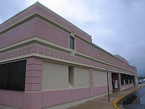
The Fajardo Soccer Stadium is a 4,000-seat association football stadium in Fajardo, Puerto Rico.

Fajardo barrio-pueblo
Historical and administrative center (seat) of Fajardo, Puerto Rico
Distance: Approx. 509 meters
Latitude and longitude: 18.329232,-65.649222
Fajardo barrio-pueblo is a barrio and the administrative center (seat) of Fajardo, a municipality of Puerto Rico. Its population in 2010 was 13,709. As was customary in Spain, in Puerto Rico, the municipality has a barrio called pueblo which contains a central plaza, the municipal buildings (city hall), and a Catholic church.

Florencio, Fajardo, Puerto Rico
Barrio of Puerto Rico
Distance: Approx. 2345 meters
Latitude and longitude: 18.313748,-65.670605
Florencio is a barrio in the municipality of Fajardo, Puerto Rico. Its population in 2010 was 4,145.

Sardinera
Barrio of Fajardo, Puerto Rico
Distance: Approx. 2474 meters
Latitude and longitude: 18.346101,-65.64288
Sardinera is a barrio in the municipality of Fajardo, Puerto Rico. Its population in 2010 was 1,190.

Ceiba State Forest
State forest in Puerto Rico
Distance: Approx. 2454 meters
Latitude and longitude: 18.32,-65.63
Ceiba State Forest (Spanish: Bosque Estatal de Ceiba), also referred to as the Ceiba State Reserve (Spanish: Reserva Estatal de Ceiba), is a mangrove forest and nature reserve located in the eastern coast of Puerto Rico, in the municipalities of Ceiba and Fajardo. The forest extends over 350 acres and is mostly made of mangrove forests which are habitat to a large number of bird species. Although named Ceiba State Forest, the forest is not home to the large ceiba tree (Ceiba pentandra), and it is actually named after the municipality it is located in.
Weather in this IP's area
broken clouds
27 Celsius
28 Celsius
27 Celsius
27 Celsius
1016 hPa
71 %
1016 hPa
1008 hPa
10000 meters
1.79 m/s
2.24 m/s
80 degree
66 %