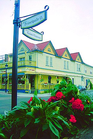
Country:
Region:
City:
Latitude and Longitude:
Time Zone:
Postal Code:
IP information under different IP Channel
ip-api
Country
Region
City
ASN
Time Zone
ISP
Blacklist
Proxy
Latitude
Longitude
Postal
Route
IPinfo
Country
Region
City
ASN
Time Zone
ISP
Blacklist
Proxy
Latitude
Longitude
Postal
Route
MaxMind
Country
Region
City
ASN
Time Zone
ISP
Blacklist
Proxy
Latitude
Longitude
Postal
Route
Luminati
Country
Region
qc
City
sainteagathedesmonts
ASN
Time Zone
America/Toronto
ISP
CC-3272
Latitude
Longitude
Postal
db-ip
Country
Region
City
ASN
Time Zone
ISP
Blacklist
Proxy
Latitude
Longitude
Postal
Route
ipdata
Country
Region
City
ASN
Time Zone
ISP
Blacklist
Proxy
Latitude
Longitude
Postal
Route
Popular places and events near this IP address

Val-David
Village municipality in Quebec, Canada
Distance: Approx. 5979 meters
Latitude and longitude: 46.03,-74.22
Val-David is a village of more than 5,200 inhabitants in the Laurentian Mountains about 80 kilometres (50 mi) north of Montreal, Quebec, Canada. Attracting about 100,000 tourists a year, Val-David is predominantly francophone although it has a small anglophone minority. The village is famous for its delicious and diverse food scene as well for its artistic and hippie character.

Sainte-Agathe-des-Monts
City in Quebec, Canada
Distance: Approx. 946 meters
Latitude and longitude: 46.05,-74.28
Sainte-Agathe-des-Monts (French pronunciation: [sɛ̃t aɡat de mɔ̃]) is a town in the province of Quebec, Canada, in the regional county municipality of Les Laurentides in the administrative region of Laurentides, also known as the "Laurentians" or the Laurentian Mountains (in English). Sainte-Agathe-des-Monts borders on a lake called Lac des Sables, and is located approximately 80 kilometres (50 mi) northwest of Montreal, and 130 kilometres (81 mi) northeast of Ottawa. The town has been twinned with Lagny-sur-Marne, France, since 1969 and Saranac Lake, New York, since 2002.

Saint-Adolphe-d'Howard
Municipality in Quebec, Canada
Distance: Approx. 9299 meters
Latitude and longitude: 45.97,-74.33
Saint-Adolphe-d'Howard is a municipality in the Laurentian Mountains, in the Province of Quebec, Canada, north-west of Montreal. Saint-Adolphe-d'Howard is home to Mont-Avalanche ski resort.

Ivry-sur-le-Lac
Municipality in Quebec, Canada
Distance: Approx. 5024 meters
Latitude and longitude: 46.07,-74.35
Ivry-sur-le-Lac (French pronunciation: [ivʁi syʁ lə lak], literally Ivry on the Lake) is a village and municipality in the Laurentides region of Quebec, Canada, part of the Les Laurentides Regional County Municipality. The municipality completely encompasses Lake Manitou which is a popular cottage vacation location. The village of Ivry-sur-le-Lac is located at the head of the north-east bay (Lacasse Bay), and the hamlet of Lac-Manitou-Sud is at the head of the south-east bay of Lake Manitou.
Lake Arpin
Lake in Lantier, Quebec, Canada
Distance: Approx. 9108 meters
Latitude and longitude: 46.13078,-74.281483
Lake Arpin is a small lake located in the Laurentian Mountains of Quebec, Canada. This is a non populated lake. The first house to be built close to the water was in 2005.
Sainte Agathe Academy
Distance: Approx. 357 meters
Latitude and longitude: 46.0525,-74.2919
Sainte Agathe Academy (SAA; French: Académie Sainte Agathe) is a public anglophone primary and secondary school in Sainte-Agathe-des-Monts, Quebec. It is operated by the Sir Wilfrid Laurier School Board. Persons from the following communities are zoned to this school for the elementary level: Sainte-Agathe-des-Monts, Doncaster, Ivry-sur-le-Lac, L'Ascension, La Conception, La Macaza, La Minerve, Labelle, Lac-Supérieur, Lantier, Mont-Blanc, Mont-Tremblant, Rivière-Rouge, Saint-Donat, Sainte-Agathe-des-Monts, Sainte-Lucie-des-Laurentides, Val-David, Val-des-Lacs, and Val-Morin, as well as the northern half of Saint-Adolphe-d'Howard.

Pripstein's Camp Mishmar
Private summer camp school
Distance: Approx. 8925 meters
Latitude and longitude: 45.9831,-74.35732
Pripstein's Camp Mishmar (Hebrew: מַחֲנֶה מִשְׁמָר) was a private co-educational summer camp in St. Adolphe d'Howard, Quebec, which operated from 1941 to 2014. Though not strictly a Jewish summer camp, Mishmar predominantly catered to a middle- and upper-class Jewish clientele.
Camp B'nai Brith (Montreal)
Jewish summer camp school
Distance: Approx. 8265 meters
Latitude and longitude: 46.123175,-74.281573
Camp B'nai Brith (Hebrew: מַחֲנֶה בְּנֵי בְּרִית) is a Jewish summer camp north of Montreal, in Sainte-Agathe-des-Monts. Camp B'nai Brith has been recognized as a pioneer in the world of community-service camps in North America. CBB offers camping to children and senior citizens on a sliding fee scale based on the family's finances, with fundraising activities subsidizing those who cannot afford to pay.
Congregation House of Israel
Synagogue in Quebec, Canada
Distance: Approx. 250 meters
Latitude and longitude: 46.05111111,-74.29027778
Congregation House of Israel (French: Congrégation Maison d'Israël, Hebrew: ק״ק בֵּית יִשְׂרָאֵל) is an Orthodox synagogue in Sainte-Agathe-des-Monts, Quebec, serving the Laurentian Jewish community. It was officially opened on 12 July 1953. The congregation is led by Rabbi Emanuel Carlebach, who assumed the role upon the passing of his father Rabbi Ephraim Carlebach in 1985.
Weather in this IP's area
clear sky
11 Celsius
10 Celsius
11 Celsius
12 Celsius
1031 hPa
68 %
1031 hPa
985 hPa
10000 meters
2.02 m/s
3.3 m/s
246 degree
07:18:37
18:05:30